
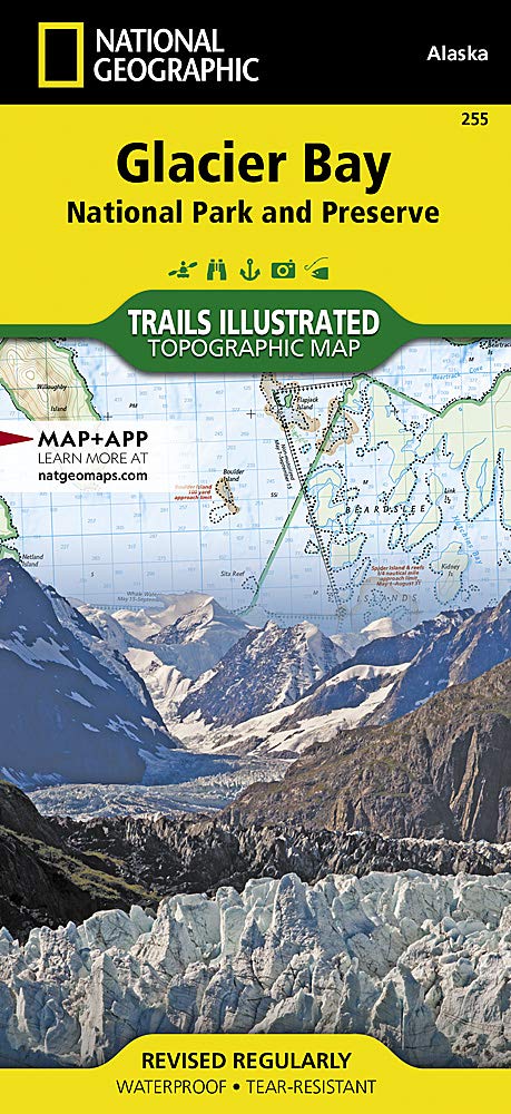
Wandelkaart 255 Glacier Bay NP- Alaska - Nat Geo
Een jaarlijks gemiddeld van 380.000 bezoekers
Korte omschrijving
TOPO Wandelkaart 255 - Glacier Bay NP- Alaska - Nat Geo Productomschrijving: Glacier Bay National Park and Preserve is een nationaal park ter grootte van 13.287 km² in het zuiden van Alaska...

Specificaties
- Uitgever: National Geographic
- ISBN-13: 9781566953863
- HOOFDCATEGORIEËN: Wandelkaart
- Activiteiten: Wandelen, Hiking & Trekking
- Regio: Alaska, USA
- Land: Verenigde Staten van Amerika (USA)
- Nationale parken: Glacier Bay NP, Alaska USA
- Schaal: 1:240000
- Afmeting: 10x19, 11x24
- Taal: Engels
Volledige omschrijving
TOPO Wandelkaart 255 - Glacier Bay NP- Alaska - Nat Geo
Productomschrijving: Glacier Bay National Park and Preserve is een nationaal park ter grootte van 13.287 km² in het zuiden van Alaska in de Verenigde Staten. Het park kan alleen over water of door de lucht worden bereikt omdat er geen wegen naartoe lopen. Desondanks bezoeken jaarlijks gemiddeld 380.000 bezoekers het park.
Engelse omschrijving: National Geographic's Trails Illustrated map of Glacier Bay National Park and Preserve in Alaska's panhandle is perfect for hiking, camping, boating, paddling, and wildlife viewing in this scenic, rugged frontier. Created in partnership with local land management agencies, this expertly researched map delivers unmatched detail and helpful information for experienced outdoor enthusiasts and casual visitors alike.
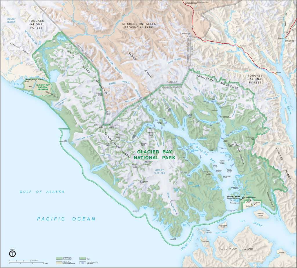
Some of the key areas of interest covered include Glacier Bay Wilderness, portions of Tongass National Forest, Chicagof Island, Endicott River Wilderness, Chilkat State Park, Chilkat Islands, Sullivan Island State Marine Park, Pleasant Island, Lemesurier Island, Inian Islands, and Tatshenshini Alsek Park. Waterways include the Gulf of Alaska; Glacier, Tituya, Berners, Tidal, Scidmore, and Taylor bays; Cross Sound; Icy Strait; Lynn Canal; North Passage; and Geikie, Muir, Tarr, Chilkoot, Chilkat, Wachusett, Queen, and Rendu inlets. The print version of this map contains detailed insets of Tarr and Johns Hopkins inlets, Gustavus, and Lamplugh Glacier.
Transportation in Glacier Bay's wilderness can be challenging, but you'll find the information you need on this map with an accurate road network, ferries, boat ramps, harbors and anchorages, seaplane bases, seaplane anchorages, airports, and landing strips. In addition to contour lines, shaded relief, and summit elevations, this map highlights the many waterways with bathymetry, depths, and navigational aids. A handy distance chart will help you plan your outings. Many recreation features and facilities are noted as well, including hiking trails, campgrounds, picnic areas, rental cabins, lodging, boat fueling stations, ranger stations, and scenic byways. Every Trails Illustrated map is printed on "Backcountry Tough" waterproof, tear-resistant paper. A full UTM grid is printed on the map to aid with GPS navigation.
Other features found on this map include: Alsek Glacier, Alsek River, Brady Glacier, Cape Fairweather, Cape Spencer, Carroll Glacier, Casement Glacier, Chilkat Lake, Chilkat Range, Chilkat River, Cross Sound, Endicott River Wilderness, Fairweather Range, Glacier Bay, Glacier Bay National Park, Glacier Bay National Preserve, Grand Plateau Glacier, Icy Point, Icy Strait, Johns Hopkins Inlet, La Chaussee Spit, Muir Glacier, Muir Inlet, Novatak Glacier, Palma Bay, Plateau Glacier, Pleasant Island, Pleasant/Lemusurier/Inian Islands Wilderness, Tarr Inlet, Tongass National Forest.
Overzichtskaarten

NAT GEO Alaska trails map
NAT GEO Alaska trails map

Producten op de overzichtskaart
Klik op een product om naar de detailpagina te gaan.
- Wandelkaart 231 Kenai Fjords NP- Alaska - Nat Geo
- Wandelkaart 248 Katmai NP- Alaska - Nat Geo
- Wandelkaart 254 Chilkoot Trail - Klondike Gold Rush - Nat Geo
- Wandelkaart 255 Glacier Bay NP- Alaska - Nat Geo
- Wandelkaart 257 Gates of the Arctic NP- Alaska - Nat Geo
- Wandelkaart 760 Kenai National Wildlife Refuge - Alaska - Nat Geo
- Wandelkaart 761 Prince William Sound West - Alaska - Nat Geo
- Wandelkaart 763 Kachemak Bay State Park - Alaska - Nat Geo
Artikelen uit dezelfde regio

Wandelkaart 231 Kenai Fjords NP- Alaska - Nat Geo • 9781566953856
TOPO Wandelkaart 231 - Kenai Fjords NP- Alaska - Nat Geo Productomschrijving: Kenai Fjords National Park is een nationaal park in de Amerikaanse staat Alaska, gelegen op het Kenai-schiereiland. Grote delen van de Kenai Mountains worden beschermd in het park. In het park ligt het Harding Icefield, een van de grootste ijsvelden van de Verenigde Staten. Engelse omschrijving: National Geog…

Wandelkaart 248 Katmai NP- Alaska - Nat Geo • 9781566952903
TOPO Wandelkaart 248 - Katmai NP- Alaska - Nat Geo Productomschrijving: Katmai National Park is een Amerikaans nationaal park in het zuiden van de staat Alaska, gelegen op het Alaska-schiereiland. Het ligt ongeveer 450 kilometer ten zuidwesten van de stad Anchorage. Het gebied is alleen per boot of vliegtuig te bereiken. Engelse omschrijving: Known for its large population of bears an…

Wandelkaart 257 Gates of the Arctic NP- Alaska - Nat Geo • 9781566953764
TOPO Wandelkaart 257 - Gates of the Arctic NP - Alaska Productomschrijving: Het Gates of the Arctic National Park and Preserve is een nationaal park ten noorden van de noordpoolcirkel in de Amerikaanse staat Alaska. Het is het meest noordelijk gelegen en op een na grootste nationale park van de Verenigde Staten. Met een oppervlakte van 34.287 km² is het park iets kleiner dan Zwitserland. …

Wandelkaart 763 Kachemak Bay State Park - Alaska - Nat Geo • 9781566950749
Wandelkaart Kachemak Bay State Park, Homer Alaska Omvat: Anchor Point, Chugach Islands, Fox River, Gore Point, Kachemak Bay, Kalgin Island, Kenai Fjords National Park, Kennedy Entrance, Nuka Bay, Nuka Island, Point Adam, Point Pogibshi, Port Dick, Tustumena Lake. Engelse omschrijving: Outdoor enthusiasts exploring the various public recreation lands in the southwestern part of the Kena…

Wandelkaart 249 Wrangell St.Elias NP - Nat.Geo. • 9781566953825
Wrangell St.Elias NP - National Geographic Productomschrijving: Met 13,2 miljoen hectare, zou Wrangell-St. Elias binnen de grenzen passen van Yellowstone, Grand Canyon, Glacier, Olympic en Yosemite National Parks met zelf nog ruimte over. Het strekt zich uit van een van de hoogste toppen van Noord-Amerika > Mount Stain Elias, tot aan de oceaan. Meer dan een kwart van het park is bedekt met…