
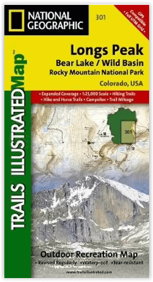
Wandelkaart 301 Longs Peak -Trails Illustrated N. Trails - Nat Geo
Bear Lake / Wild Basin / Rocky Mountain NP
Korte omschrijving
Wandelkaart 301 Longs Peak - Nat Geo Productomschrijving: Engelse omschrijving: Towering over the Rocky Mountains stands the 14,259 foot high Longs Peak. National Geographic's Trails Il...

Specificaties
- Uitgever: National Geographic
- ISBN-13: 9781566954310
- HOOFDCATEGORIEËN: Wandelkaart
- Activiteiten: Wandelen, Hiking & Trekking
- Regio: Colorado, USA
- Land: Verenigde Staten van Amerika (USA)
- Nationale parken: Rocky Mountain NP, Colorado USA
- Schaal: 1:25000
- Afmeting: 10x19
- Taal: Engels
Volledige omschrijving
Wandelkaart 301 Longs Peak - Nat Geo
Productomschrijving:
Engelse omschrijving: Towering over the Rocky Mountains stands the 14,259 foot high Longs Peak. National Geographic's Trails Illustrated map of Longs Peak and the surrounding south-east areas of Rocky Mountain National Park is designed to meet the needs of those who are looking for a phenomenal climbing experience as well as for all outdoor enthusiasts. Expertly researched and created in partnership with local land management agencies, this map features key points of interest including Bear Lake, Wild Basin, Moraine Park , Glacier Basin, the privately owned MacGregor Ranch Conservation Easement and the western edge of the Roosevelt National Forest.
With extensive detail of Longs Peak and miles of clearly marked trails, scenic byways lakes and creeks, the map can guide you off the beaten path and back again. The clearly marked trails include mileages between intersections. The map base includes contour lines and elevations for summits and passes. Some of the many recreation features include: visitor centers, campgrounds, backcountry campsites, trailheads, and interpretive trails.
Every Trails Illustrated map is printed on "Backcountry Tough" waterproof, tear-resistant paper. A full UTM grid is printed on the map to aid with GPS navigation. Other features found on this map include: Longs Peak, Rocky Mountain National Park, Roosevelt National Forest.
Locatie op kaart
Overzichtskaarten

NAT GEO Colorado trail maps
NAT GEO Colorado trail maps

Producten op de overzichtskaart
Klik op een product om naar de detailpagina te gaan.
- Wandelkaart 110 Leadville & Fairplay - Colorado - Nat Geo
- Wandelkaart 127 Aspen - Independence Pass - Colorado USA
- Wandelkaart 137 Pikes Peak & Cañon City - Nat Geo
- Wandelkaart 138 Sangre de Cristo Mountains - Nat Geo
- Wandelkaart 139 La Garita Caldera - Cochetopa - Nat Geo
- Wandelkaart 140 Weminuche Wilderness Colorado USA - Nat Geo
- Wandelkaart 141 Telluride- Silverton- Ouray & Lake City - Nat Geo
- Wandelkaart 144 Durango & Cortez- Colorado - Natgeo
- Wandelkaart 200 Rocky Mountain NP- Colorado - Nat Geo
- Wandelkaart 208 Colorado National Monument - Natgeo
- Wandelkaart 245 Black Canyon of the Gunnison NP - Natgeo
- Wandelkaart 301 Longs Peak -Trails Illustrated N. Trails - Nat Geo
- Wandelkaart 601 Aspen Local Trails - Nat Geo

NAT GEO Montana trails map
NAT GEO Montana trails map

Producten op de overzichtskaart
Klik op een product om naar de detailpagina te gaan.
- Wandelkaart 215 Glacier & Waterton Lakes NP - Montana - Nat Geo
- Wandelkaart 301 Longs Peak -Trails Illustrated N. Trails - Nat Geo
- Wandelkaart 302 Yellowstone NP & Old Faithful - Nat Geo
- Wandelkaart 303 Mammoth Hot Springs- Yellowstone - Nat Geo
- Wandelkaart 304 Tower & Canyon Yellowstone NP - Nat Geo
- Wandelkaart 306 Yosemite SW- Yosemite Valley - Nat Geo
- Wandelkaart 314 Many Glacier NP- Waterton lakes - Montana
Artikelen uit dezelfde regio

Wandelkaart 1304 Colorado Backpack Loops- Noord - Natgeo • 9781566957557
TOPO Wandelkaart 1304 - Colorado Backpack Loops- Noord - Natgeo Productomschrijving: Colorado is gelend voor zijn outdoor recreatrieve opportuniteiten. Eén van deze bezigheden is uiteraard backcountry & hiking. De Colorado Backpack Loops North Topographic Map Guide omavt de dozijn aan cirkelvormige wandelroutes geselecteerd door het personeel van National Geographic voor hun diversiteit, h…

Reisgids Colorado - Insight Guides ENG • 9781789198393
Reisgids Colorado USA - Insight Guides ENG Productomschrijving: Van het beslissen wanneer je gaat, tot het kiezen van wat te zien als je aankomt, deze gids voor Colorado is alles wat je nodig hebt om je perfecte reis te plannen, met insider informatie over must-see, top attracties zoals Denver Art Museum, Pikes Peak en het Old Fort National Historic Site, en culturele juweeltjes zoals de g…

Wandelkaart 110 Leadville & Fairplay - Colorado - Nat Geo • 9781566953641
TOPO Wandelkaart 110 - Leadville & Fairplay - Colorado - National Geographic Productomschrijving: Leadville & Fairplay zijn locaties in de Amerikaanse staat Colorado. De dorpen liggen op een hoogte van 3000 meter, en zijn daarmee een van de hoogstgelegen steden van Colorado. In het begin van de tijd van de goudkoorts ontstond de nederzetting, in het jaar 1859. Het is een meestal rustige st…

Wandelkaart 119 Yampa & Gore Pass Colorado USA - Nat Geo • 9781566953931
Yampa & Gore Pass Colorado USA - Nat Geo Productomschrijving: Outdoor enthousiastelingen die het hele jaar door willen genieten van de recreatieve mogelijkheden in en rond het zuiden van Routt National Forest zullen zich verbazen over National Geographic's Trails Illustrated kaart van Yampa en Gore Pass. Gemaakt in samenwerking met de U.S. Forest Service, Bureau of Land Management en ander…

Reisgids Colorado USA - Lonely Planet • 9781787016811
Reisgids Colorado - Lonely Planet Productomschrijving: Spectaculaire vergezichten, eindeloze poedersneeuwafdalingen en bergstadjes met echo's van het Oude Westen - Colorado is een plek die al heel lang mensen tot avontuur uitnodigt. Lonely Planet brengt je naar het hart van Colorado, met geweldige reiservaringen en het beste planningsadvies. Ga de pistes op in Aspen, ontdek het Oude Westen…