
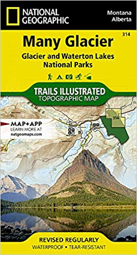
Wandelkaart 314 Many Glacier NP- Waterton lakes - Montana
Een locatie binnen het Glacier National Park
Korte omschrijving
TOPO Wandelkaart 314 - Many Glacier NP- Waterton lakes Productomschrijving: Many Glacier is een locatie binnen het Glacier National Park gelegen in de U.S. in de staat van Montana Engels...

Specificaties
- Uitgever: National Geographic
- ISBN-13: 9781566954709
- HOOFDCATEGORIEËN: Wandelkaart
- Activiteiten: Wandelen, Hiking & Trekking
- Regio: Montana, USA
- Land: Verenigde Staten van Amerika (USA)
- Nationale parken: Glacier NP, Montana USA, Wateron Lakes NP Alberta Canada
- Schaal: 1:50000
- Afmeting: 10x19
- Taal: Engels
Volledige omschrijving
TOPO Wandelkaart 314 - Many Glacier NP- Waterton lakes
Productomschrijving: Many Glacier is een locatie binnen het Glacier National Park gelegen in de U.S. in de staat van Montana
Engelse omschrijving: Created in partnership with local land management agencies, National Geographic's Trails Illustrated map of Many Glacier, Glacier and Waterton Lakes National Parks offers unparalleled detail for outdoor enthusiasts exploring the pristine landscapes contained within these two spectacular parks. This expertly researched map features key areas of interest including Many Glacier, Upper Kintia Lake, Rising Sun, Saint Mary Lake, Belly River, and the Waterton Lakes.
The Many Glacier map can guide you off the beaten path and back again with hundreds of miles of mapped trails including portions of the Pacific Northwest and Continental Divide trails. The map base includes contour lines and elevations for summits, passes and many lakes. Helpful information about recreation activities available in the parks, regulations, and snow and water hazards are included as well. Recreation features are clearly marked, including campgrounds, mountain bike trails, waterfalls, picnic areas, and horse rental locations. Every Trails Illustrated map is printed on "Backcountry Tough" waterproof, tear-resistant paper. A full UTM grid is printed on the map to aid with GPS navigation.
Other features found on this map include: Glacier, Lake Sherburne, Lewis Range, Livingston Range, Lower Saint Mary Lake, Mount Cleveland, Saint Mary Lake, Upper Waterton Lake.
Locatie op kaart
Overzichtskaarten

NAT GEO Montana trails map
NAT GEO Montana trails map

Producten op de overzichtskaart
Klik op een product om naar de detailpagina te gaan.
- Wandelkaart 215 Glacier & Waterton Lakes NP - Montana - Nat Geo
- Wandelkaart 301 Longs Peak -Trails Illustrated N. Trails - Nat Geo
- Wandelkaart 302 Yellowstone NP & Old Faithful - Nat Geo
- Wandelkaart 303 Mammoth Hot Springs- Yellowstone - Nat Geo
- Wandelkaart 304 Tower & Canyon Yellowstone NP - Nat Geo
- Wandelkaart 306 Yosemite SW- Yosemite Valley - Nat Geo
- Wandelkaart 314 Many Glacier NP- Waterton lakes - Montana
Artikelen uit dezelfde regio

Wandelkaart 721 Absaroka - Beartooth Wilderness - Montana • 9781566955812
Wandelkaart 721 - Absaroka - Beartooth Wilderness - Montana Productomschrijving: In het Amerikaanse Montana en Wyoming, ligt dit prachtige Absorka Wilderness gebied, waar er dag van vandaag nog steeds wilde paarden rondlopen. Het gebied staat bekend voor zij schitterende vergezichten, en horizon om U tegen te zeggen. De kaart is gedetailleerd en beschikt over alle noodzakelijk details om e…


Wandelkaart 305 Yellowstone Lake - Yellowstone NP - Nat Geo • 9781566954365
Yellowstone Lake - Yellowstone NP - Nat Geo Omvat: Big Game Ridge, Colter Peak, Eagle Peak, Heart Lake, Lewis Lake, Mount Hancock, Mount Sheridan, North Absaroka Wilderness, Red Mountains, Shoshone National Forest, Teton National Forest, Teton Wilderness, Thorofare Plateau, Washakie Wilderness, Yellowstone Lake, Yellowstone National Park. Engelse omschrijving: National Geographic's Tra…

Wandelkaart 302 Yellowstone NP & Old Faithful - Nat Geo • 9781566954334
Yellowstone National Park & Old Faithful - Nat Geo Omvat: Craig Pass, Gallatin National Forest, Grand Teton National Park, Heart Lake, Jedediah Smith Wilderness, John D. Rockefeller, Jr. Memorial Parkway, Lewis Lake, Mount Sheridan, Pitchstone Plateau, Red Mountains, Shoshone Lake, Targhee National Forest, Teton National Forest, Teton Wilderness, Yellowstone National Park. Engelse omsc…

Wandelkaart 723 Bozeman- Big Sky & Bridger Range - Natgeo • 9781566956802
TOPO Wandelkaart 723 - Bozeman- Big Sky & Bridger Range Productomschrijving: Bozeman Pass is een bergpas gelegen ongeveer 21 km ten oosten van Bozeman, Montana en ongeveer 24 km ten westen van Livingston, Montana. It verdeeld de Bridger & Gallatin bergmassieven. Engelse omschrijving: Located just north of Yellowstone National Park, Absaroka-Beartooth Wilderness is known for it high pea…

Reisgids Yellowstone & Grand Teton National Parks - Lonely Planet • 9781838699819
Reisgids Yellowstone & Grand Teton - Lonely Planet Productomschrijving: Lonely Planet Yellowstone & Grand Teton National Parks is je paspoort voor het meest relevante, actuele advies over wat je moet zien en overslaan, en welke verborgen ontdekkingen er op je wachten. Spot wolven en grizzly's in Lamar Valley, zie geisers uitbarsten in Old Faithful en Upper Geyser Basin, of ga het water op …