
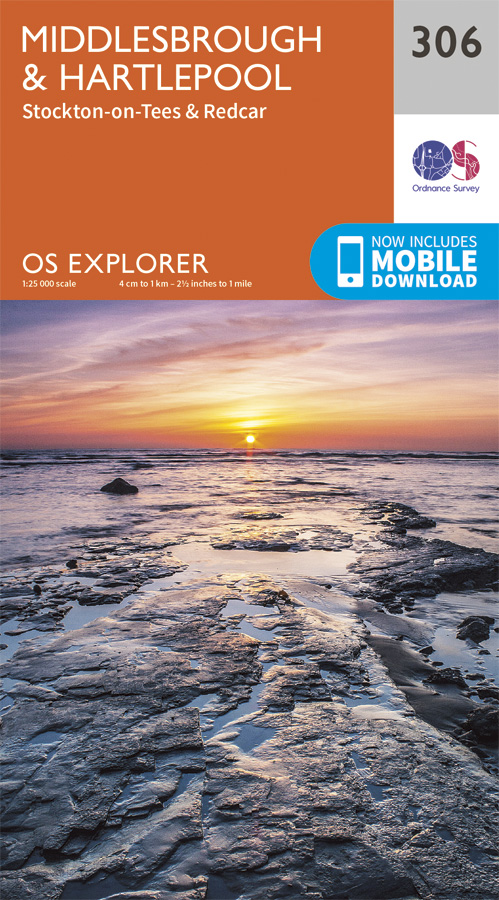
Wandelkaart 306 Middlesbrough & Hartlepool - OSI
Omvat het gebied rond Middlesbrough in het noordoosten
Korte omschrijving
Wandelkaart Middlesbrough & Hartlepool - North Yorkshire Omvat ook: Stockton-on-Tees & Redcar Productomschrijving: OS Explorer kaart 306 omvat het gebied rond Middlesbrough in het noordo...

Specificaties
- Uitgever: Ordnance Survey
- ISBN-13: 9780319245583
- HOOFDCATEGORIEËN: Wandelkaart
- Activiteiten: Wandelen, Hiking & Trekking
- Regio: North Yorkshire, Engeland
- Land: England
- Schaal: 1:25000
- Afmeting: 13x23
- Taal: Engels
- Reeks: Explorer Series OSI
Volledige omschrijving
Wandelkaart Middlesbrough & Hartlepool - North Yorkshire
Omvat ook: Stockton-on-Tees & Redcar
Productomschrijving: OS Explorer kaart 306 omvat het gebied rond Middlesbrough in het noordoosten van Engeland, deze kaart behandelt Hartlepool en Redcar, Stockton-on-Tees en de rivier de Tees. Hoogtepunten van het gebied zijn de Tees Forest, Teesdale way, Tees Link en delen van de Cleveland Way. De OS Explorer kaart voor Middlesbrough & Hartlepool is beschikbaar in zowel de standaard papieren versie als de weerbestendige 'Actief' versie
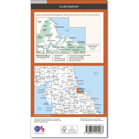
Kaart nummer 306 is een all purpose kaart vol gepakt met informatie om u het gebied te helpen leren kennen. De kaarten bestrijken het land. Elke kaart heeft een oppervlakte van 40 km door 40 km (25 mijl door 25 mijl) en zoals andere kaarten van Ordnance Survey, National Grid-vierkanten worden verstrekt zodat elke functie een unieke referentienummer kan worden gegeven.
Productdiscription: OS Explorer map 306 covers the area around Middlesbrough in the North East of England, this map covers Hartlepool, Redcar, Stockton-on-Tees and the River Tees. Highlights of the area include the Tees Forest, Teesdale Way, Tees Link, and parts of Cleveland Way. The OS Explorer map for Middlesbrough & Hartlepool is available in both the standard paper version and weatherproof 'Active' version
Locatie op kaart
Gekoppelde artikelen

Wandelkaart 306 Middlesbrough & Hartlepool - OSI • 9780319245583
standaard versieWandelkaart Middlesbrough & Hartlepool - North Yorkshire Omvat ook: Stockton-on-Tees & Redcar Productomschrijving: OS Explorer kaart 306 omvat het gebied rond Middlesbrough in het noordoosten van Engeland, deze kaart behandelt Hartlepool en Redcar, Stockton-on-Tees en de rivier de Tees. Hoogtepunten van het gebied zijn de Tees Forest, Teesdale way, Tees Link en delen van de Cleveland W…

Wandelkaart 306 Middlesbrough & Hartlepool - OSI • 9780319471784
weatherproof versieWandelkaartMiddlesbrough & Hartlepool - North East England Omvat ook: Stockton-on-Tees & Redcar. Productbeschrijving: OS Explorer kaart 306 omvat het gebied rond Middlesbrough in het noordoosten van Engeland, deze kaart behandelt Hartlepool en Redcar, Stockton-on-Tees en de rivier de Tees. Hoogtepunten van het gebied zijn de Tees Forest, Teesdale Way, Tees Link en delen van de Clevelan…
Overzichtskaarten

OSI Explorer & Explorer Active - Noord Engeland - Lake District
OSI Explorer & Explorer Active - Noord Engeland - Lake District

Producten op de overzichtskaart
Klik op een product om naar de detailpagina te gaan.
- Wandelkaart 275 Liverpool- South West England - OSI
- Wandelkaart 276 Bolton- Wigan & Warrington- Machester - OSI
- Wandelkaart 277 Manchester & Salford - OSI
- Wandelkaart 278 Sheffield & Barnsley- South Yorkshire - OSI
- Wandelkaart 279 Doncaster- South Yorkshire - OSI
- Wandelkaart 280 Isle of Axholme- Lincolnshire - OSI
- Wandelkaart 281 Ancholme Valley- Lincolnshire - OSI
- Wandelkaart 283 Louth & Mablethorpe- Lincolnshire - OSI
- Wandelkaart 284 Grimsby- Cleethorpes & Immingham - OSI
- Wandelkaart 285 Southport & Chorley- Merseyside - OSI
- Wandelkaart 286 Blackpool & Preston- Lancashire - OSI
- Wandelkaart 287 West Pennine Moors- Lankashire - OSI
- Wandelkaart 288 Bradford & Huddersfield- West Yorkshire - OSI
- Wandelkaart 289 Leeds- Harrogate- Wetherby & Pontefract - OSI
- Wandelkaart 290 York- Selby & Tadcaster- North Yorkshire - OSI
- Wandelkaart 291 Goole & Gilberdyke- Yorkshire - OSI
- Wandelkaart 292 Withernsea & Spurn Head- East Riding - OSI
- Wandelkaart 293 Kingston upon Hull & Beverley - OSI
- Wandelkaart 294 Market Weighton & central Yorkshire Wolds - OSI
- Wandelkaart 295 Bridlington- Driffield & Hornsea - OSI
- Wandelkaart 296 Lancaster- Morecambe & Fleetwood - OSI
- Wandelkaart 297 Lower Wharfedale & Washburn Valley - OSI
- Wandelkaart 298 Nidderdale AONB- Yorkshire - OSI
- Wandelkaart 299 Ripon & Boroughbridge- North Yorkshire - OSI
- Wandelkaart 300 Howardian Hills AONB & Malton - OSI
- Wandelkaart 301 Scarborough- Bridlington & Flamborough
- Wandelkaart 302 Northallerton & Thirsk- North Yorkshire
- Wandelkaart 303 Whitehaven & Workington - OSI
- Wandelkaart 304 Darlington & Richmond- North Cleveland
- Wandelkaart 305 Bishop Auckland & Durham - OSI
- Wandelkaart 306 Middlesbrough & Hartlepool - OSI
- Wandelkaart 307 Consett & Derwent reservoir - OSI
- Wandelkaart 308 Durham & Sunderland- England - OSI
- Wandelkaart 314 Solway Firth- Wigton & Silloth - OSI
- Wandelkaart 315 Carlisle- Brampton- Longtown - OSI
- Wandelkaart 316 Newcastle upon Tyne- Northumberland- OSI
- Wandelkaart OL2 Yorkshire Dales- Southern & Western Areas - OSI
- Wandelkaart OL19 Howgill Fells and Upper Eden Valley - OSI
- Wandelkaart OL21 South Pennines - Yorkshire - OSI
- Wandelkaart OL26 North York Moors - Western area - OSI
- Wandelkaart OL27 North York Moors- Eastern area - OSI
- Wandelkaart OL30 Yorkshire Dales - Yorkshire England - OSI
- Wandelkaart OL31 North Pennines- Teesdale & Weardale - OSI
- Wandelkaart OL41 Forest of Bowland & Ribblesdale - OSI
- Wandelkaart OL43 Hadrian's Wall - OSI
Artikelen uit dezelfde regio

Wandelgids Trekking the Coast to Coast Path - Knife Edge • 9781912933143
Trekking the Coast to Coast Path - Knife Edge Productomschrijving: Deze beroemde wandelroute van om en bij de 290 km, loopt door 3 nationale parken, 3 wereldbekende nationale parken die elk appart hun eigen specifieke voordelen bieden. Route: St-Beest to Robin Hood's Bay Engelse omschrijving: The definitive two-way guide to the Coast to Coast Path: both eastbound and westbound rou…

Wandelkaart 302 Northallerton & Thirsk- England - OSI • 9780319471746
Wandelkaart Northallerton & Thirsk - North Yorkshire England Omvat ook: Catterick & Bedale. Productbeschrijving: Kaart nummer 302 in de OS Explorer kaarten reeks is ideaal voor het ontdekken North Yorkshire rond Thirsk en Northallerton. Dit gebied is onderdeel van de Vale van Mowbray, en heeft zwoele rivieren en golvende landschappen om te ontdekken, die in detail op deze kaart worden …

Fietskaart Yorkshire Dales National Park - Goldeneye • 9781859651421
Fietskaart Yorkshire Dales National Park - Goldeneye Productomschrijving: De Yorkshire Dales is een heuvellandschap in Noord-Engeland dat voornamelijk ten oosten van de waterscheiding van het Penninisch gebergte is gelegen in Noord-Yorkshire. Het maakt voornamelijk deel uit van het graafschap North Yorkshire, een klein gedeelte is gelegen in Cumbria. Het beeld dat men in deze omgeving aant…

Wandelkaart 299 Ripon & Boroughbridge - England - OSI • 9780319471715
Wandelkaart Ripon & Boroughbridge - North Yorkshire England Omvat ook: Easingwold. Productbeschrijving: Kaart nummer 299 in de OS Explorer kaarten reeks is ideaal voor ontdekken van North Yorkshire rond Ripon en Boroughbridge. Bezoek de kathedraal stad van Ripon en de Ripon markt, of de Ripon Hornblower, een traditie van de Middeleeuwen. Andere hoogtepunten van het gebied zijn: Easingw…

Wandelkaart 298 Nidderdale AONB North Yorkshire - OSI • 9780319471708
Wandelkaart Nidderdale AONB - North Yorkshire England Omvat ook: Fountains Abbey, Ripon & Pateley Bridge. Productbeschrijving: Kaart nummer 298 in de OS Explorer kaarten reeks beslaat een gebied van Noord-Yorkshire rond Nidderdale. De Nidderdale Way en Ripon Rowel pad, voeren uit door dit schilderachtige gebied, die ook een deel van de Yorkshire Dales National Park heeft. Hoogtepunten …