
Wandelkaart 900 Banff South & Banff and Kootenay NP - Nat Geo
2 van Canada's mooiste nationale parken
Korte omschrijving
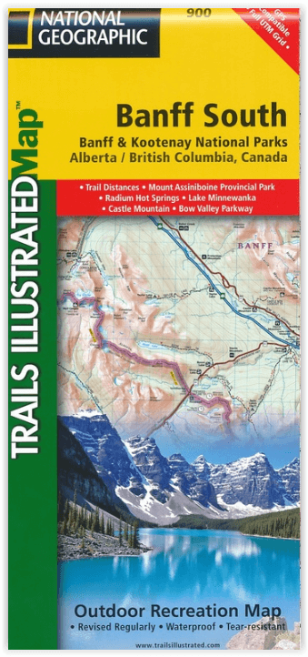
Wandelkaart 900 - Banff South & Banff and Kootenay NP - Natgeo Productomschrijving: Deze omvat een overzicht van alle recreatieve wandelpaden, wegen en vele andere informatie die u zou kunne...

Specificaties
- Uitgever: National Geographic
- ISBN-13: 9781566956581
- HOOFDCATEGORIEËN: Wandelkaart
- Regio: Alberta, Canada, British Colombia, Canada
- Land: Canada
- Nationale parken: Banff NP Alberta Canada, Kootenay National Park BC Canada
- Schaal: 1:100000
- Afmeting: 10x19
- Taal: Engels
Volledige omschrijving
Wandelkaart 900 - Banff South & Banff and Kootenay NP - Natgeo
Productomschrijving: Deze omvat een overzicht van alle recreatieve wandelpaden, wegen en vele andere informatie die u zou kunnen nodig hebben in deze 2 schitterende nationale parken, die letterlijk aan elkaar werden genaaid. De wildernis van Banff en Kootenay, zijn geen zondag wandelplaatsje, je bereidt uw tocht altijd goed voor, en gaat nooit alleen, mits u over de nodig ervaring beschikt. In deze locaties wonen de dieren nog vrij, en het omvat ook de grotere wilde dieren.
Engelse omschrijving: National Geographic's Trails Illustrated map of Banff South delivers unmatched detail for outdoor enthusiasts exploring the unparalleled mountain scenery and year-round recreational opportunities in the Canadian Rockies. Expertly researched and created in cooperation with Parks Canada and others, the map covers the southern and eastern areas of Banff National Park including popular points of interest Lake Minnewanka, Bow River, Johnston Canyon and the town of Banff. The map also covers Kootenay National Park; Scalp Creek Nature Area; Panther Corner, Dormer Sheep and Ghost PLUZs; Wild Horse and Red Deer River Recreation Areas; Height of the Rockies, Don Getty and Bow Valley Wildland Provincial Parks; Ghost River Wilderness Area; and Mount Assiniboine.
Explore the area by following the map to trailheads and then along precisely mapped trails, shown with distance markers in miles and kilometers and labeled for hiking, biking and horseback riding. To aid in your navigation the map shows glaciers and icefields, contour lines and elevations, labeled peaks and passes and water features. Find suitable areas for exploration, according to your area of interest, with labeled campgrounds and campsites, horse camps and corrals, hot springs, river access points, scenic viewpoints, interpretive trails and areas for hiking, cross-country and downhill skiing, biking, fishing.
.png)
Locatie op kaart
Overzichtskaarten

NAT GEO Jasper Alberta trail map
NAT GEO Jasper Alberta trail map

Producten op de overzichtskaart
Klik op een product om naar de detailpagina te gaan.
Artikelen uit dezelfde regio

Reisgids Vancouver pocket guide - Lonely Planet • 9781838699253
Vancouver pocket guide van Lonely Planet Productomschrijving: Voor zoveel of dat "Second Hollywood" Vancouver groot is, is Vancouver Island minstens even groot. Omvat: Downtown, West End, Gastown, Chinatown, Yaletown, Granville Island, Fairview, South Granville, Kitsilano, University of British Columbia Engelse omschrijving: Lonely Planet’s Pocket Vancouver is your passport to the …

Wandelgids British Columbia walking guide Cicerone • 9781852843403
Wandelgids British Columbia walking guide (9781852843403) Cicerone Productomschrijving: Een gids voor wandelingen in Noord-Amerika's wilde en mooie British Columbia, Canada. Van de Canadese Rocky Mountains naar de Stille Oceaan heeft Brits-Columbia 637 provinciale parken, zes nationale parken, brede regio's van beschermde grond en eeuwenoude bossen. De routes zijn een mix van langere bergp…

Wandelkaart 13 Het beste van Lake Louise - Gemtrek • 9781895526752
Wandelkaart - Het beste van Lake Louise - Gemtrek Productomschrijving: Lake Louis, het befaamde meer, die althans de naam meedraagt. We spreken uiteraard over een volledig gebied. De Lake zelf is een prachtig helderblauw watergebied, met een immens uitzicht op de bijgelegen hoge met sneeuwbedekte bergen. In de winter kan tot een meter sneeuw op het water liggen, in de zomer vallen de blade…

Reisgids Canada - insight guide • 9789066554849
Reisgids - Canada - insight guide Productomschrijving: Canada is het op één na grootste land ter wereld en strekt zich uit over een afstand van 5500 km tussen de Atlantische Oceaan en de Grote Oceaan. De variatie van landschappen is dan ook ongekend groot en ondanks deze enorme afmetingen zijn de auteurs en fotografen op de bekende, onovertroffen en veelvuldig bekroonde Insight Guide-wijze…

Travelguide - British Columbia & the Canadian Rockies - LP • 9781787013650
Travelguide - British Columbia & the Canadian Rockies - LP Covers: Alberta, British Columbia, Yukon Territory and more Product description: Sigh-inducing mountains, mist-shrouded forests and epic tooth-and-claw wildlife: this is Canada’s legendary outdoor wonderland. And it’s served alongside a full menu of distinctive, ever-inviting communities. Lonely Planet will get you to the heart…