
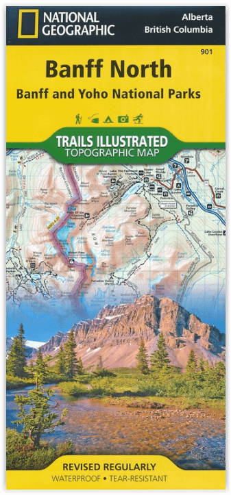
Wandelkaart 901 Banff North - Banff and Yoho NP - Nat Geo
Topografische wandelkaart van 2 van Canada's nationale parken
Korte omschrijving
TOPO Wandelkaart 901 - Banff North - Banff and Yoho NP - Natgeo Productomschrijving: Deze topografische wandelkaart van 2 van Canada's mooiste nationale parken heeft heel wat in petto. De ka...

Specificaties
- Uitgever: National Geographic
- ISBN-13: 9781566956598
- HOOFDCATEGORIEËN: Wandelkaart
- Regio: Alberta, Canada
- Land: Canada
- Nationale parken: Banff NP Alberta Canada, Yoho NP, Alberta, Canada
- Schaal: 1:100000
- Afmeting: 10x19
- Taal: Engels
Volledige omschrijving
TOPO Wandelkaart 901 - Banff North - Banff and Yoho NP - Natgeo
Productomschrijving: Deze topografische wandelkaart van 2 van Canada's mooiste nationale parken heeft heel wat in petto. De kaart is meer dan voldoende voor deze 2 zeer grote weliswaar wilde plaatsen. Wat er ook te vinden valt is bijvoorbeeld het beeldschone Lake Louis, die te vinden is langs de grote en enige autoroute door dit stukje nationaal park, die dan ook verder loopt in de richting van Jasper NP.
Engelse omschrijving: National Geographic's Trails Illustrated map of Banff North delivers unmatched detail for outdoor enthusiasts exploring the unparalleled mountain scenery and abundance of recreational opportunities of the Canadian Rockies. Expertly researched and created in cooperation with Parks Canada and others, the map covers the northern and western areas of Banff National Park as well as Yoho and Kootenay National Parks, Siffleur and White Goat Wilderness Areas, Kootenay Plains Provincial Park and the southeastern tip of Jasper National Park. Many popular recreation points of interest are shown, including Lakes Louise and O'Hara as well as the scenic Icefields Parkway, displayed with distance markers.
Explore the area by following the map to trailheads and then along precisely mapped trails, shown with distance markers in miles and kilometers and labeled for hiking, biking and horseback riding. To aid in your navigation the map shows glaciers and icefields, contour lines and elevations, labeled peaks and passes, areas of rock debris and water features. Find suitable areas for exploration, according to your area of interest, with labeled campgrounds and campsites, backcountry lodging and cabins, horse camps and corrals, biking and skiing areas, river access points, fishing areas, lookout towers and scenic viewpoints. The map also includes background information about the area, bear safety tips and essential contact information.
Every Trails Illustrated map is printed on "Backcountry Tough" waterproof, tear-resistant paper. A full UTM grid is printed on the map to aid with GPS navigation. Other features found on this map include: Banff National Park, Lake Louise.
.png)
Locatie op kaart
Overzichtskaarten

NAT GEO Jasper Alberta trail map
NAT GEO Jasper Alberta trail map

Producten op de overzichtskaart
Klik op een product om naar de detailpagina te gaan.
Artikelen uit dezelfde regio

Wandelkaart 900 Banff South & Banff and Kootenay NP - Nat Geo • 9781566956581
Wandelkaart 900 - Banff South & Banff and Kootenay NP - Natgeo Productomschrijving: Deze omvat een overzicht van alle recreatieve wandelpaden, wegen en vele andere informatie die u zou kunnen nodig hebben in deze 2 schitterende nationale parken, die letterlijk aan elkaar werden genaaid. De wildernis van Banff en Kootenay, zijn geen zondag wandelplaatsje, je bereidt uw tocht altijd goed voo…


Reisgids Wat & Hoe West-Canada - Kosmos • 9789043932530
Reisgids West-Canada - Kosmos Productomschrijving: Met deze Wat & Hoe Reisgids West-Canada ga je voorbereid onderweg. Bezoek het multiculturele Vancouver, ontdek de moderne architectuur van Calgary of trek de Canadese Rocky Mountains in. Ook de prachtige nationale parken van Canada, zoals Banff of Jasper, zijn het bezoeken meer dan waard. Wat krijg je: - Een gids met perfect reisfo…

Wandelkaart 903 Jasper NP North - Alberta - Nat Geo • 9781566956611
TOPO Wandelkaart 903 - Jasper NP North - Alberta - National Geographic Productomschrijving: Het Jasper National Park is een nationaal park in Canada, gelegen in het westen van Alberta, en onderdeel van de Rocky Mountains. Het beslaat een gebied van 10.878 km² en omvat onder meer het plaatsje Jasper en Maligne Lake. Het Banff National Park ligt ten zuiden van dit park. Jasper staat bekend o…

Wandelkaart D70 Kananaskis Country Alberta Canada - Gem Trek • 9781990161001
Wandelkaart Kananaskis Country Alberta Canada - Gem Trek Productomschrijving: Waterdichte en scheurbestendige kaart voor Kananaskis Country in de Canadese Rockies. Kaartdekking: De Kananaskis Country Kaart bestrijkt heel Kananaskis Country in de Canadese Rockies. De kaart strekt zich uit van Canmore en de Bow Valley in het noorden tot de Highwood River en Cataract Creek in het zuiden. …

Wandelkaart 05 Banff & Mount Assiniboine Canada - Gemtrek • 9781895526981
Wandelkaart Banff & Mount Assiniboine Canada Productomschrijving: Een prachtige regio, die in de zomer met geen enkele plaats in de wereld vergeleken kan worden. Canada, en zeker het westen, behoren tot de mooiste plaatsen ter wereld. Engelse omschrijving: Gem Trek’s Banff & Mount Assiniboine map meets the needs of visitors looking to explore the southern portion of Banff National Par…