
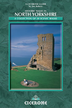
Wandelgids North Yorkshire historic walks - Cicerone
Omvat Skipton Castle- Ripon en Fountains Abbey & Ripley Castle
Korte omschrijving
Wandelgids - North Yorkshire historic walks - Cicerone Productomschrijving: Een gids over historische wandelingen in North Yorkshire, in 20 meestal circulaire routes. Zij brengen u van open ...

Specificaties
- Uitgever: CICERONE Press
- ISBN-13: 9781852843892
- HOOFDCATEGORIEËN: Wandelgids
- Activiteiten: Wandelen, Hiking & Trekking
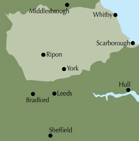
- Regio: North & North East England, Yorkshire, England
- Land: England
- Historische wandelroutes: North Yorkshire Historic walks
- Blz.: 160
- Afmeting: 12x17
- Editie: 1
- Taal: Engels
Volledige omschrijving
Wandelgids - North Yorkshire historic walks - Cicerone
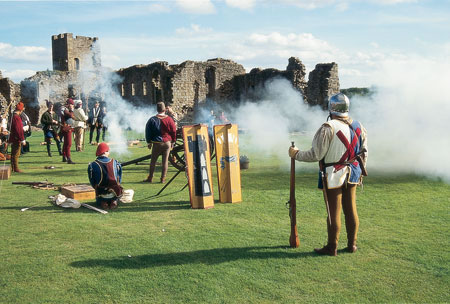
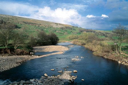
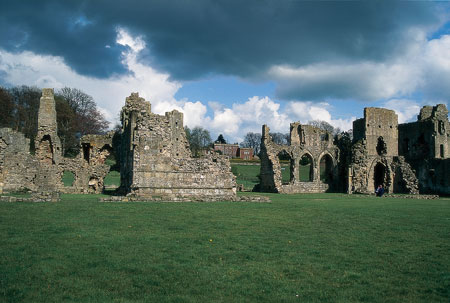
Productomschrijving: Een gids over historische wandelingen in North Yorkshire, in 20 meestal circulaire routes. Zij brengen u van open heidegebied en blootgestelde delen van heuvel en kliffen naar de meer beschutte dales en de straten van York. Wandelingen bevatten Skipton Castle, Ripon en Fountains Abbey, Ripley Castle, Castle Howard, Whitby Abbey, Bolton Abbey en de Romeinse stad Aldborough. Historische wandelingen in North Yorkshire nemen een poging om wat pracht van dit land, de ruime akkers te onthullen. Vergezeld door OS (Ordnance Servey kaarten) toewijzing en geïllustreerd met kleurenfoto's, combineren de serie van wandelingen, landschap met architectuur, natuurlijke schoonheid met geschiedenis, en ons erfgoed, met onze diverse en complexe cultuur.
Product description: The historic past makes its presence felt in virtually every fold and turn of the north Yorkshire landscape, and the walks in this guidebook have been chosen for their combination of scenic and historical appeal.
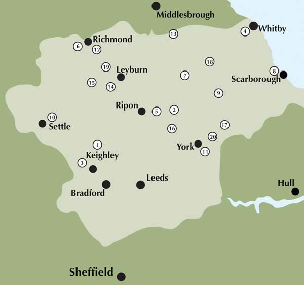
- The guide contains 20 walks, 4.5 to 12 miles in length. - The walks take in a variety of scenery, including open moorland, hillside, gentle dales and coastal cliffs.- The visit numerous historical towns, such as Richmond and York, and a variety of historical sites, including castles, churches
- The guide is in full colour throughout, and each route is accompanied by Ordnance Survey mapping.
Locatie op kaart
Overzichtskaarten

Hystorische wandel- en fietsroutes
Hystorische wandel- en fietsroutes

Producten op de overzichtskaart
Klik op een product om naar de detailpagina te gaan.
- Wandelkaart - South Downs Way - Harvey maps
- Wandelgids - North Yorkshire historic walks - Cicerone
- Wandelkaart OL13 - Brecon Beacons NP - Eastern area - OSI
- Wandelgids - Pilgrim Pathways walking guide - Trailblazer
- Wandelgids - The Great Glen Way - Trailblazer
- Wandelgids - Hadrian's wall Path - Knife Edge
- Wandelgids - Hadrian's Wall Path - Trailblazer
- Wandelkaart XT40 - Offa's Dyke Path - Harvey Maps
- Wandelkaart OL43 - Hadrian's Wall - OSI
- Wandelgids - Cleveland Way - Trailblazer
- Wandelkaart 351 - Dunbar & North Berwick- Schotland - OSI
- Wandelgids - Walking in the Forest of Dean - Cicerone
- Wandelkaart 130 - Salisburry & Stonehenge- Wiltshire - OSI
- Wandelkaart 256 - Wrexham- Wrecsam & Llangollen - OSI
- Wandelkaart 130 - Salisbury & Stonehenge- Wiltshire - OSI
- Wandelgids - John Muir Trail - Cicerone
- Wandelkaart - Rob Roy Way National trail - Harvey maps
- Wandelkaart - Hadrian's Wall Path - Harvey maps
- Wandelkaart - Offa's Dyke Path- Route Map Booklet - Cicerone
Artikelen uit dezelfde regio

Mountainbikegids Yorkshire Dales mountain biking - Cicerone • 9781852846763
Mountainbikegids - Yorkshire Dale mountain biking - Cicerone Productomschrijving: Een handige gids over 30 korte, middellange, lange en volledig-dag MTB routes over het Yorkshire Dales National Park, de speeltuin van de bergfietser van Noord-Engeland. Circulaire ritten bezoeken de grote valleien en nemen lussen rond twee van de drie pieken, Whernside en Pen-y-Gent. Kies een route door midd…

Wandelkaart 291 Goole & Gilberdyke Yorkshire - OSI • 9780319244883
Wandelkaart Goole & Gilberdyke - Yorkshire England Productbeschrijving: Holme-on-Spalding-Moor, Hemingbrough & Howden. 291 / Goole & Gilberdyke, Yorkshire, England - Aan het begin van de Humber toont OS Explorer kaart 291 de rivieren de Ouse en de Trent, de stad van Goole en het omliggende gebied. Hoogtepunten zijn de Bubwith Rail Trail, Hoden 20 recreatieve paden en de Trans Pennine …

Wandelkaart 295 Bridlington Driffield & Hornsea - OSI • 9780319245477
Wandelkaart Bridlington- Driffield & Hornsea - Yorkshire Productbeschrijving: 295 / Bridlington, Driffield & Hornsea, East Riding of Yorkshire, England - Van Hornsea langs de kust naar Bridlington en de binnenvaart tot Driffield. OS Explorer kaart 295 is de perfecte partner voor al uw outdoor avonturen. Het omvat ook delen van vier recreatieve paden: landtong way, Hornsea Rail Trail,…

Wandelgids Dales Way-Map Booklet - Cicerone • 9781786310941
Map Booklet - The Dales Way - Cicerone Press Productomschrijving: OPGELET: inbegrepen indien u de wandelgids zelf koopt. Kaart van de 79 mijl (135 km) lange Dales Way door de Yorkshire Dales tussen Ilkley en Bowness-on-Windermere. Dit boekje is bijgesloten bij de Cicerone gids en toont de volledige route op OS 1:25,000 kaarten. Het is een van de meest rustige meerdaagse wandelingen in Gro…

Fietskaart Yorkshire Dales West - Harvey maps • 9781851374656
Fietskaart Yorkshire Dales West - Harvey maps Productomschrijving: Gedetailleerde wandel-, fiets- en off-roadkaart die GPS compatibel is. Omvat nauwkeurig geselecteerde off-road fietsroutes. Met een groot gebied op een compact blad. De Yorkshire Dales West omvatten bovenste Ribblesdale, met inbegrip van de Yorkshire 3 pieken - Whernside, Ingleborough en Pen y Gent, de Howgill Fells, en Den…