
Wandelkaart Offa's Dyke Path- Route Map Booklet - Cicerone
283 km tussen Sedbury (bij Chepstow) en Prestatyn
Korte omschrijving
Wandelkaart boekje - Offa's Dyke Path - Cicerone Productomschrijving: Kaartboekje van het 177 mijl (283 km) lange Offa's Dyke Path National Trail, tussen Sedbury (bij Chepstow) en Prestatyn...

Specificaties
- Uitgever: CICERONE Press
- ISBN-13: 9781852848941
- HOOFDCATEGORIEËN: Wandelkaart
- Activiteiten: Wandelen, Hiking & Trekking
- Regio: Gloucestershire, Egland, Herefordshire, England, Shropshire West Midlands
- Land: England, United Kingdom, Great Britain, Wales
- Historische wandelroutes: Offa's Dyke Path (283 km)
- Blz.: 80
- Schaal: 1:25000
- Afmeting: 12x17
- Editie: 1
- Taal: Engels
Volledige omschrijving
Wandelkaart boekje - Offa's Dyke Path - Cicerone
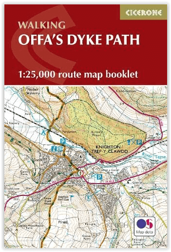
Productomschrijving: Kaartboekje van het 177 mijl (283 km) lange Offa's Dyke Path National Trail, tussen Sedbury (bij Chepstow) en Prestatyn. Het pad is in 2 weken te lopen en is geschikt voor wandelaars van alle ervaringsniveaus. Dit compacte boekje met OS 1:25,000 kaarten toont de volledige route en biedt alle kaarten die u nodig heeft, en wordt bij de gids geleverd.
Omvat: Chepstow, Hay-on-Wye, Kington, Bishops Castle, Montgomery, Welshpool, Oswestry, Llangollen, Denbigh & Prestatyn.
Engelse omschrijving: Map of the 177 mile (283km) Offa's Dyke Path National Trail, between Sedbury (near Chepstow) and Prestatyn. The trail takes 2 weeks to walk, and is suitable for walkers at all levels of experience. This compact booklet of OS 1:25,000 maps shows the full route, providing all of the mapping you need, and is included with the guidebook.
Seasons:
This walk is exceptional in all seasons, though the Black Mountains and Clwydian range deserve respect in winter conditions, and especially in mist, since there are few landmarks on the Black Mountain ridge.
Difficulty:
The trail includes a couple of unavoidably long stages and there are some mountain and moorland stages, but the route poses no special difficulties and caters for walkers of all levels of ability provided that sensible advance planning is undertaken
Must See:
Geology - limestone gorge of the lower Wye, igneous intrusions around Hergest ridge, Breidden Hills dolerite, limestone escarpments north of Llangollen Uplands - Black Mountain moorlands, remote Clun Forest, Clwydian ridge Lowlands - orchards and meadows, Montgomery canal, broad Severn valley Historical attractions - Tintern abbey and Llanthony priory, border castles, Pontcysyllte aqueduct
Gekoppelde artikelen

Wandelgids The Offa's Dyke Path - England & Wales - Cicerone • 9781852847760
standaard versieWandelgids The Offa's Dyke Path - Wales - Cicerone Productomschrijving: Deze gids beschrijft het Offa's Dyke Path National Trail, een langeafstandswandeling van 283 km langs de Engels-Welshe grens tussen Sedbury (bij Chepstow) en Prestatyn. De gids is opgedeeld in 12 etappes met suggesties voor het plannen van alternatieve routes. Met 1:25K OSI (Ordnance Servey) kaart boekje. Engelse o…
Overzichtskaarten

Hystorische wandel- en fietsroutes
Hystorische wandel- en fietsroutes

Producten op de overzichtskaart
Klik op een product om naar de detailpagina te gaan.
- Wandelkaart - South Downs Way - Harvey maps
- Wandelgids - North Yorkshire historic walks - Cicerone
- Wandelkaart OL13 - Brecon Beacons NP - Eastern area - OSI
- Wandelgids - Pilgrim Pathways walking guide - Trailblazer
- Wandelgids - The Great Glen Way - Trailblazer
- Wandelgids - Hadrian's wall Path - Knife Edge
- Wandelgids - Hadrian's Wall Path - Trailblazer
- Wandelkaart XT40 - Offa's Dyke Path - Harvey Maps
- Wandelkaart OL43 - Hadrian's Wall - OSI
- Wandelgids - Cleveland Way - Trailblazer
- Wandelkaart 351 - Dunbar & North Berwick- Schotland - OSI
- Wandelgids - Walking in the Forest of Dean - Cicerone
- Wandelkaart 130 - Salisburry & Stonehenge- Wiltshire - OSI
- Wandelkaart 256 - Wrexham- Wrecsam & Llangollen - OSI
- Wandelkaart 130 - Salisbury & Stonehenge- Wiltshire - OSI
- Wandelgids - John Muir Trail - Cicerone
- Wandelkaart - Rob Roy Way National trail - Harvey maps
- Wandelkaart - Hadrian's Wall Path - Harvey maps
- Wandelkaart - Offa's Dyke Path- Route Map Booklet - Cicerone
Artikelen uit dezelfde regio

Wandelkaart XT Malvern Hills AONB England - Harvey map • 9781851376056
Wandelkaart - Malvern Hills AONB England - Harvey map Productomschrijving: Deze Mavern Hills zijn een samenstelling van heuvels in de Engelse counties, Worcestershire, Herefordshire, en een klein deel van Gloucestershire, en domineren de volledige regio rond deze counties van het district van Alvern Hills. Het hoogst gelegen punt van deze regio biedt een panorama van de Severn vallei met d…

Fotoboek Cotswolds - The beauty of The Cotswolds AONB • 9781859652183
Fotoboek Cotswolds - The beauty of The Cotswolds AONB Productomschrijving: De eerste van een nieuwe serie van massamarkt souvenirboeken. Een Memento, een aandenken voor de duizenden toeristen die de Cotswolds, Cornwall, Lake District en Noord-Devon bezoeken. Dit fotoboek is een bewijs van William Fricker zijn lange geschiedenis met de Cotswoldheuvels. Deze beelden zijn vergaard geweest uit…

Wandelkaart 168 Stroud- Tetbury & Malmesbury - OSI • 9780319470404
Wandelkaart Stroud- Tetbury & Malmesbury - England Productbeschrijving: Kaart nummer 168 in de OS Explorer kaarten reeks omvat Stroud, Tetbury, Malmesbury en Nailsworth. Hoogtepunten van het gebied zijn onder meer: Cotswolds AONB, Cotswold Way, Monarch Way en de Thames Path. De OS Explorer kaart voor Stroud, Tetbury & Malmesbury is beschikbaar in zowel de standaard papieren versie als de w…

Wandelkaart 202 Leominster & Bromyard Hererfordshire - OSI • 9780319243954
Wandelkaart Leominster & Bromyard - Hererfordshire England Productbeschrijving: Kaart nummer 202 dekt Leominster, Bromyard en Hereford. Hoogtepunten zijn de Herefordshire trail, Bromyard Downs, Three Choirs Way en de Wye Valley Walk. Omvat ook Burghill en Bodenham. De OS Explorer kaart voor Leominster & Bromyard is beschikbaar in zowel de standaard papieren versie als de weerbestendige 'Ac…

Wandelgids Walking in the Wye Valley - Cicerone • 9781852847241
Wandelgids - Walking in the Wye Valley - Cicerone Productomschrijving: Een gids met 30 gevarieerde wandelingen van 3 tot 10 mijl, in de vallei van de Wye, en de mooiste rivier in Engeland en Wales, tussen Chepstow in het zuiden en Plynlimon. Het landschap varieert van open heidevelden naar beboste kloven en is bezaaid met de sites van de IJzertijd met heuvelforten en kastelen. Centra omvat…