
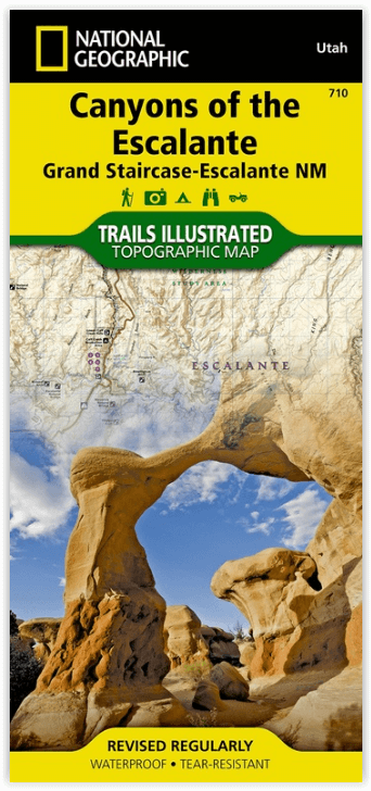
Wandelkaart 710 Canyons of the Escalante NP - Nat Geo
Grand Staircase - Het Kaiparowits Pl - Canyons van de Escalateau
Korte omschrijving
Wandelkaart Canyons of the Escalante NP - Nat Geo Productomschrijving: Dit National monument omvat drie belangrijke gebieden, de Grand Staircase, het Kaiparowits Plateau, en de Canyons van d...

Specificaties
- Uitgever: National Geographic
- ISBN-13: 9781566953245
- HOOFDCATEGORIEËN: Wandelkaart
- Regio: Utah, USA
- Land: Verenigde Staten van Amerika (USA)
- Waterafstotende kaart: Nat Geo waterproof series
- Schaal: 1:75000
- Afmeting: 10x19
- Taal: Engels
Volledige omschrijving
Wandelkaart Canyons of the Escalante NP - Nat Geo
Productomschrijving: Dit National monument omvat drie belangrijke gebieden, de Grand Staircase, het Kaiparowits Plateau, en de Canyons van de Escalante. De regio omvat de steden van Big Water, Glendale en Kanab in Utah in het zuidwesten en de steden van Escalante en Boulder in het noordoosten
Omvat: Box-Death Hollow Wilderness, Capitol Reef National Park, Circle Cliffs, Dixie National Forest, Escalante River, Fiftymile Mountain, Glen Canyon National Recreation Area, San Juan River, Smoky Mountain, Straight Cliffs.
Engelse omschrijving: At over 1.7 million acres, Grand Staircase - Escalante National Monument encompasses the largest land area of all national monuments in the United States. National Geographic's Trails Illustrated map of Canyons of the Escalante delivers unmatched detail and valuable information to assist you in your exploration of this remote and colorful wilderness. Expertly researched and created in partnership with local land management agencies, this map features key points of interest including Fiftymile Bench, Escalante Petrified Forest State Park, Anasazi State Park Museum, and Horse Canyon.
Hiking route summaries will guide you off the beaten path and back again and high clearance and four-wheel-drive roads are clearly marked to keep you out of trouble. River mileage on the Escalante River is noted as well, for those exploring the canyons by boat. The map base includes contour lines and elevations for summits. Recreation features include campgrounds, trailheads, picnic areas, points of interest, fishing access, and boat launches.
Every Trails Illustrated map is printed on "Backcountry Tough" waterproof, tear-resistant paper. A full UTM grid is printed on the map to aid with GPS navigation.
Overzichtskaarten

NAT GEO Utah trail maps
NAT GEO Utah trail maps

Producten op de overzichtskaart
Klik op een product om naar de detailpagina te gaan.
- Wandelkaart 210 Canyonlands NP - Utah - Natgeo
- Wandelkaart 211 Arches National Park- Utah - Natgeo
- Wandelkaart 214 Zion National Park - Natgeo
- Wandelkaart 219 Bryce Canyon NP Utah - Natgeo
- Wandelkaart 220 Dinosaur National Monument - Natgeo
- Wandelkaart 267 Capitol Reef NP Utah - Natgeo
- Wandelkaart 310 Canyonlands NP - Island in the Sky District
- Wandelkaart 311 Canyonlands NP - Needles District - Natgeo
- Wandelkaart 312 Canyonlands NP - Maze District - Natgeo
- Wandelkaart 703 Manti-La Sal National forest - Natgeo
- Wandelkaart 704 Flaming Gorge- Recreational Area - Utah
- Wandelkaart 709 Wasatch Front North Utah - Nat Geo
- Wandelkaart 710 Canyons of the Escalante NP - Nat Geo
- Wandelkaart 213 Glen Canyon & Capitol Reef NP - Nat Geo
Artikelen uit dezelfde regio

Wandelkaart 507 Moab Oost - Dewey Bridge & Sand Flats - Nat Geo • 9781566959025
Wandelkaart Moab Oost - Dewey Bridge & Sand Flats - Nat Geo Productomschrijving: Deze kaart omvat het Oostelijke gedeelte van het grote Moab recreatie gebied van het befamde National Geographic's Trails Illustrated. De kaart biedt een overzicht genummerd 507 op onderstaande kaart van het gebied. Het gebied omvat 3 kaarten met nummers, 505, 506 & 507. De 505 is de kaart die alles in één kee…

Wandelkaart 213 Glen Canyon & Capitol Reef NP - Nat Geo • 9781566953436
Wandelkaart Glen Canyon & Capitol Reef NP - Nat Geo Omvat: Bullfrog Creek, Cataract Canyon, Dirty Devil River, Escalante River, Glen Canyon, Glen Canyon Dam, Glen Canyon National Recreation Area, Kaibito Creek, Lake Powell, Mount Hillers, Navajo Creek, Paria River, Rainbow Plateau, Red Canyon, San Juan River, Smoky Mountain, Wahweap Creek, Wilson Mesa. Engelse omschrijving: Let Nationa…

Wandelkaart 219 Bryce Canyon NP Utah - Natgeo • 9781566953207
TOPO Wandelkaart 219 - Bryce Canyon NP Utah - Natgeo Productomschrijving: Bryce Canyon Nationaal Park is een Amerikaans nationaal park gelegen in het zuidwesten van Utah. De hoofd atractie in het park is Bryce Canyon, die ondanks zijn naam, geen echte canyon is, maar een collectie van lange natuurlijke amphitheaters langs de oostelijke zijde van het Paunsaugunt Plateau. Engelse omschri…

Wandelkaart 703 Manti-La Sal National forest - Natgeo • 9781566953771
TOPO Wandelkaart 703 - Manti-La Sal National forest - Nat Geo Productomschrijving: Het Manti–La Sal National Forest omvat meer dan 4,900 km, en is gelegen in centraal- en zuidoostelijke deel van Utah en het extreme westelijke deel van Colorado. Engelse omschrijving: Expertly researched and created in cooperation with the U.S. Forest Service, Bureau of Land Management and others, Natio…

Wandelkaart 211 Arches National Park- Utah - Natgeo • 9781566953276
TOPO Wandelkaart 211 - Trails Illustrated Arches NP - Utah Productomschrijving: Het Arches National Park is een iets kleiner exemplaar onder die van Amerika vergeleken uiteraard. Het Park is beroemd omwille van de vele speciale rotsformaties en balancerende rotsen zoals de Courthouse Towers, Windows Section, Fiery Furnace, Devils Garden, Klondike Bluffs en de Balanced Rock. Er zijn meer da…