
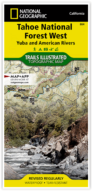
Wandelkaart 804 Tahoe National Forest West - Nat Geo
Yuba & American Rivers
Korte omschrijving
Tahoe National Forest West - Nat Geo Omvat: Donner Pass, Eldorado National Forest, Granite Chief Wilderness, Mosquito Ridge, Plumas National Forest, Sawtooth Ridge, Tahoe National Forest, Tr...

Specificaties
- Uitgever: National Geographic
- ISBN-13: 9781566954259
- HOOFDCATEGORIEËN: Wandelkaart
- Activiteiten: Wandelen, Hiking & Trekking
- Regio: Californië, USA
- Land: Verenigde Staten van Amerika (USA)
- Waterafstotende kaart: Nat Geo waterproof series
- Schaal: 1:63360
- Afmeting: 10x19
- Taal: Engels
Volledige omschrijving
Tahoe National Forest West - Nat Geo
Omvat: Donner Pass, Eldorado National Forest, Granite Chief Wilderness, Mosquito Ridge, Plumas National Forest, Sawtooth Ridge, Tahoe National Forest, Truckee.
Engelse omschrijving: Expertly researched and created in partnership with the U.S. Forest Service and others, National Geographic's Trails Illustrated map of Yuba and American Rivers region of Tahoe National Forest provides an unparalleled tool for exploring this historically significant region of the Sierras. Whatever the season, you'll find this map a useful tool in pursuing a host of recreational activities from skiing and snowmobiling to camping and boating. The map features many key points of interest, including French Meadows and New Bullards Bar Reservoirs, Granite Chief Wilderness, South Yuba River Recreation Area, Malakoff Diggins State Historic Park, Donner Memorial State Park and the western rim of the Lake Tahoe Basin Management Unit.
The Tahoe National Forest West map can guide you off the beaten path and back again with miles of clearly marked trails including portions of the Pacific Crest, Pioneer, and Tahoe Rim trails. To help you choose the path that's right for you, trails are color coded according to the designated usage and mileage between intersections is indicated. The Yuba Donner scenic byways is noted for those wishing to take in the scenery by car. Many recreation features are noted as well, including ski areas, campgrounds, trailheads, wildlife viewing areas, boat launches, and swimming and fishing areas. The map base includes contour lines and elevations for summits, passes and many lakes.
Every Trails Illustrated map is printed on "Backcountry Tough" waterproof, tear-resistant paper. A full UTM grid is printed on the map to aid with GPS navigation.
Locatie op kaart
Overzichtskaarten

NAT GEO California trail maps
NAT GEO California trail maps

Producten op de overzichtskaart
Klik op een product om naar de detailpagina te gaan.
- Wandelkaart 205 Sequoia & Kings Canyon NP - California
- Wandelkaart 206 Yosemite NP - California - Nat Geo
- Wandelkaart 218 Redwood National & State Parks - Nat Geo
- Wandelkaart 221 Death Valley NP - Nevada - Natgeo
- Wandelkaart 226 Joshua Tree NP - California - Nat Geo
- Wandelkaart 256 Mojave National park California - Nat Geo
- Wandelkaart 306 Yosemite SW- Yosemite Valley - Nat Geo
- Wandelkaart 307 Yosemite NP North West - Nat Geo
- Wandelkaart 308 Yosemite NE- Tuolumne Meadows - Nat Geo
- Wandelkaart 309 Yosemite SE - Ansel Adams Wilderness - Nat Geo
- Wandelkaart 322 Mount Whitney California - Nat Geo
- Wandelkaart 803 Lake Tahoe Basin - California - Nat Geo
- Wandelkaart 804 Tahoe National Forest West - Nat Geo
- Wandelkaart 805 Tahoe Nat. Forest East - Sierra Buttes - Nat Geo
- Wandelkaart 809 Mammoth Lakes - Mono Divide - Nat Geo
- Wandelkaart 810 Shaver Lake - Sierra National Forest - Nat Geo
Artikelen uit dezelfde regio

Wandelkaart 309 Yosemite SE - Ansel Adams Wilderness - Nat Geo • 9781566954136
Wandelkaart Ansel Adams Wilderness - Nat Geo Productomschrijving: National Geographic's Trails Illustrated kaart van Yosemite SE levert ongeëvenaarde details en waardevolle informatie om u te helpen bij uw verkenning van deze adembenemende wildernis. Deze kaart is gemaakt in samenwerking met lokale landbeheerders en biedt ongeëvenaarde details en nuttige informatie voor zowel ervaren outdo…


Wandelkaart 307 Yosemite NP North West - Nat Geo • 9781566954129
Yosemite North West - Nat Geo Omvat: Emigrant Wilderness, Lake Eleanor, Stanislaus National Forest, Yosemite National Park. Engelse omschrijving: National Geographic's Trails Illustrated map of Yosemite North West- Hetch Hetchy Reservoir is designed to meet the needs of outdoor enthusiasts by combining valuable information with unmatched detail of this magnificent region of Yosemite Na…

Wandelkaart 814 Big Sur & Ventana Wilderness - Natgeo • 9781566955782
TOPO Wandelkaart 814 - Big Sur & Ventana Wilderness - Natgeo Productomschrijving: Big Sur & Ventana Wilderness California- Natgeo zijn in andere woorden, het Los Padres National Forest in het United States national forest in southern en central California. National Geographic's Trails Illustrated map of Big Sur, Ventana Wilderness combines unmatched detail with helpful information to o…

Reisgids California - Insight Guides ENG • 9781839053306
Reisgids California - Insight Guides Productomschrijving: Van het beslissen wanneer je gaat tot kiezen wat je gaat zien als je aankomt, dit is alles wat je nodig hebt om je reis te plannen en het beste van Californië te ervaren, met diepgaande insiderinformatie over must-see topattracties zoals Hollywood en verborgen culturele juweeltjes zoals de Pacific Coast Highway. Engelse om…

Wandelkaart 218 Redwood National & State Parks - Nat Geo • 9781566953191
Redwood National & State Parks California - Nat Geo Omvat: Big Lagoon, Klamath National Forest, Klamath River, Lake Earl, Maple Creek, Pelican Bay, Point Saint George, Redwood, Rocky Point, Saint George Reef, Siskiyou Mountains, Siskiyou National Forest, Siskiyou Wilderness, Six Rivers National Forest, Smith River, Trinidad Head. Engelse omschrijving: Let National Geographic's Trails I…