
Wandelkaart 298 Nidderdale AONB North Yorkshire - OSI
Een gebied van Noord-Yorkshire rond Nidderdale
Korte omschrijving
Wandelkaart Nidderdale AONB - North Yorkshire England Omvat ook: Fountains Abbey, Ripon & Pateley Bridge. Productbeschrijving: Kaart nummer 298 in de OS Explorer kaarten reeks beslaat ee...

Specificaties
- Uitgever: Ordnance Survey
- ISBN-13: 9780319471708
- HOOFDCATEGORIEËN: Wandelkaart
- Activiteiten: Wandelen, Hiking & Trekking
- Regio: North Yorkshire, Engeland
- Land: England
- Waterafstotende kaart: Ordnance Survey ACTIVE Explorer Weatherproof Maps
- AONB - Area of Outstanding Beauty: Nidderdale AONB
- Schaal: 1:25000
- Afmeting: 13x24
- Taal: Engels
- Reeks: Explorer ACTIVE Series OSI
Volledige omschrijving
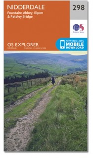
Wandelkaart Nidderdale AONB - North Yorkshire England
Omvat ook: Fountains Abbey, Ripon & Pateley Bridge.
Productbeschrijving: Kaart nummer 298 in de OS Explorer kaarten reeks beslaat een gebied van Noord-Yorkshire rond Nidderdale. De Nidderdale Way en Ripon Rowel pad, voeren uit door dit schilderachtige gebied, die ook een deel van de Yorkshire Dales National Park heeft. Hoogtepunten van het gebied zijn onder andere: Ripon, Pateley Bridge en Fountains Abbey. De OS Explorer kaart voor Nidderdale is beschikbaar in zowel de standaard papieren versie als de weerbestendige 'Actief' versie.
Productdiscription: Map sheet number 298 in the OS Explorer series covers an area of North Yorkshire around Nidderdale. The Nidderdale Way and Ripon Rowel Walk run through this picturesque area, which also has a section of the Yorkshire Dales National Park. Highlights of the area include: Ripon, Pateley Bridge and Fountains Abbey. The OS Explorer map for Nidderdale is available in both the standard paper version and weatherproof 'Active' version.
Locatie op kaart
Gekoppelde artikelen

Wandelkaart 298 Nidderdale AONB- Yorkshire - OSI • 9780319245507
standaard versieWandelkaart Nidderdale AONB - Yorkshire England Omvat ook: Fountains Abbey, Ripon & Pateley Bridge Productomschrijving: Kaart nummer 298 in de OS Explorer kaarten serie heeft een oppervlakte van North Yorkshire rond Nidderdale. De Nidderdale way en Ripon Rowel lopen door dit pittoreske gebied, die ook een deel van het Yorkshire Dales National Park heeft. Hoogtepunten van het gebied zij…

Wandelkaart 298 Nidderdale AONB North Yorkshire - OSI • 9780319471708
weatherproof versieWandelkaart Nidderdale AONB - North Yorkshire England Omvat ook: Fountains Abbey, Ripon & Pateley Bridge. Productbeschrijving: Kaart nummer 298 in de OS Explorer kaarten reeks beslaat een gebied van Noord-Yorkshire rond Nidderdale. De Nidderdale Way en Ripon Rowel pad, voeren uit door dit schilderachtige gebied, die ook een deel van de Yorkshire Dales National Park heeft. Hoogtepunten …
Overzichtskaarten

Area's of Outstanding Natural Beauty - AONB's UK
Area's of Outstanding Natural Beauty - AONB's UK

Producten op de overzichtskaart
Klik op een product om naar de detailpagina te gaan.
- Wandelgids - Guide to the Cotswolds AONB - AA
- Wandelkaart 24 - Chilterns AONB - AA
- Fietskaart- en Mtb kaart - The Cotswolds - Goldeneye
- Wandelgids - Cotswold classic walks guidebook - Goldeneye
- Wandelkaart - Cotswold South AONB - Goldeneye
- Wandelgids - Exploring the Cotswolds - Goldeneye
- Wandelgids - Cotswold Classic Walks - Goldeneye
- Wandelkaart - Cotswolds- Malverns & Forest of Dean - Goldeneye
- Wandelgids - The Cotswold Way 30 classic routes - Cicerone
- Wandelgids - Kent walking guide - Cicerone
- Wandelgids - North Downs Way Nat. trail - Cicerone
- Wandelgids - Chilterns walking guide - Cicerone
- Wandelgids - Suffolk coast & Heaths walks - Cicerone
- Wandelgids - North Downs Way - Map Booklet - Cicerone
- Wandelgids - North Pennines AONB walking guide - Cicerone
- Wandelgids - Ridgeway National Trail - Cicerone
- Wandelgids - Forest of Bowland & Pendle - Cicerone
- Wandelgids - Hampshire's Test Way walking guide - Cicerone
- Wandelgids & Fietsgids - The Cotswold AONB - Cicerone
- Wandelgids - Walking on the Gower - Cicerone
- Wandelgids - North Wessex Downs - Cicerone Press
- Wandelgids - Walking on the North Wessex Downs - Cicerone
- Wandelgids - Silverdale & Arnside AONB - Cicerone
- Wandelgids - The Kennet and Avon Canal walking guide - Cicerone
- Wandelgids - North Downs Way- 246 km - Trailblazer
- Wandelkaart OL2 - Yorkshire Dales- Southern & Western Areas - OSI
- Wandelkaart OL19 - Howgill Fells and Upper Eden Valley - OSI
- Wandelkaart OL21 - South Pennines - Yorkshire - OSI
- Wandelkaart OL31 - North Pennines- Teesdale & Weardale - OSI
- Wandelkaart OL40 - The Broads - OSI
- Wandelkaart OL41 - Forest of Bowland & Ribblesdale - OSI
- Wandelkaart OL45 - The Cotswolds AONB- Gloucestershire - OSI
- Wandelkaart 108 - Lower Tamer Valley & Plymouth- Cornwall- OSI
- Wandelkaart 115 - Exmouth & Sidmouth- Devon - OSI
- Wandelkaart 137 - Ashford- Kent downs AONB- England - OSI
- Wandelkaart 140 - Quantock Hills AONB- Somerset - OSI
- Wandelkaart 140 - Quantock Hills AONB & Bridgwater- Devon - OSI
- Wandelkaart 147 - Sevenoaks & Tonbridge- Kent - OSI
- Wandelkaart 164 - Gower AONB & Gwyr- South Wales - OSI
- Wandelkaart 164 - Gower AONB & Gwyr- Wales - OSI
- Wandelkaart 171 - Chiltern Hills West & Henley-on-Thames OSI
- Wandelkaart 171 - Chiltern Hills West AONB- Wycombe - OSI
- Wandelkaart 172 - Chiltern Hills East AONB- Wycombe - OSI
- Wandelkaart 181 - Chiltern Hills AONB North- England - OSI
- Wandelkaart 181 - Chiltern Hills North AONB- Wycombe - OSI
- Wandelkaart 190 - Malvern Hills & Bredon Hill - OSI
- Wandelkaart 190 - Malvern Hills AONB & Bredon Hill - OSI
- Wandelkaart 203 - Ludlow- Shropshire Hills AONB - OSI
- Wandelkaart 217 - Long Mynd & Wenlock Edge- Schropshire- OSI
- Wandelkaart 254 - Lleyn Peninsular East- North Wales - OSI
- Wandelkaart 261 - Boston- Lincolnshire AONB - OSI
- Wandelkaart 262 - Anglesey West- Wales AONB - OSI
- Wandelkaart 263 - Anglesey East AONB- Wales - OSI
- Wandelkaart 273 - Lincolnshire Wolds South AONB - OSI
- Wandelkaart 282 - Lincolnshire Wolds North AONB - OSI
- Wandelkaart 298 - Nidderdale AONB- Yorkshire - OSI
- Wandelkaart 298 - Nidderdale AONB North Yorkshire - OSI
- Wandelkaart 300 - Howardian Hills AONB - OSI
- Wandelkaart 300 - Howardian Hills AONB & Malton - OSI
- Wandelkaart - Mourne Mountains N. Ireland - Harvey maps
- Wandelkaart - Fietskaart Forest of Bowland - Harvey maps
- Wandelkaart XT40 - Anglesey Coastal Path N. Wales - Harvey Maps
- Wandelkaart XT40 - Pennine Way Noord - Harvey Maps
- Wandelkaart XT40 - Pennine Way Zuid - Harvey Maps
- Wandelgids Cotswold - Way Two-way trekking guide - Knife Edge
- Reisgids Oxford & the Cotswolds AONB - Edicola
- Reisgids Cotswolds England - Rough Guides
- Reisgids Go Slow- Sussex & the South Downs- Weald & Coast - Bradt
- Travelguide Oxford & The Cotswolds pocket guide - Lonely Planet
- Wandelgids - The Ridgeway National trail - Trailblazer
Artikelen uit dezelfde regio

Wandelkaart 100 Malton & Pickering Yorkshire - OSI • 9780319261989
Wandelkaart Malton & Pickering - North Yorkshire England - OSI Productbeschrijving: Landranger kaart 100 bestrijkt van het zuidwesten van het North York Moors National Park, en omvat de steden Malton, Pickering, Helmsley en Easingwold. De start van de Cleveland Way (of einde) in Helmsley is 177km lang, of volg verschillende wandelpaden langs de pittoreske rivier Derwent. De OS Landrang…

Wandelkaart 302 Northallerton & Thirsk North Yorkshire - OSI • 9780319245545
Wandelkaart Northallerton & Thirsk - North Yorkshire England Omvat ook: Catterick & Bedale Productomschrijving: Kaart nummer 302 in de OS Explorer kaarten reeks is ideaal voor het ontdekken North Yorkshire rond Thirsk en Northallerton. Dit gebied maakt deel uit van de Vale van Mowbray, en heeft meanderende rivieren en golvende landschappen te verkennen, die in detail op deze kaart word…

Wandelkaart 101 Scarborough Bridlington & Filey - OSI • 9780319474242
Wandelkaart Scarborough- Bridlington & Filey - North Yorkshire Productbeschrijving: Kaart OS Landranger 101 beslaat de kust stad van Scarborough, evenals de zuidoostelijke hoek van het North York Moors National Park. De Wolds Way en Cleveland way (onderdeel van het Europese lange pad E2) ontmoeten hier, en u vindt er ook de steden Bridlington en Filey. Hoogtepunten van het gebied zijn het …

Wandelkaart & Fietskaart Forest of Bowland - Harvey maps • 9781851374731
Wandelkaart - Fietskaart Forest of Bowland - Harvey maps Productomschrijving: Deze kaart van de Forest of Bowland is 2-in-1. Aan de ene kant is een wandelkaart; aan de andere een kaart geschikt voor fietsers. De Forest of Bowland heeft veel te bieden voor wandelaars, ruiters en fietsers, en deze praktische kaart zal u helpen om dit prachtige deel van Engeland te verkennen. De wandelaar…

Wandelkaart 94 Whitby & Esk Dale- North Yorkshire - OSI • 9780319261927
Wandelkaart Whitby & Esk Dale - North Yorkshire England Productbeschrijving: OS Landranger kaart 94 toont van het meeste van het North York Moors National Park, en omvat Robin Hoods Bay, Whitby en Saltburn-by-the-Sea. De Esk Dale is een schilderachtige vallei - Volg de Esk Valley Walk (56km) om het beste van dit gebied te zien De OS Landranger kaarten reeks heeft betrekking op Groot-Br…