
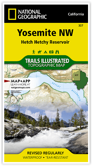
Wandelkaart 307 Yosemite NP North West - Nat Geo
Hetch Hetchy Reservoir & Pacific Crest and John Muir trails

Korte omschrijving
Yosemite North West - Nat Geo Omvat: Emigrant Wilderness, Lake Eleanor, Stanislaus National Forest, Yosemite National Park. Engelse omschrijving: National Geographic's Trails Illustrated...

Specificaties
- Uitgever: National Geographic
- ISBN-13: 9781566954129
- HOOFDCATEGORIEËN: Wandelkaart
- Activiteiten: Wandelen, Hiking & Trekking
- Regio: Californië, USA
- Land: Verenigde Staten van Amerika (USA)
- Waterafstotende kaart: Nat Geo waterproof series
- Nationale parken: Yosemeti NP, California USA
- Schaal: 1:40000
- Afmeting: 10x19
- Taal: Engels
Volledige omschrijving
Yosemite North West - Nat Geo
Omvat: Emigrant Wilderness, Lake Eleanor, Stanislaus National Forest, Yosemite National Park.
Engelse omschrijving: National Geographic's Trails Illustrated map of Yosemite North West- Hetch Hetchy Reservoir is designed to meet the needs of outdoor enthusiasts by combining valuable information with unmatched detail of this magnificent region of Yosemite National Park. Expertly researched and created in partnership with the National Park Service, U.S. Forest Service and others, the map's coverage extends from the park's northwestern border to the White Wolf area and features key points of interest of Yosemite Wilderness including Lake Eleanor, Grand Canyon of the Tuolumne River, Tilden Lake and Pate Valley as well as the Emigrant Wilderness in the neighboring Stanislaus National Forest.
Get off the beaten path and back again by following precisely mapped trails with mileage markers, including portions of the Pacific Crest and John Muir trails, which are both highlighted. To aid in your navigation of the region, the map includes contour lines, elevations, labeled peaks and summits, water features and selected waypoints. Some of the marked recreation features are campgrounds, campsites, fee stations and ski areas. Ranger stations are clearly marked as well. Also included are camping, hiking, wilderness permit, and safety information.
Every Trails Illustrated map is printed on "Backcountry Tough" waterproof, tear-resistant paper. A full UTM grid is printed on the map to aid with GPS navigation.
Locatie op kaart
Overzichtskaarten

NAT GEO California trail maps
NAT GEO California trail maps

Producten op de overzichtskaart
Klik op een product om naar de detailpagina te gaan.
- Wandelkaart 205 Sequoia & Kings Canyon NP - California
- Wandelkaart 206 Yosemite NP - California - Nat Geo
- Wandelkaart 218 Redwood National & State Parks - Nat Geo
- Wandelkaart 221 Death Valley NP - Nevada - Natgeo
- Wandelkaart 226 Joshua Tree NP - California - Nat Geo
- Wandelkaart 256 Mojave National park California - Nat Geo
- Wandelkaart 306 Yosemite SW- Yosemite Valley - Nat Geo
- Wandelkaart 307 Yosemite NP North West - Nat Geo
- Wandelkaart 308 Yosemite NE- Tuolumne Meadows - Nat Geo
- Wandelkaart 309 Yosemite SE - Ansel Adams Wilderness - Nat Geo
- Wandelkaart 322 Mount Whitney California - Nat Geo
- Wandelkaart 803 Lake Tahoe Basin - California - Nat Geo
- Wandelkaart 804 Tahoe National Forest West - Nat Geo
- Wandelkaart 805 Tahoe Nat. Forest East - Sierra Buttes - Nat Geo
- Wandelkaart 809 Mammoth Lakes - Mono Divide - Nat Geo
- Wandelkaart 810 Shaver Lake - Sierra National Forest - Nat Geo
Artikelen uit dezelfde regio

Wandelkaart 322 Mount Whitney California - Nat Geo • 9781566956468
Wandelkaart Mount Whitney California - Nat Geo Productomschrijving: Mount Whitney is universeel bekend als de hoogste piek in de aangrenzende Verenigde Staten, evenals het hoogste punt in Californië. National Geographic's Trails Illustrated kaart van Mount Whitney levert ongeëvenaarde details en waardevolle informatie om je te helpen bij je verkenning van dit prachtige gebied. Deze ka…

Wandelgids Hiking the Pacific Crest Trail - Cicerone • 9781852849207
Hiking the Pacific Crest Trail - PCT - Cicerone Productomschrijving: Een wandelgids over de Pacific Crest Trail (PCT), een epische wandeling van 3300 km van de Mexicaanse grens naar het Canadese British Columbia. Een van 's werelds beste wandelingen, de route loopt door Californië, Oregon en de staat Washington, langs de Mojave-woestijn, High Sierras, Cascades en talloze meer wilde bergen …

Wandelkaart 811 Angeles National Forest - Natgeo • 9781566955775
Wandelkaart Angeles National Forest, California USA (9781566955775) National Geographic Productomschrijving: Een bosgebied in de onmiskenbare San Gabriel Mountains in het zuiden van de Amerikaanse staat Californië. Het bestaat uit twee delen die van elkaar gescheiden worden door de Soledad Canyon. Het Angeles National Forest reikt tot net over de grens met San Bernardino County in het oost…

Wandelkaart 206 Yosemite NP - California - Nat Geo • 9781566952996
TOPO Wandelkaart 206 - Yosemite NP- California - Nat geo Productomschrijving: Yosemite National Park, wat een parel van schoonheid en tegelijk wereld bekend, is een nationaal park in het oosten van de Amerikaanse staat Californië. Hij ligt op de westelijke flanken van de centrale Sierra Nevada, in het oosten van Tuolumne, Mariposa en Madera County. Engelse omschrijving: Explore the maj…

Reisgids San Francisco - Gallimard • 9782742453474
Reisgids San Francisco - Gallimard Productomschrijving: Van Chinatown tot de Golden Gate Bridge, van Mission tot Twin Peakes, van SFMoMa tot het Asian Art Museum, van Potrero tot Haight-Ashbury, San Francisco ontvouwt zich in een oogwenk met een gids als geen ander. Franse omschrijving: De Chinatown au Golden Gate Bridge, de Mission à Twin Peakes, du SFMoMa à l'Asian Art Museum, …