
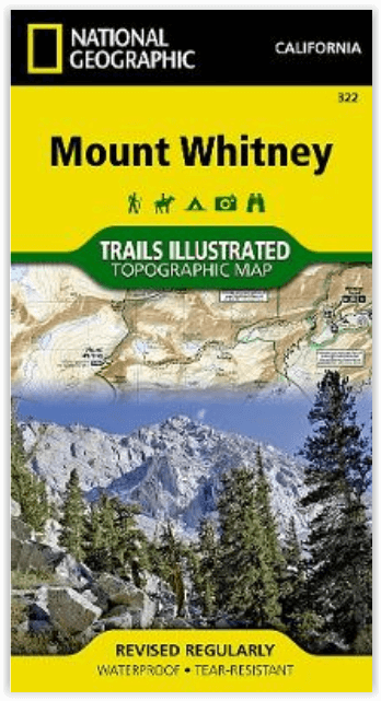
Wandelkaart 322 Mount Whitney California - Nat Geo
South Fork Kern River- Diaz Lake & Cottonwood Lakes
Korte omschrijving
Wandelkaart Mount Whitney California - Nat Geo Productomschrijving: Mount Whitney is universeel bekend als de hoogste piek in de aangrenzende Verenigde Staten, evenals het hoogste punt in Ca...

Specificaties
- Uitgever: National Geographic
- ISBN-13: 9781566956468
- HOOFDCATEGORIEËN: Wandelkaart
- Activiteiten: Wandelen, Hiking & Trekking
- Regio: Californië, USA
- Land: Verenigde Staten van Amerika (USA)
- Schaal: 1:40000
- Afmeting: 10x19
- Taal: Engels
- Reeks: National Geographic
Volledige omschrijving
Wandelkaart Mount Whitney California - Nat Geo
Productomschrijving: Mount Whitney is universeel bekend als de hoogste piek in de aangrenzende Verenigde Staten, evenals het hoogste punt in Californië. National Geographic's Trails Illustrated kaart van Mount Whitney levert ongeëvenaarde details en waardevolle informatie om je te helpen bij je verkenning van dit prachtige gebied.
Deze kaart, die deskundig is onderzocht en gemaakt in samenwerking met lokale beheerders, toont de belangrijkste interessante gebieden, waaronder Sequoia, Kings Canyon en Inyo nationale parken, Sequoia-Kings Canyon en de John Muir wildernisgebieden: South Fork Kern River, Diaz Lake en Cottonwood Lakes.
Engelse omschrijving: Mount Whitney is universally famous as the highest peak in the contiguous United States, as well as the highest point in California. National Geographic's Trails Illustrated map of Mount Whitney delivers unmatched detail and valuable information to assist you in your exploration of this beautiful region. Expertly researched and created in partnership with local land management agencies, this map features key areas of interest including Sequoia, Kings Canyon, and Inyo national parks, Sequoia-Kings Canyon and the John Muir wildernesss areas: South Fork Kern River, Diaz Lake, and Cottonwood Lakes.
With miles of mapped trails including the popular Pacific Crest and John Muir trails, this map can guide you off the beaten path and back again in some of the most breathtaking scenery in the region. The clearly marked trails include mileage between intersections. A Mount Whitney trail profile inset showing the changes in altitude from various points along the Pacific Crest Trail Junction and the Whitney Portal Trailhead provides a handy tool for hikers. Scenic byways are noted for those wishing to take in the scenery by car. The map base includes contour lines and elevations for summits, passes and many lakes. Some of the many recreation features noted are campgrounds, trailheads, boat launches, swimming and fishing areas, and pack stations. A variety of helpful information about climbing Mount Whitney, Inyo National Forest, Sequoia and Kings Canyon National Parks, safety tips, and more is included as well.
Every Trails Illustrated map is printed on ''Backcountry Tough'' waterproof, tear-resistant paper. A full UTM grid is printed on the map to aid with GPS navigation.
Locatie op kaart
Overzichtskaarten

NAT GEO California trail maps
NAT GEO California trail maps

Producten op de overzichtskaart
Klik op een product om naar de detailpagina te gaan.
- Wandelkaart 205 Sequoia & Kings Canyon NP - California
- Wandelkaart 206 Yosemite NP - California - Nat Geo
- Wandelkaart 218 Redwood National & State Parks - Nat Geo
- Wandelkaart 221 Death Valley NP - Nevada - Natgeo
- Wandelkaart 226 Joshua Tree NP - California - Nat Geo
- Wandelkaart 256 Mojave National park California - Nat Geo
- Wandelkaart 306 Yosemite SW- Yosemite Valley - Nat Geo
- Wandelkaart 307 Yosemite NP North West - Nat Geo
- Wandelkaart 308 Yosemite NE- Tuolumne Meadows - Nat Geo
- Wandelkaart 309 Yosemite SE - Ansel Adams Wilderness - Nat Geo
- Wandelkaart 322 Mount Whitney California - Nat Geo
- Wandelkaart 803 Lake Tahoe Basin - California - Nat Geo
- Wandelkaart 804 Tahoe National Forest West - Nat Geo
- Wandelkaart 805 Tahoe Nat. Forest East - Sierra Buttes - Nat Geo
- Wandelkaart 809 Mammoth Lakes - Mono Divide - Nat Geo
- Wandelkaart 810 Shaver Lake - Sierra National Forest - Nat Geo
Artikelen uit dezelfde regio

Wandelkaart 805 Tahoe Nat. Forest East - Sierra Buttes - Nat Geo • 9781566953818
Tahoe National Forest East - Sierra Buttes - Nat Geo Omvat: Donner Pass, Eldorado National Forest, Granite Chief Wilderness, Mosquito Ridge, Plumas National Forest, Sawtooth Ridge, Tahoe National Forest, Truckee. Engelse omschrijving: Expertly researched and created in partnership with the U.S. Forest Service and others, National Geographic's Trails Illustrated map of Yuba and American…

Reisgids California - DK Eyewitness • 9780241309292
Reisgids California - DK Eyewitness Productomschrijving: Tour a winery in Napa, hike to the waterfalls in Yosemite National Park or ride a classic cable car in San Francisco: everything you need to know is clearly laid out within colour-coded chapters. Discover the best of California with this indispensable travel guide. Detailed chapters with area maps cover: Los Angeles; South Centra…

Reisgids Californië- Arizona- Nevada & Utah - Gottmer • 9789025779139
Californië- Arizona- Nevada & Utah van Gottmer Productomschrijving: Of je nu nieuwsgierig bent naar cultuurbepalende wereldsteden als San Francisco en Los Angeles dan wel je juist graag terugtrekt in de natuur: de zuidwestelijke hoek van de VS is voor iedereen een gebied vol hoogtepunten. Californië trekt het grootste aantal bezoekers, gevolgd door de Grand Canyon in Arizona, de nationale …

Wandelgids Hiking the Pacific Crest Trail - Cicerone • 9781852849207
Hiking the Pacific Crest Trail - PCT - Cicerone Productomschrijving: Een wandelgids over de Pacific Crest Trail (PCT), een epische wandeling van 3300 km van de Mexicaanse grens naar het Canadese British Columbia. Een van 's werelds beste wandelingen, de route loopt door Californië, Oregon en de staat Washington, langs de Mojave-woestijn, High Sierras, Cascades en talloze meer wilde bergen …

Wandelkaart 804 Tahoe National Forest West - Nat Geo • 9781566954259
Tahoe National Forest West - Nat Geo Omvat: Donner Pass, Eldorado National Forest, Granite Chief Wilderness, Mosquito Ridge, Plumas National Forest, Sawtooth Ridge, Tahoe National Forest, Truckee. Engelse omschrijving: Expertly researched and created in partnership with the U.S. Forest Service and others, National Geographic's Trails Illustrated map of Yuba and American Rivers region o…