
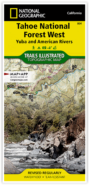
Wandelkaart 804 Tahoe National Forest West - Nat Geo
Yuba & American Rivers
Korte omschrijving
Tahoe National Forest West - Nat Geo Omvat: Donner Pass, Eldorado National Forest, Granite Chief Wilderness, Mosquito Ridge, Plumas National Forest, Sawtooth Ridge, Tahoe National Forest, Tr...

Specificaties
- Uitgever: National Geographic
- ISBN-13: 9781566954259
- HOOFDCATEGORIEËN: Wandelkaart
- Activiteiten: Wandelen, Hiking & Trekking
- Regio: Californië, USA
- Land: Verenigde Staten van Amerika (USA)
- Waterafstotende kaart: Nat Geo waterproof series
- Schaal: 1:63360
- Afmeting: 10x19
- Taal: Engels
Volledige omschrijving
Tahoe National Forest West - Nat Geo
Omvat: Donner Pass, Eldorado National Forest, Granite Chief Wilderness, Mosquito Ridge, Plumas National Forest, Sawtooth Ridge, Tahoe National Forest, Truckee.
Engelse omschrijving: Expertly researched and created in partnership with the U.S. Forest Service and others, National Geographic's Trails Illustrated map of Yuba and American Rivers region of Tahoe National Forest provides an unparalleled tool for exploring this historically significant region of the Sierras. Whatever the season, you'll find this map a useful tool in pursuing a host of recreational activities from skiing and snowmobiling to camping and boating. The map features many key points of interest, including French Meadows and New Bullards Bar Reservoirs, Granite Chief Wilderness, South Yuba River Recreation Area, Malakoff Diggins State Historic Park, Donner Memorial State Park and the western rim of the Lake Tahoe Basin Management Unit.
The Tahoe National Forest West map can guide you off the beaten path and back again with miles of clearly marked trails including portions of the Pacific Crest, Pioneer, and Tahoe Rim trails. To help you choose the path that's right for you, trails are color coded according to the designated usage and mileage between intersections is indicated. The Yuba Donner scenic byways is noted for those wishing to take in the scenery by car. Many recreation features are noted as well, including ski areas, campgrounds, trailheads, wildlife viewing areas, boat launches, and swimming and fishing areas. The map base includes contour lines and elevations for summits, passes and many lakes.
Every Trails Illustrated map is printed on "Backcountry Tough" waterproof, tear-resistant paper. A full UTM grid is printed on the map to aid with GPS navigation.
Locatie op kaart
Overzichtskaarten

NAT GEO California trail maps
NAT GEO California trail maps

Producten op de overzichtskaart
Klik op een product om naar de detailpagina te gaan.
- Wandelkaart 205 Sequoia & Kings Canyon NP - California
- Wandelkaart 206 Yosemite NP - California - Nat Geo
- Wandelkaart 218 Redwood National & State Parks - Nat Geo
- Wandelkaart 221 Death Valley NP - Nevada - Natgeo
- Wandelkaart 226 Joshua Tree NP - California - Nat Geo
- Wandelkaart 256 Mojave National park California - Nat Geo
- Wandelkaart 306 Yosemite SW- Yosemite Valley - Nat Geo
- Wandelkaart 307 Yosemite NP North West - Nat Geo
- Wandelkaart 308 Yosemite NE- Tuolumne Meadows - Nat Geo
- Wandelkaart 309 Yosemite SE - Ansel Adams Wilderness - Nat Geo
- Wandelkaart 322 Mount Whitney California - Nat Geo
- Wandelkaart 803 Lake Tahoe Basin - California - Nat Geo
- Wandelkaart 804 Tahoe National Forest West - Nat Geo
- Wandelkaart 805 Tahoe Nat. Forest East - Sierra Buttes - Nat Geo
- Wandelkaart 809 Mammoth Lakes - Mono Divide - Nat Geo
- Wandelkaart 810 Shaver Lake - Sierra National Forest - Nat Geo
Artikelen uit dezelfde regio

Wandelkaart 252 Channel Islands National Park - Nat Geo • 9781566954105
Channel Islands National Park - Nat Geo Productomschrijving: De Channel Islands Nationaal Park, gelegen voor de kust van Californië, zijn de thuisbasis van vele unieke soorten flora en fauna. National Geographic's Trails Illustrated kaart van Channel Islands National Park bestrijkt met ongeëvenaard detail de vijf eilanden die het park omvat, inclusief The Nature Conservancy gebied van Sant…


Wandelkaart 307 Yosemite NP North West - Nat Geo • 9781566954129
Yosemite North West - Nat Geo Omvat: Emigrant Wilderness, Lake Eleanor, Stanislaus National Forest, Yosemite National Park. Engelse omschrijving: National Geographic's Trails Illustrated map of Yosemite North West- Hetch Hetchy Reservoir is designed to meet the needs of outdoor enthusiasts by combining valuable information with unmatched detail of this magnificent region of Yosemite Na…

Reisgids San Francisco & Northern California - DK Eyewitness • 9780241360071
San Francisco & Northern California Omvat: Presidio, Pacific Heights and the Marina, Fisherman's Wharf and North Beach, Chinatown and Nob Hill, Financial District and Union Square, Civic Center, Haight Ashbury and the Mission, Golden Gate Park and Land's End, and sights beyond the city, plus major parts of Northern California including Carmel, Mendocino, Napa Wine Country, Lake Tahoe & Yos…

Reisgids San Francisco - Gallimard • 9782742453474
Reisgids San Francisco - Gallimard Productomschrijving: Van Chinatown tot de Golden Gate Bridge, van Mission tot Twin Peakes, van SFMoMa tot het Asian Art Museum, van Potrero tot Haight-Ashbury, San Francisco ontvouwt zich in een oogwenk met een gids als geen ander. Franse omschrijving: De Chinatown au Golden Gate Bridge, de Mission à Twin Peakes, du SFMoMa à l'Asian Art Museum, …

Reisgids California wine country USA - Top 10 - Eyewitness • 9781409326823
California wine country USA - Top 10 - Eyewitness Productomschrijving: Explore California's world-class wineries, take a leisurely tour on the Napa Valley Wine Train, cycle along the Silverado Trail or venture to the Russian River for the renowned River Jazz and Blues Festival. From Top 10 festivals to the Top 10 beaches - discover the best of California Wine Country with this easy-to-use …