
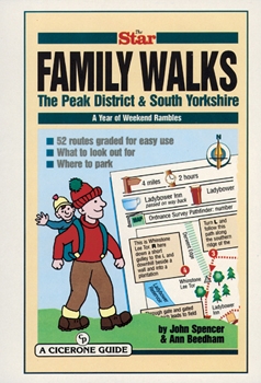
Wandelgids Peak District & South Yorkshire - Cicerone
Winnaar van de beste gids van COLA/OWG 1998
Korte omschrijving
Wandelgids - Peak District & South Yorkshire - Cicerone Productomschrijving: Een gids naar 52 korte circulaire wandelingen in het Peak District en Zuid-Yorkshire, in Noord-Engeland, aangepas...

Specificaties
- Uitgever: CICERONE Press
- ISBN-13: 9781852842574
- HOOFDCATEGORIEËN: Wandelgids
- Activiteiten: Wandelen, Hiking & Trekking
- Regio: Midlands, England, Yorkshire, England
- Land: England
- Nationale parken: Peak District NP, Derbyshire UK
- Blz.: 64
- Afmeting: 15x21
- Editie: 1
- Taal: Engels
Volledige omschrijving
Wandelgids - Peak District & South Yorkshire - Cicerone
Productomschrijving: Een gids naar 52 korte circulaire wandelingen in het Peak District en Zuid-Yorkshire, in Noord-Engeland, aangepast door plaatselijke Sheffield krant "The Star Weekend walking kolom". Routes zijn 2 tot 3 uur lang, dus ideaal voor gezinnen. Winnaar van de beste gids van COLA/OWG 1998. Allemaal binnen een uur van Sheffield. Deze collectie van 52 wandelingen in het Peak District en Zuid-Yorkshire omvat alles, van wandelingen langs kanalen tot ruwere routes, van vallei ballades tot boswandelingen.
Product description: This collection of 52 walks in the peak District and South Yorkshire covers everything from canalside ambles to ridge routes, from valley strolls to woodland wanders. Adapted from The Star’s popular Weekend Walk column, almost all are suitable for families with children, and everyone is graded with a guide as to how long the routes should take to make planning your outing easier. Almost all the walks take no more than two or three hours to complete, leaving you free to explore neighbouring town and places of interest.
- How to get there
- Local pubs & refreshment stops
- Which walks deserve a picnic break
- A short description of natural or local history to make each outing more enjoyable.
Locatie op kaart
Artikelen uit dezelfde regio

Reisgids Yorkshire England - Rough Guides • 9781789194159
Reisgids Yorkshire England - Rough Guides Productomschrijving: The Rough Guide to Yorkshire was the first comprehensive guidebook to England’s largest county. Detailed coverage of the ruggedly beautiful Dales and Moors, the magnificent North Sea coast and historic York rubs shoulders with penetrating insights into the multi-cultural cities of Leeds and Sheffield, the resurgent port of Hull…

Wandelgids Cleveland Way - Trailblazer • 9781905864911
The 177 km long Cleveland Way -Trailblazer Productomschrijving: The Cleveland Way is een Nationaal Trail in de omgeving van historisch Cleveland in noord England. De route een dikke 177 km tussen Helmsley en the Brigg bij Filey, strelend aan de North York Moors National Park. De route is een historische route die de geschiedenis van de regio in kaart brengt, en uiteraard een nationaal park…

Reisgids Go Slow North York Moors & Yorkshire Wolds - Bradt • 9781804690093
Reisgids North York Moors national park - Bradt Productomschrijving: Inwoner van Yorkshire, natuurliefhebber en reisschrijver Mike Bagshaw (Auteur) heeft deze nieuwe 3e van Bradt's North York Moors & Yorkshire Wolds, onderdeel van Bradt's bekroonde serie Go Slow travel gidsen over Britse regio's, grondig bijgewerkt. Het blijft de enige zelfstandige gids voor deze regio van contrasten. Wand…

Wandelkaart 295 Bridlington Driffield & Hornsea - OSI • 9780319245477
Wandelkaart Bridlington- Driffield & Hornsea - Yorkshire Productbeschrijving: 295 / Bridlington, Driffield & Hornsea, East Riding of Yorkshire, England - Van Hornsea langs de kust naar Bridlington en de binnenvaart tot Driffield. OS Explorer kaart 295 is de perfecte partner voor al uw outdoor avonturen. Het omvat ook delen van vier recreatieve paden: landtong way, Hornsea Rail Trail,…

Wandelkaart Cleveland Way - Across North York NP - Harvey maps • 9781851374892
Wandelkaart Cleveland Way - Across North York NP - Harvey maps Productomschrijving: 174km (109 mijl) van Helmsley over het North York Moors National Park naar Saltburn en langs de kust via Scarborough eindigend met Filey. Informatie over het vinden van accommodatie, camping, voedsel. Routebeschrijving naar het begin. Ook Ranger Service contacten met nummers en uitbreidingen van steden/dorp…