
Reisgids Norfolk & Suffolk - Rough Guides
The Norfolk Broads - Suffolk coast
Korte omschrijving
Norfolk & Suffolk - Rough Guides Productomschrijving: De Rough Guide to Norfolk & Suffolk richt zich op een van de meest populaire regio's van het Verenigd Koninkrijk. In full colour, met ti...

Specificaties
- Uitgever: Rough Guides
- ISBN-13: 9781839050749
- HOOFDCATEGORIEËN: Reisgids
- Activiteiten: Toerisme
- Regio: Norfolk East England, Suffolk East Anglia
- Land: England
- Blz.: 352
- Afmeting: 13x20
- Editie: 4
- Taal: Engels
Volledige omschrijving
Norfolk & Suffolk - Rough Guides
Productomschrijving: De Rough Guide to Norfolk & Suffolk richt zich op een van de meest populaire regio's van het Verenigd Koninkrijk. In full colour, met tientallen prachtige foto's, zal het u inspireren om dit diverse en prachtige gebied te verkennen.
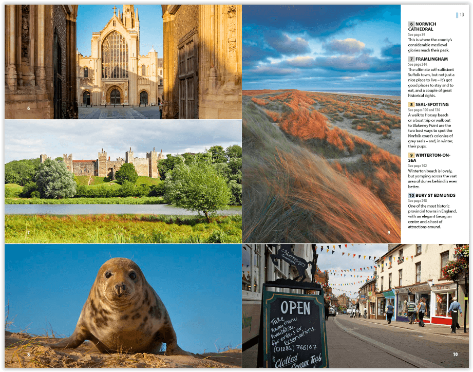
Levendige, onderhoudende verslagen in de kenmerkende eerlijke, openhartige stijl van de Rough Guides behandelen attracties van de unieke natuur van de Norfolk Broads tot prachtige kustplaatsen en statige huizen, kunstgaleries en kerken - Norfolk heeft de dichtste concentratie van middeleeuwse kerken in de wereld. Gedetailleerde recensies tonen u de gastronomische hoogtepunten van het gebied en we maken een lijst van de beste boerenmarkten, boerderijwinkels en echte brouwerijen.
Engelse omschrijving: The Rough Guide to Norfolk & Suffolk focuses on one of the UK’s most popular regions. In full colour throughout, with dozens of gorgeous photos, it will inspire you to explore this diverse and beautiful area. Lively, entertaining accounts in Rough Guides’ signature honest, forthright style cover attractions from the unique wildlife of the Norfolk Broads to stunning coastal resorts and stately homes, art galleries and churches – Norfolk has the densest concentration of medieval churches in the world. Detailed reviews show you the area’s gastronomic highlights and we list the best farmers’ markets, farm shops and real-ale breweries.
The guide also has suggestions on the best things to do with the kids, from getting out on the river to visiting theme parks and family attractions. As well as all the vital practical information you’ll need, The Rough Guide to Norfolk & Suffolk is packed with contextual information on the region’s fascinating history, architecture and strong artistic and literary connections. The guide is easy to use, too, with plenty of full-colour maps showing sights and listings.
Artikelen uit dezelfde regio

Wandelkaart 212 Woodbridge & Saxmundham - OSI • 9780319244050
Wandelkaart Woodbridge & Saxmundham - Suffolk Coast Omvat ook: Aldeburgh & Framlingham. Productbeschrijving: Kaart nummer 212 in de OS Explorer kaarten reeks omvat Saxmundham, Woodbridge, Aldeburgh, Framlingham en Leiston. Hoogtepunten van het gebied zijn onder andere: Aldeburgh Bay, Orford Ness, de Suffolk Coast Path, rivers Deben en Alde en Suffolk Coast AONB. De OS Explorer kaart vo…

Wandelkaart 210 Newmarket & Havehill- Barrow - OSI • 9780319470824
Wandelkaart Newmarket & Havehill- Barrow - Suffolk England Omvat ook: Barrow, Clare & Kedington. Productbeschrijving: Kaart nummer 210 in de OS Explorer kaarten reeks is ideaal voor het ontdekken van het gebied rond het oosten van Cambridgeshire en ten westen van Suffolk, rond de paardenrennen stad van Newmarket. De Stour Valley naast de rivier Stour, of verken de steden Haverhill, New…

Wandelkaart 197 Ipswich Felixstowe & Harwich - OSI • 9780319470695
Wandelkaart Ipswich- Felixstowe & Harwich - England Omvat ook: Woodbridge & Manningtree. Productbeschrijving: Kaart nummer 197 in de OS Explorer kaarten reeks omvat Ipswich, Felixstowe, Harwich, Woodbridge en Manningtree. Hoogtepunten van het gebied zijn onder andere: Suffolk kust en Heaths AONB, Suffolk Coast Path, Essex Way, en Alton way. De OS Explorer kaart voor Ipswich, Felixstowe…

Wandelkaart 133 North East Norfolk - Cromer - Wroxham - OSI • 9780319475508
North East Norfolk- Cromer & Wroxham - OSI Productomschrijving: Kaart nummer 133 in de OS Landranger kaartenserie bestrijkt het noordoosten van Norfolk, Cromer, Holt, North Walsham, Aylsham, Sherringham en Wroxham en omvat Barton Broad en het zuidelijkste deel van de Peddars Way & Norfolk Coast Path. De kaart bestrijkt een gebied van 40 km bij 40 km (25 mijl bij 25 mijl). Engelse omsch…

Wandelkaart 132 King's Lynn & Fakenham England - OSI • 9780319474556
Wandelkaart North West Norfolk- King's Lynn & Fakenham Productbeschrijving: Kaart nummer 132 in de OS Landranger kaarten reeks heeft de oppervlakte van Noord west Norfolk, King's lynn, Wells-Next-The-Sea, Fakenham, Hunstanton, Dereham en Holmes volgende de zee. Andere hoogtepunten van het gebied: de Peddars Way & Norfolk Coast Path, Holkham Bay, Brancaster Bay en The Wash. De OS Landra…