
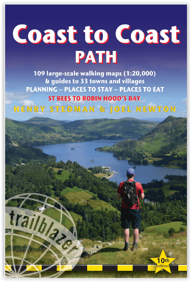
Wandelgids Coast to Coast path - Trailblazer
St-Bees to Robin Hood's Bay - 307 km door 3 Nationale parken
Korte omschrijving
Coast to Coast path 370 km - Trailblazer Productomschrijving: 109 kaarten, 14 etappe kaarten en 60 kleurfoto's van één van Engeland's mooiste wandelroutes, en tevens meest gekend. Het Coast ...

Specificaties
- Uitgever: Trailblazer Publications
- ISBN-13: 9781912716258
- HOOFDCATEGORIEËN: Wandelgids
- Activiteiten: Wandelen, Hiking & Trekking
- Auteur: Henry Stedman, Joel Newton
- Regio: Cumbria & Lake District, England, Yorkshire, England
- Land: England
- Lange afstand wandelroutes: Coast to Coast- St-Bees to Robinhood's bay England (370 km)
- Blz.: 268
- Afmeting: 12x18
- Editie: 10
- Taal: Engels
Volledige omschrijving
Coast to Coast path 370 km - Trailblazer
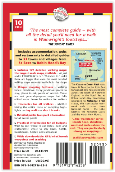
Productomschrijving: 109 kaarten, 14 etappe kaarten en 60 kleurfoto's van één van Engeland's mooiste wandelroutes, en tevens meest gekend. Het Coast to Coast Pad is een pad van 307 km dat loopt van St Bees aan de Ierse Zee over de breedte van Noord-Engeland naar de Noordzee bij Robin Hood's Bay. Deze spectaculaire wandeling van twee weken doorkruist drie nationale parken - het Lake District, de Yorkshire Dales en de North York Moors. Bedacht door de legendarische fellwalker Alfred Wainwright is dit een zeer populaire route en in 2022 kreeg hij eindelijk de status van National Trail.
Engelse omschrijving: Coast to Coast Path: St Bees to Robin Hood's Bay
The Coast to Coast Path is a 191½-mile (307km) trail that runs from St Bees on the Irish Sea across the width of Northern England to the North Sea at Robin Hood’s Bay.This spectacular two-week walk crosses three National Parks – the Lake District, the Yorkshire Dales and the North York Moors. Devised by legendary fellwalker Alfred Wainwright this is a very popular trail and in 2022 it was finally awarded National Trail status.
- Now designated a National Trail – The award of £5.6 million for trail upgrading (2023-5) should ensure ongoing publicity.
- Post pandemic, stay-cations remain the holidays of choice
- Text and maps in clear two-colour style
- All-in-one guide – Trailblazer guides include practical information not usually found in walking guides to the UK: reviews of places to stay, places to eat, attractions along the way and detailed public transport information showing all access points on the path and car parks near the trail, for weekend and day walkers.
- The largest scale walking maps available – At just under 1:20,000 (8cm or 31/8 inches to 1 mile) our maps (fully-edited and drawn by walkers for walkers) are igger than even the most detailed walking maps currently available in the shops.
- 109 trail maps and town plans
- 14 stage maps with profiles and 2 overview maps
- 60 colour photos; colour flower guide.
.png)
Locatie op kaart
Artikelen uit dezelfde regio

Wandelgids Rocky Rambler's wild walks - Cicerone • 9781852843472
Wandelgids - Rocky Rambler's wild walks - Cicerone Productomschrijving: Een gids over familiewandelen in het Lake District. Rocky Rambler's Wild Walks stimuleert kinderen om uit te kiezen, en de wandelingen te leiden. Gericht op kinderen van 6 tot 14 jaar, de gids bevat duidelijke instructies en heldere illustraties, die iedere wandeling gemakkelijk en leuk maakt om te volgen. 10 wandeling…

Wandelgids The Pennine Way - Trailblazer • 9781912716333
The Pennine Way 420 km - Trailblazer Productomschrijving: De Pennine Way, het bekendste nationale pad van Groot-Brittannië, slingert zich 420 km over woeste heidevelden en door stille dalen langs de ruggengraat van Noord-Engeland. Het begint in Edale in het Peak District en eindigt net over de grens in Schotland bij Kirk Yetholm. Dit prachtige wandelpad doorkruist 3 nationale parken - het …

Reisgids Lake District - Top 10 - DK Eyewitness • 9780241296288
DK Eyewitness TOP 10 Lake District Omvat: Windermere, the Central Fells, Ullswater, the Northwest, Whitehaven & Wasdale. Productomschrijving: Bezoek de schilderachtige dorpjes van Grasmere, maak een rondvaart door Windermere, haal munttaart in Kendal of ga wandelen in de vallei van Langdale. Van de Top 10 kastelen en huizen tot de Top 10 pubs en herbergen - ontdek het beste van het Lak…

Wandelkaart OL31 North Pennines- Teesdale & Weardale - OSI • 9780319469491
Wandelkaart North Pennines- Teesdale & Weardale - England Omvat ook: Teesdale & Weardale Productbeschrijving: Kaart nummer OL31 in de OS Explorer kaarten reeks, omvat de North Pennines AONB, Barnard Castle, Alton en Allenheads. Hoogtepunten van het gebied zijn onder andere: Hamsterley community Forest, Middleton, Milburn Forest, Cow green en Burnhope Reservoirs, Weardale en een deel va…

Reisgids Lake district Nationale Park UK - Rough Guides • 9781839058684
Reisgids Lake district NP - Rough Guides Omvat: Windermere, Grasmere and the central fells, Coniston Water, Hawkshead and the south, Keswick, Derwent Water and the north, the western fells and valleys, Ullswater, out of the National Park. Productomschrijving: The Rough Guide to the Lake District NP is de beste all-purpose gids voor het Engelse Lake District, prachtig geïllustreerd met …