
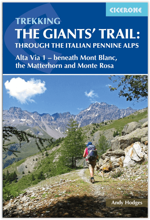
Wandelgids The Giant's Trail - Cicerone
De Giants' trial of de Alta Via 1 - 180 km door Italiaanse bergen
Korte omschrijving
Wandelgids - The Giants' Trail - Ciceorne Press Productomschrijving: De Alta Via 1 in Italië, een pad van 180 km door de Italiaanse Alpen langs de noordelijke flank van de Aosta-vallei, bied...

Specificaties
- Uitgever: CICERONE Press
- ISBN-13: 9781852849924
- HOOFDCATEGORIEËN: Wandelgids
- Activiteiten: Wandelen, Hiking & Trekking
- Auteur: Andy Hodges
- Regio: Piemonte, Italië, Valle d’Aosta, Italië
- Land: Italië
- Lange afstand wandelroutes: The Giants' trail, Italië (180 km)
- Blz.: 188, 192
- Afmeting: 12x17
- Editie: 1
- Taal: Engels
Volledige omschrijving
Wandelgids - The Giants' Trail - Ciceorne Press
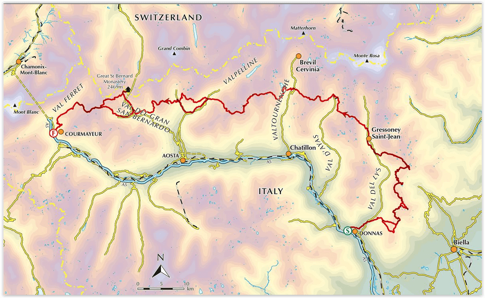
Productomschrijving: De Alta Via 1 in Italië, een pad van 180 km door de Italiaanse Alpen langs de noordelijke flank van de Aosta-vallei, biedt een prachtig uitzicht op de Alpenreuzen: de Mont Blanc, de Matterhorn, de Grand Combin en de Monte Rosa. Inderdaad, het is ook wel bekend als de Giants 'Trail en kan worden gecombineerd met een zusterroute, de Alta Via 2 (bedekt in een aparte Cicerone-gids), die langs de zuidelijke flank van de vallei loopt om de Tor des Geants te vormen. .
Engelse omschrijving: Italy's Alta Via 1, a 180km trail through the Italian Alps following the northern flank of the Aosta Valley, boasts magnificent views of the Alpine giants: Mont Blanc, the Matterhorn, the Grand Combin and Monte Rosa. Indeed, it is sometimes known as the Giants' Trail and can be combined with a sister-route, the Alta Via 2 (covered in a separate Cicerone guide), which runs along the southern flank of the valley, to form the Tor des Geants.
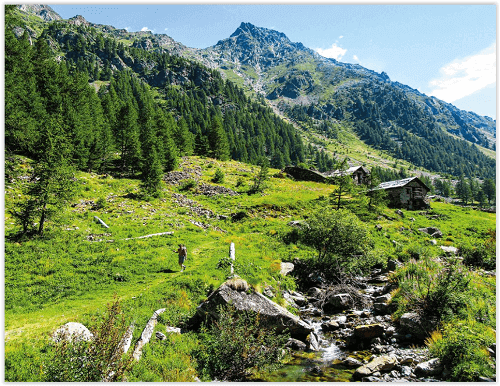
Stretching from Donnas to Courmayeur, the Alta Via 1 offers fantastic alpine walking, with welcoming refuges and small hotels providing overnight accommodation (and great food) along the way.
The guide presents the route in two sections, for the advantage of those who can't spare the full fortnight-plus needed to walk the entire AV1. The trail is described in 16 stages, with alternative stages covering some popular variants, including an optional detour to visit the famed monastery at the Great St Bernard Pass. Each stage includes clear route description and mapping, plus notes on local points of interest and accommodation options. An alternative itinerary, list of useful contacts, kitlist and glossary can be found in the appendices. The AV1 crosses cols of nearly 3000m as it traverses the side-valleys of the main Aosta Valley. Suited to those with some of experience of alpine trekking, the walking is demanding but without technical difficulty. And the rewards are many: quieter huts, breathtaking vistas and a chance to immerse yourself in fabulous mountain landscapes overlooked by soaring, snow-clad giants.
Artikelen uit dezelfde regio

Wandelgids Walliser Alpen - SAC • 9783859023963
Wandelgids Walliser Alpen Omvat: Mont Dolent- Grand Combin & Pigne d'Arolla Productomschrijving: Deze Alpine bergwandelgids is gewijd aan de tweede Wallis regio's. Het bevat veilige en lonende wandel routes op een aanzienlijk aantal prachtige bergen werden veel dichter bij de bewoners van de noordelijke Alpen verplaatst. Hij begint met de machtige uitlopers van de Mont Blanc en eindig…

Wandelkaart 294 Gressoney Valle d'Aoste - Swisstopo • 9783302002941
Wandelkaart Gressoney - Valle d'Aoste Italië - Swisstopo Productomschrijving: Gressoney-La-Trinité is een gemeente in de Italiaanse provincie Valle d'Aosta. Gressoney-La-Trinité grenst aan de volgende gemeenten: Alagna Valsesia, Ayas, Gressoney-Saint-Jean, Riva Valdobbil & Zermatt zwitserland. Detail: Zeer gedetailleerde topografische wandelkaarten van een klein stuke Zwitserland met s…

Wandelkaart 275 Valle Antigorio Lombardije - Swisstopo • 9783302002750
Wandelkaart Valle Antigorio - Lombardije Italië - Swisstopo Omvat: Alpe Dèvero, Bosco/Gurin & Craveggia Productomschrijving: De Valle Antigorio is een vallei in de Noord-Italiaanse regio Piemonte. Het strekt zich uit van Chioso in het zuiden naar Domodossola. De noordelijke Talfortsetzung is Val Formazza, de zuidelijke voortzetting word Val d'Ossola genoemd Detail: Zeer gedetaillee…

Wandelkaart 38 Bassa Valle di Gressoney - Fraternali Ed. • 9788897465591
Wandelkaart Bassa Valle di Gressoney - Fraternali Ed. Productomschrijving: Een gedetailleerde wandelkaart van Italie. De uitgeverij Fraternali heeft een prachtige serie gemaakt van wandelkaarten met schaal 1:25.000. De kaarten zijn gedrukt op scheur- en watervast papier. Voor de bergsporter en de bergwandelaar staan alle noodzakelijke details op de kaart: hoogtelijnen, toppen, waterlopen, …

Wandelkaart 292 Courmayeur Valle d'Aoste - Swisstopo • 9783302002927
Wandelkaart Courmayeur - Valle d'Aoste Italië - Swisstopo Productomschrijving: Courmayeur is een plaats met bijbehorende gemeente in de Italiaanse provincie Valle d'Aosta. De gemeente omvat de dalen Val Ferret en Val Veny die langs het Mont Blancmassief lopen. Waar de rivieren uit de twee dalen, de Dora di Ferret en de Dora di Veny, samenkomen, bij Entrèves ontstaat de Dora Baltea, de hoof…