
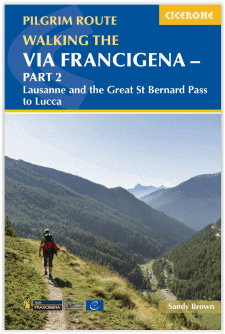
Wandelgids Via Francigena pilgrim route - Part 2
725 km over de Great Saint Bernard Pass naar Toscane
Korte omschrijving
Via Francigena pilgrim route - Part 2 Productomschrijving: Deze gloed nieuwe gids beschrijft Deel 2 van de pelgrimroute tussen Lausanne in Zwitserland tot de stad Lucca in Italië. De 725 km ...

Specificaties
- Uitgever: CICERONE Press
- ISBN-13: 9781786310866
- HOOFDCATEGORIEËN: Wandelgids
- Activiteiten: Wandelen, Hiking & Trekking
- Regio: Wallis
- Land: Italië, Zwitserland
- Bedevaart routes: Via Francigena Lausanne tot Lucca - Part 2
- Blz.: 256
- Afmeting: 12x17
- Editie: 1
- Taal: Engels
Volledige omschrijving
Via Francigena pilgrim route - Part 2
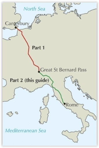
Productomschrijving: Deze gloed nieuwe gids beschrijft Deel 2 van de pelgrimroute tussen Lausanne in Zwitserland tot de stad Lucca in Italië. De 725 km lange trek loopt over de Alpen via de grote Saint Bernard Pass, daalt dan af naar de Po vallei, over de Cisa pass tot in Toscane in 32 etappes
Engelse omschrijving: Guidebook to the Via Francigena pilgrim route from Lausanne to Lucca. Starting at Lake Geneva (Lac Léman), the 725km route crosses the Alps at historic Great Saint Bernard Pass, descends the Po Valley, then climbs to cross the Cisa Pass into Tuscany. Described in 32 stages, with information on facilities and pilgrim hostels.
- Seasons:
Suitable for walking in spring, summer and autumn. The Great Saint Bernard Pass is fully open to hikers only in August and September.
- Centres:
Lausanne, Martigny, Great Saint Bernard Pass, Aosta, Ivrea, Vercelli, Pavia, Piacenza, Pontremoli, Pietrasanta, Lucca.
- Difficulty:
Each stage is graded for difficulty (1-4). A few mountainous stages include steep and slippery slopes. No special gear is required to walk the Via Francigena in season, but off-season crossings of the Great Saint Bernard Pass require winter mountain gear and careful attention to changing mountain conditions.
- Must See:
Dazzling Lake Geneva, the 1500-year-old Abbey of Saint-Maurice, the spectacular 2469m Great Saint Bernard Pass across the Alps, the emerald peaks of Italy's Aosta Valley, well-preserved medieval cities of Vercelli, Pavia and Piacenza, spectacular views from the Monte Valoria at the Cisa Pass, resorts of the Lunigiana coastline and the charming walled city of Lucca.
Locatie op kaart
Overzichtskaarten

Alle Bedevaart routes in ons gamma
Alle Bedevaart routes in ons gamma

Producten op de overzichtskaart
Klik op een product om naar de detailpagina te gaan.
- Wandelgids - GR655 - Bruxelles-Paris-Tours - FFR
- Via Francigena - Canterbury au col du Grand Saint-Bernard - Anwb
- Wandelkaart - Roncevaux à Compostelle - IGN
- Wandelgids - Japan's Kumano Kodo Pelgrimage - Cicerone
- Wandelgids - Camino Inglés and Ruta do Mar - Cicerone
- Wandelgids - Chemin d'Arles Compostelle - La voie du Sud- Rando
- Wandelgids - Camino dos Faros walking - Cicerone
- Wandelkaart 922 - Chemins vers St-Jacques-de-Compostella - IGN
- Wandelgids Le Puy aux Pyrénées - guide poche - Ed. Rando
- Wandelgids - Spaanse St-Jakobsweg - Hikeline
- Compostelle en France nouveaux chemins- Ed.Ouest France
- Fietsgids Bedevaart Ruta Via de la Plata cycle route - Cicerone
- Wandelgids - Guide des chemins de pèlerinage d'Europe
- Wandelgids Via Francigena - Part 3 Lucca to Rome - Cicerone
- Wandelgids Via Francigena pilgrim route - Part 2
- Reisverhaal Onderweg - Alleen over het St. Olavspad
- Wandegids - Marcher Vers Compostelle - Larousse
- Wandelgids - Moissac-Roncevaux GR65 - Via Le Puy - FFR
- Wandelgids - Camino Ignaciano Loyola - Manresa - Bradt
- Wandelgids - Camino de Santiago - Via Podiensis GR65 - Cicerone
- Wandelgids 650 Sentier Saint-Jacques - Genève-Le-Puy GR65 - FFR
- Wandelgids GR65 - Le Puy-en-valais > Figeac - FFR
- Wandelgids Via Tolosana- Arles naar Toulouse - Rother
- Wandelgids GR 654 - Périgueux-Roncevaux - FFR
- Wandelgids - The Pilgrim's Way - Cicerone
- Wandelgids- St-Jakobsweg - Rother
- Wandelgids Camino de Santiago - Rother
- Bedevaartgids - le Puy-en-Velay to Figeac - Le Félin
- Bedevaartgids - Figeac to St-Jean - Le Félin
- Bedevaartgids - le Puy-en-Velay à Figeac - Le Félin
- Bedevaartgids - Figeac à St-Jean - Le félin
- Wandelgids - The Way of St Francis - Cicerone
- Wandelgids - Montgenèvre à Arles - FFR
- Wandelgids - Via de la Plata- Sevilla tot Santiago - Rother
- Wandelgids - Via Podiensis- Le Puy-en-Velay > Pyreneeën - Rother
- Wandelgids Schweiz- Konstanz- Rorschach am Genf - Rother
- Wandelgids - Irun bis Santiago - Rother
- Wandelgids - Chemin du Piémont tot de Pyréneen - Rando
- Wandelgids Marburg- via Trier na Vézelay - Rother
- Wandelgids Osterreich - Hainburg am Feldkirch - Rother
- Alle Europese Pelgrim & bedevaart routes - Freytag & Berndt
- Wandelgids - Caminho Português in 15 etappes - Elmar
- Wandelgids - Pelgrimsroute 7-1 - LAW Pelgrimspad - Wandelnet
- Wandelgids - Pelgrimsroute 7-2 - LAW Pelgrimspad - Wandelnet
- Tous les chemins de Compostelle - Ed. Ouest-France
- Wandelgids Jakobswegweiser Weinviertel - Freytag & Berndt
- Wandelkaart 89020 - Le-Puy-en-Velay - Moissac GR65-1 - IGN
- Wandelkaart 89021 - Moissac - Roncevaux GR65-2 - IGN
Artikelen uit dezelfde regio


Wandelkaart 88 Monte Rosa - Kompass • 9783991218883
Wandelkaart Monte Rosa - Kompass Productomschrijving: Het 50 km lange Monte Rosa bergmassief ligt in het Zwitsers-Italiaanse grensgebied, in de Walliser Alpen. De hoogste top is de 4.634 m hoge Dufourspitze, de hoogste berg van Zwitserland. - De rit omhoog met de beroemde Gornergratbahn naar de 3.135 m hoge Gornergrat is spectaculair: het uitzicht strekt zich uit van de ijswereld van de Mo…

Wandelkaart 1305 - Dent de Morcles Wallis - Swisstopo • 9783302013053
Wandelkaart Dent de Morcles - Wallis Zwitserland - Swisstopo Productomschrijving: Kaart 1305 - Dent de Morcles is een bergkam boven het dal van Martigny op het kruispunt van de E27 en E62, net boven de Forèt des Salairons Detail: Zeer gedetailleerde topografische kaarten & wandelkaarten van een klein stuke Zwitserland met schaal 1:25.000.en nr 1011 > 1374. De topografische details van …

Wandelkaart 1287 - Sierre Wallis Zwitserland - Swisstopo • 9783302012872
Wandelkaart Sierre - Wallis Zwitserland - Swisstopo Productomschrijving: Kaart 1287 - Gelegen pal aan de rand van Naturpark Dfyn-Finges, waaronder het Varnerwald, als sterk bebost gebiedt in het hooggebergte. Detail: Zeer gedetailleerde topografische kaarten & wandelkaarten van een klein stuke Zwitserland met schaal 1:25.000.en nr 1011 > 1374. De topografische details van deze kaarten …

Wandelgids Alpine touren im Walliser Alpen - SAC • 9783859023970
Wandelgids Alpine touren im Walliser Alpen Productomschrijving: Alpinisme in het kanton Wallis! Dit is een eigen wereld: het unieke gevoel van de westelijke Alpen, bergbeklimmen en rotsklimmen in het midden van de machtige gletsjer bergen van de Walliser bergen, met haar protagonisten Mont Dolent, Mont Vélan, Grand Combin, Dente Blanche, Dent d' Hérens, Matterhorn, Obergabelhorn, Weisshorn…
Wandelgids - Gotthard- von der Furka zum Lukmanier - SAC • 9783859021495
Wandelgids Gotthard- von der Furka zum Lukmanier Productomschrijving: Deze gids beschrijft enkele van de 600 routes en biedt talrijke voorstellen voor doorgewinterde wandelaars, en rots en ijs routes voor klassieke klimmers, evenals routes voor klimmers. Het bevat informatie over alle bergtoppen en overgangen in de Gotthard-gebied, alsmede informatie over geologie en plantkunde. Duitse…