
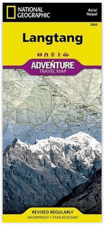
Wandelkaart 3004 Langtang NP- Nepal - Nat Geo
De perfecte aanvulling op een reisgids van de regio
Korte omschrijving
TOPO Wandelkaart 3004 - Langtang NP- Nepal - Nat Geo Productomschrijving: Trekking, klimmen en wildwatervaren zijn slechts enkele van de activiteiten die avonturiers kunnen ondernemen in het...

Specificaties
- Uitgever: National Geographic
- ISBN-13: 9781566955225
- HOOFDCATEGORIEËN: Wandelkaart
- Activiteiten: Wandelen, Hiking & Trekking
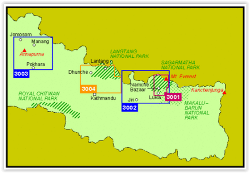
- Regio: Centraal Nepal
- Land: Nepal
- Nationale parken: Langtang NP
- Schaal: 1:125000
- Taal: Engels
Volledige omschrijving
TOPO Wandelkaart 3004 - Langtang NP- Nepal - Nat Geo
Productomschrijving: Trekking, klimmen en wildwatervaren zijn slechts enkele van de activiteiten die avonturiers kunnen ondernemen in het Langtang National Park. National Geographic's Adventure Map of Langtang is een instrument van onschatbare waarde voor reizigers die deze opmerkelijke regio en de rest van Nepal willen verkennen. Steden en dorpen zijn duidelijk aangegeven en gemakkelijk te vinden in de gebruiksvriendelijke index. Een wegennet compleet met hoofd- en kleine wegen helpt u de route te vinden die bij u past. Met speciale inhoud voor diverse en unieke recreatieve, ecologische, culturele en historische bestemmingen, is deze kaart een perfecte aanvulling op een reisgids.
Engelse omschrijving: Trekking, climbing, and whitewater rafting are just some of the activities adventurers can enjoy in Langtang National Park. National Geographic's Adventure Map of Langtang is an invaluable tool for travelers seeking to explore this remarkable region as well as the rest of Nepal. Cities and towns are clearly indicated and easy to find in the user-friendly index. A road network complete with major and minor roads will help you find the route that's right for you. With specialty content to include diverse and unique recreational, ecological, cultural, and historical destinations, this map is a perfect companion to a guidebook.
A detailed map of Nepal is shown on one side of the map, as well as maps of Kathmandu and its commercial neighborhood of Thamel. The reverse side features a topographic and trekking map the Langtang region. Helpful travel aids such as visitor centers, checkpoints, health posts, lodging, religious sites, settlements, and post offices are clearly indicated. In addition to restaurants, lodging, and shopping areas, a variety of resources are indicated on the inset maps as well including embassies/consulates, international organizations, places of worship, banks, police stations, bus stops, and more.
Every Adventure Map is printed on durable synthetic paper, making them waterproof, tear-resistant and tough — capable of withstanding the rigors of international travel.
Locatie op kaart
Artikelen uit dezelfde regio

Wandelkaart 04 Rolwaling Himal - Nelles • 5425013063685
Rolwaling Himal - Nelles Productomschrijving: Rolwaling Himal (Rolwaling Valley), Gaurishankar dorp, is een deel van de Himalaya in Oost-centraal Nepal langs de Tibetaanse grens. Rolwaling Himal omvat Melungtse 7181m en Melungtse II 7023m binnen Tibet en Gaurishankar 7134m op de Nepalese grens met zo'n 50 extra toppen boven de 6000m, al dat zich uitstrekt van de "Nangpa La" pas waar de Mah…