
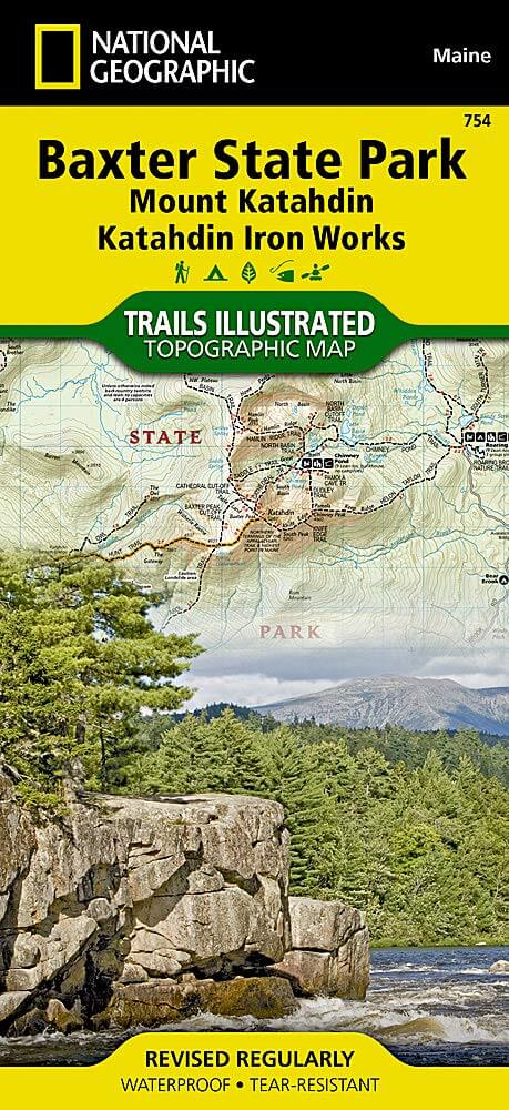
Wandelkaart 784 Baxter State Park- Mount Katahdin - Natgeo
Baxter State Park is een groot wild park permanent beschermd
Korte omschrijving
TOPO Wandelkaart 784 - Baxter State Park- Mount Katahdin - Natgeo Productomschrijving: Baxter State Park is een groot wild park permanent beschermd als state park,gelegen in het Northeast P...

Specificaties
- Uitgever: National Geographic
- ISBN-13: 9781566955850
- HOOFDCATEGORIEËN: Wandelkaart
- Regio: Maine, USA
- Land: Verenigde Staten van Amerika (USA)
- Regionale parken: Baxter State Park, Maine USA
- Schaal: 1:63360
- Afmeting: 10x19
- Taal: Engels
Volledige omschrijving
TOPO Wandelkaart 784 - Baxter State Park- Mount Katahdin - Natgeo
Productomschrijving: Baxter State Park is een groot wild park permanent beschermd als state park,gelegen in het Northeast Piscataquis, Piscataquis County in north-central Maine, United States. Gelegen in de North Maine Woods region, and the Katahdin Woods and Waters National Monument borders Baxter State Park.
Engelse omschrijving: Governor Percival P. Baxter so enjoyed vacationing in the Maine woods as a child, he purchased nearly 6,000 acres of land in 1930 to fulfill his dream of creating a park. The park that bears his name now covers 209,501 acres and includes Mount Katahdin, Maine's highest peak. National Geographic's Trails Illustrated map of Baxter State Park combines unmatched detail with helpful information to offer an invaluable tool for making the most of your visit. Expertly researched and created in partnership with local land management agencies, this map features key points of interest including Katahdin Iron Works, Borestone Mountain, Trout Brook Farm, and South Branch Pond.
With over 200 miles of hiking trails including a portion of the Appalachian Trail, this map will prove invaluable in your exploration of the park. Trail mileage between intersections will help you choose the path that's right for you. The map base includes contour lines and elevations for summits, passes and many lakes. Some of the recreation features noted include campgrounds, trailheads, interpretive trails, picnic areas, rental cabins, boating access, and canoe carry down points.
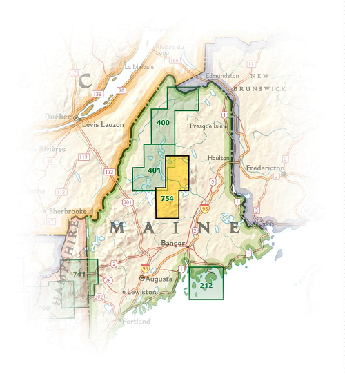
Locatie op kaart
Artikelen uit dezelfde regio

Reisgids New England USA - Insight guides ENG • 9781839053238
New England USA - Insight guides Productomschrijving: Van beslissen wanneer u gaat tot kiezen wat u gaat zien wanneer u aankomt, dit is alles wat u nodig hebt om uw reis te plannen en het beste van New England te ervaren, met diepgaande insiderinformatie over must-see topattracties zoals Cape Cod National Seashore en de Freedom Trail, maar ook verborgen culturele juweeltjes. Engelse om…

Reisgids New England - Top 10 - DK Eyewitness • 9780241364772
DK Eyewitness TOP 10 New England Omvat: Boston, New Hampshire, Vermont, Rhode Island, Cape Cod and more Productomschrijving: Verken de historische stad Boston, ga wandelen in het prachtige Vermont of ga naar Rhode Island. Van de Top 10 festivals en evenementen tot de Top 10 buitenactiviteiten - deze gebruiksvriendelijke reisgids staat boordevol informatie om u te helpen het allerbeste …

Wandelgids New England & Mid-Atlantic States NP's - Lonely Planet • 9781838696078
New England & Mid-Atlantic States National Parks Productomschrijving: Lonely Planet's New England and the Mid-Atlantic States' National Parks is uw paspoort voor het meest actuele advies over wat u moet zien en overslaan. Fiets over koetswegen, wandel over ladderpaden en scheer over Skyline Drive, allemaal met uw vertrouwde reisgenoot. Duik in het hart van de nationale parken van New Engla…

Wandelkaart 1513 Appalachian Trail - Deel 13 - Natgeo • 9781597756501
Wandelkaart 1513 > Appalachian Trail deel 9 > Pleasant Pond > Katahdin (9781597756501) Nat Geo Productomschrijving: Deze trail is een wonderbaarlijke route die van Main tot in Atlanta loopt, en ettelijke duizenden Km lang is. De route loopt door de mooiste delen van Oost USA, meerbepaald Virginia e.d. De route wordt jaarlijke door duizenden liefhebbers afgelopen, maar aangezien de route du…

Wandelkaart 212 Acadia National Park - Natgeo • 9781566953528
Wandelkaart 212, Trails Illustrated Acadia NP - Nat Geo Productomschrijving: National Geographic gekend over gans de wereld door zijn natuur documentaires and magazines, is hier nu ook aanwezig als cartograaf. Met een topografisch exemplaar over het nationale park Acadia in Maine. Acadia NP ligt in het ZO van de Amerikaanse staat Maine. Het gebied bestaat uit bergen, bossen en meren. Ook …