

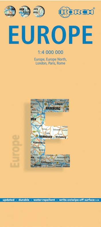
Landkaart Europa - Borch
Belgium- France- Germany- Netherlands- Spain- Italy- Portugal
Korte omschrijving
Wandelkaart Landkaart Europa - Borch Productomschrijving: Our soft-laminated folded map of Europe in the 14th edition shows: Europe 1:4 000 000, Europe North 1:5 000 000, the cities of Londo...
Specificaties
- Uitgever: Borch GmbH
- ISBN-13: 9783866093379
- HOOFDCATEGORIEËN: Wandelkaart, Wegenkaart - Landkaart
- Activiteiten: Street/Road maps & city plans, Wandelen, Hiking & Trekking
- Regio: Europa
- Land: Europa
- Schaal: 1:4000000
- Editie: 19
- Taal: Duits, Engels, Frans, Itailaans, Spaans
Volledige omschrijving
Wandelkaart Landkaart Europa - Borch
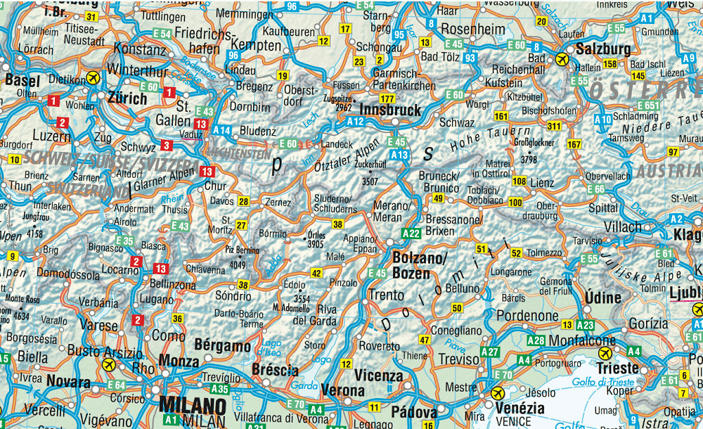
Productomschrijving: Our soft-laminated folded map of Europe in the 14th edition shows: Europe 1:4 000 000, Europe North 1:5 000 000, the cities of London and Paris 1:15 000, Rome 1:13 000 and their Regions each in 1:700 000. In addition you find the Top 15 sights and airports of this three cities and a map of the European Union with time zones. Borch Maps are easy to fold, durable and water-repellent with a wipeable surface. Borch Maps show hotels, museums, monuments, markets, public transport, top sights and points of interest, overview maps, time zones, and much more...
Covering only 2% of the earth’s surface, Europe is home to just over 742 million people spread out over 10.18 million square kilometres and currently represents the world’s largest economy and second-smallest continent. About 508 million Europeans reside in the 28 EU member states. Europe is one of the seven continents, even though it is actually just a peninsula of Eurasia.
The Ural Mountains and River and the Caspian Sea separate Europe from Asia to the east. Europe is bordered by the Arctic Ocean to the north, the Atlantic Ocean to the west, the Mediterranean to the south and the Caucasus Mountains and Black Sea on its southeastern perimeter. Europe boasts a diverse array of climatic and geographic regions, languages and cultures, world cities, beautiful countryside and breathtaking sea and mountainscapes.
Artikelen uit dezelfde regio
Wegenatlas Europa - Freytag & Berndt • 9783707923766
Wegenatlas Europa - F&B Productomschrijving: Deze wegenatlas is goed leesbaar. Met vele symbolen wordt informatie gegeven van o.a. campings, veerdiensten en (jeugd-)herbergen gegeven. Het wegennetwerk is goed weergeven, zowel de hoofdwegen, provinciale- en lokale wegen. Tevens worden wegnummers duidelijk vermeld. Afstanden tussen plaatsen zijn in kilometers op de kaart ingetekend, daarnaa…

Landkaart Wegenkaart Planning map Europe - Lonely Planet • 9781786579102
Wegenkaart & Planning map Europe - Lonely Planet Productomschrijving: With an easy-fold, easy-to-use format, Lonely Planet Europe Planning Map is your conveniently-sized passport to traveling with ease. Get more from your map and your trip with images and information about top country attractions, itinerary suggestions and themed lists. With this easy-to-use, full colour navigation tool i…

L'Europe à vélo - Véloroutes et voies vertes Europe - Suzac Ed. • 9782490795086
Véloroutes et voies vertes Europe - Suzac Ed. Productomschrijving: L'intégrale des itinéraires cyclables de moyenne et longue distance à travers l'Europe, avec parcours repérés et légendés qui renseignent sur les principaux bourgs, villes et villages traversés. Un panorama complet de l'Europe à vélo : – Le réseau cyclable EuroVelo, regroupant 19 routes spécialement aménagées pour l'it…

Wandelgids De mooiste wandelroutes van Europa - Debo Prod. • 9789036644082
De mooiste wandelroutes van Europa - Debo Productomschrijving: Dit boek neemt je mee door heel Europa. Het bevat routes van verschillende lengte en zwaarte, voor ervaren wandelaars, voor beginners en voor gezinnen. Uiteraard mag de Camino de Santiago niet ontbreken, net als de Via Francigena, de pelgrimsroute vanuit Canterbury dwars door Frankrijk en de Alpen naar Rome. Maar ook over d…

Plano Wandkaart Europa Gelamineerd - 124 x 88 cm - F&B • 5425013060271
Plano Wandkaart Europa - F&B Productomschrijving: Politiek overzicht,elk land in een verschillende kleur. Met inzet: Scandinavië, Ijsland - Plaatsnamenregister op rugzijde van de kaart - Internationaal vliegveld, vliegveld - Vaarroutes