
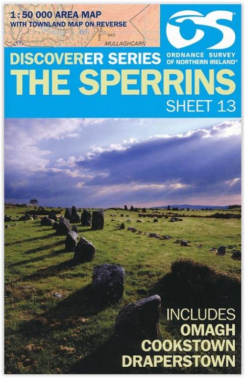
Wandelkaart 13 The Sperrins Ulster N. Ireland - OSNI
De Sperrins of genaamd de Sperrin Mointains
Korte omschrijving
The Sperrins Ulster Northern Ireland - OSI Productomschrijving: De Sperrins of genaamd de Sperrin Mointains, zijn een gebergte in N.W. Noord-Ierland, meer bepaald in de districten Mid Ulster...

Specificaties
- Uitgever: Ordnance Survey
- ISBN-13: 9781905306848
- HOOFDCATEGORIEËN: Wandelkaart
- Activiteiten: Wandelen, Hiking & Trekking
- Regio: Northern Ireland, UK, Ulster, Ireland
- Land: Noord Ierland
- Schaal: 1:50000
- Afmeting: 11x18
- Taal: Engels
Volledige omschrijving
The Sperrins Ulster Northern Ireland - OSI
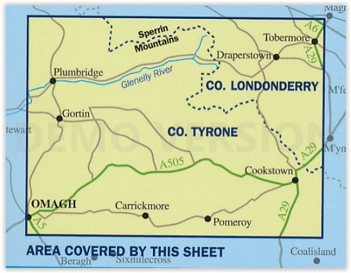
Productomschrijving: De Sperrins of genaamd de Sperrin Mointains, zijn een gebergte in N.W. Noord-Ierland, meer bepaald in de districten Mid Ulster, Fermanagh and Omagh en Derry and Strabane.
Key Features:
- Each map covers an area of 40km x 30km and is based on the Irish Grid co-ordinate system
- The OSNI Discoverer Series is fully compatible with the Republic of Ireland Discovery Series, using the same sheet numbering system, same co-ordinate system, same data source in the border areas and a similar cartographic style
- The OSNI Discoverer Series contains important tourist information including youth hostels, picnic areas, view points, camp sites and shows road classification, way marked walks, paths and numbered national cycle networks
- Some maps include a townland map on the reverse, with an index for easy reference
- Shows water features such as loughs, rivers and canals with names, as well as beaches and marshes
- Easy to use legend printed in English, French and German
- Relief is shown in easy to read coloured layers and includes contours at 10m intervals
Technical Information:
- There are 18 sheets in the series. The sheet numbering system is on an all Ireland basis
- Scale of 1:50 000 i.e. 2cms on the map represents 1km on the ground
- Updated every three years
- Full Irish Grid co-ordinates enabling a unique reference to be given to any feature or point
- Digitally derived from OSNI’s large-scale database
- All International, County and Local Government District boundaries shown.
Locatie op kaart
Overzichtskaarten

OSI Northern Ireland - OSNI
OSI Northern Ireland - OSNI

Producten op de overzichtskaart
Klik op een product om naar de detailpagina te gaan.
- Wandelkaart 04 Discoverer Coleraine- Northern Ireland - OSNI
- Wandelkaart 05 Discoverer Ballycastle - Discoverer series - OSNI
- Wandelkaart 07 Discoverer Londonderry- Ulster - N.Ireland - OSNI
- Wandelkaart 08 Ballymoney County Antrim - OSNI
- Wandelkaart 09 Larne County Antrim - OSNI
- Wandelkaart 13 The Sperrins Ulster N. Ireland - OSNI
- Wandelkaart 14 Discoverer Lough Neagh - Antrim - N.Ireland - OSNI
- Wandelkaart 15 Discoverer Belfast - OSNI
- Wandelkaart 17 Discoverer Lower Lough Erne - OSNI
- Wandelkaart 18 Discoverer Enniskillen & Irvinestown - OSNI
- Wandelkaart 19 Discoverer Armagh - OSNI
- Wandelkaart 20 Discoverer Craigavon- N.Ireland - OSNI
- Wandelkaart 21 Discoverer Strangford Lough - OSNI
- Wandelkaart 27 Upper Lough Erne (Lisnaskea) - OSNI
- Wandelkaart 28 Monaghan-Keady (Castleblayney) - OSNI
- Wandelkaart 29 Discoverer The Mournes - OSNI
Artikelen uit dezelfde regio

Reisgids Great Britain - DK Eyewitness • 9780241408292
Reisgids Great Britain - DK Eyewitness Productomschrijving: Visit Stonehenge's mysterious monoliths, take the sea air in buzzing Brighton or come face to face with the Vikings in York: everything you need to know is clearly laid out within colour-coded chapters. Discover the best of Great Britain with this indispensable travel guide. Inside DK Eyewitness Travel Guide Great Britain: -…

Reisgids Great Britain - Lonely Planet • 9781838693541
Reisgids Great Britain - Lonely Planet Productomschrijving: Buckingham Palace, Stonehenge, Manchester United, The Beatles - Groot-Brittannië heeft iconen zoals nergens anders en reizen hierheen is een fascinerende mix van beroemde namen en verborgen juweeltjes.. Omvat: London, Canterbury, Southeast England, Oxford, Cotswolds, Southwest England, Cambridge, East Anglia, Birmingham, the M…

Wandelkaart 07 Discoverer Londonderry Ulster N.Ireland - OSNI • 9781905306961
Wandelkaart Londonderry - Ulster Northern Ireland - OSI Productomschrijving: County Londonderry meerbepaald is een van de graafschap van Ierland, en is een van de zes graafschappen van Noord-Ierland. Het ligt in de provincie Ulster. Het is genoemd naar de hoofdstad Derry. De locatie van de stad zelf is echt vol laagbouw, de rest rond de stad van Derry, is puur natuur, en een uitgroepen sup…

Wandelgids The Mourne mountains - Knife Edge • 9781912933037
Wandelgids - The Mourne mountains - Knife Edge Outdoor Limited Productomschirjving: De enige gids die gaat over de Mourne Mountains in Noord Ierland, geschreven door een lokale wandelaar van County Down: 30 uitgekozen routes met Real 1: 25.000 kaarten: dit maakt navigatie eenvoudig en bespaart u geld: geen extra kaarten nodig. Engelse omschrijving: The only guidebook for the Mourne Mou…

Wandelkaart XT25 Mourne Mountains N. Ireland - Harvey maps • 9781851376124
Wandelkaart - Mourne Mountains N. Ireland - Harvey maps Productomschrijving: Noord Ireland behoort toe aan Engeland, maar geen enkel haar op het hoofd doet denken aan Engeland als u in Noord Ierland rond loopt in de Morne Mountains, of de mournes ook soms wel genaamd. U kunt het zo wat vergelijken met de Schotse Highlands. Eveneens geen regio die doet denken aan Engeland. De Mourne Mountai…