
Wandelkaart 2241 SB Albi & Cordes-sur-Ciel - IGN
Albi & Cordes-sur-Ciel zijn gelegen in de Tarn
Korte omschrijving
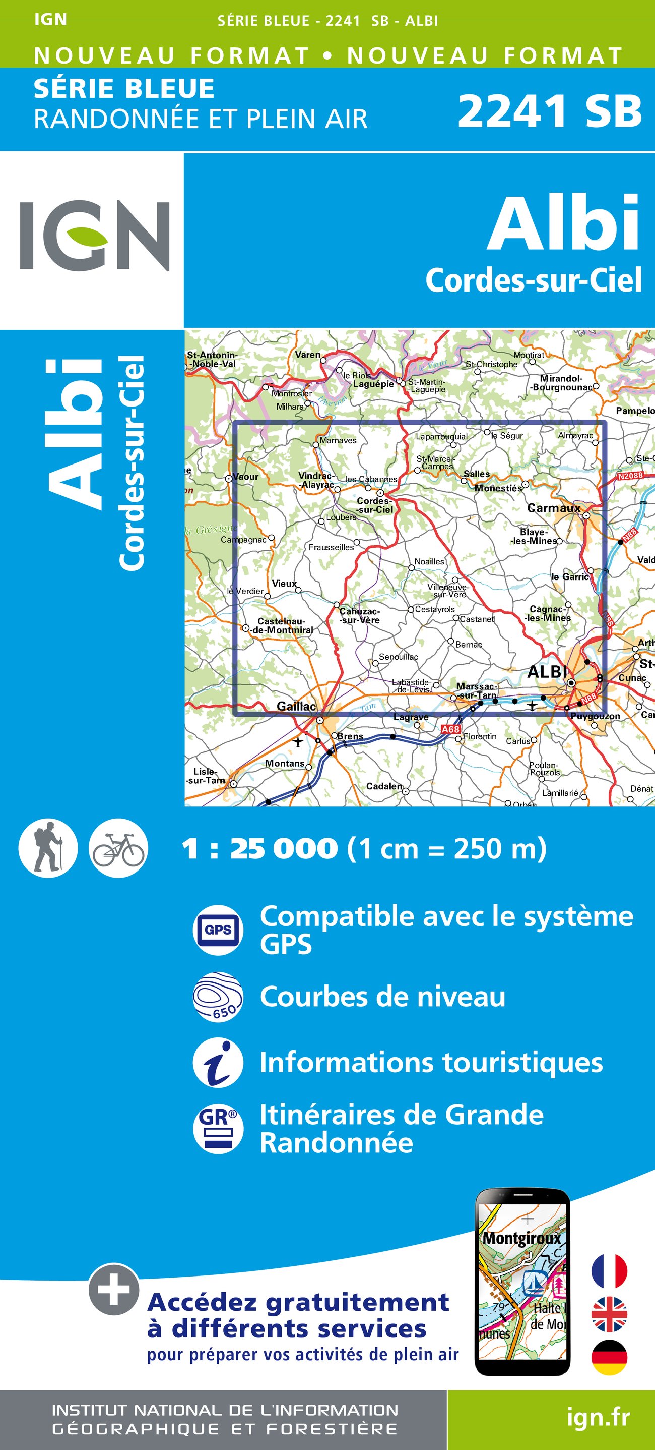
Wandelkaart 2241 SB - Albi & Cordes-sur-Ciel Productomschrijving: Deze topografische kaarten hebben een zeer nauwkeurige gronddetail, niet te vergeten de topografische hoogteprofielen, die h...

Specificaties
- Uitgever: Institut Géographique National
- ISBN-13: 9782758533276
- HOOFDCATEGORIEËN: Wandelkaart
- Activiteiten: Wandelen, Hiking & Trekking
- Regio: Occitanië, Frankrijk
- Land: Frankrijk
- Departement: Tarn (81)
- UNESCO werelderfgoed: Albi, France 2010
- Schaal: 1:25000
- Afmeting: 11x22
- Editie: 1
- Taal: Frans
- Reeks: IGN Cartes NOUVELLE Série Bleue
Volledige omschrijving
Wandelkaart 2241 SB - Albi & Cordes-sur-Ciel
Productomschrijving: Deze topografische kaarten hebben een zeer nauwkeurige gronddetail, niet te vergeten de topografische hoogteprofielen, die het wandelen een stuk gemakkelijker maken. Albi is een stad in het zuiden van Frankrijk. Het is de hoofdstad van het Franse departement Tarn. Door Albi stroomt de rivier Tarn. Er wonen ca. 50.000 mensen in Albi, die Albigeois worden genoemd. Sinds juli 2010 staat het op de UNESCO-werelderfgoedlijst.
Desciptive produits: Ces cartes topographiques d'une très grande précision contiennent tous les détails existant sur le terrain : voies de communication jusqu'au moindre sentier, constructions jusqu'au hangar, bois, arbre isolé, rivière, source... Sans oublier la représentation du relief par des courbes de niveau.
Locatie op kaart
Overzichtskaarten

18--IGN TOP25 reeks, ET, OT & SB
18--IGN TOP25 reeks, ET, OT & SB

Producten op de overzichtskaart
Klik op een product om naar de detailpagina te gaan.
- Wandelkaart 2134 SB Tulle- Donzenac & Gorges de la Vézère - IGN
- Wandelkaart 2234 SB La Roche-Canillac & Marcillac-la-Croisille
- Wandelkaart 2235 SB Argentat - IGN
- Wandelkaart 2036 ET Souillac & Vallée de la Dordogne - IGN
- Wandelkaart 2136 ET Rocamadour & Padirac - IGN
- Wandelkaart 2236 SB St-Céré & Sousceyrac-en-Quercy - IGN
- Wandelkaart 2137 SB Gramat- Rocamadour - IGN
- Wandelkaart 2237 SB Lacapelle-Marival & Latronquière - IGN
- Wandelkaart 1838 SB Cancon & Miramont-de-Guyenne - IGN
- Wandelkaart 2038 SB Puy l'Evêque & Luzech - IGN
- Wandelkaart 2138 OT Cahors & St-Cirq-Lapopie - IGN
- Wandelkaart 2238 SB Figeac & Cajarc - IGN
- Wandelkaart 1839 SB Villeneuve-sur-Lot & Castelmoron-sur-lot
- Wandelkaart 2039 SB Cahors (Ouest) & Labastide-Marnhac - IGN
- Wandelkaart 2139 SB Cahors & Limogne-en-Quercy - IGN
- Wandelkaart 2239 SB Villefranche-de-Rouergue & Martiel - IGN
- Wandelkaart 1840 SB Agen & Port-Sainte-Marie - IGN
- Wandelkaart 2140 SB Caussade & St-Antonin-Noble-Val - IGN
- Wandelkaart 2040 SB Najac- Varen & Laguépie - IGN
- Wandelkaart 1841 SB Condom & Lectoure - IGN
- Wandelkaart 1941 SB St-Nicolas-de-la-Grave & Miradoux - IGN
- Wandelkaart 2041 SB Montauban & Castelsarrasin - IGN
- Wandelkaart 2141 SB Nègrepelisse & Monclar-de-Quercy - IGN
- Wandelkaart 2241 SB Albi & Cordes-sur-Ciel - IGN
- Wandelkaart 1842 SB Fleurance & Valence-sur-Baïse - IGN
- Wandelkaart 1942 SB Beaumont-de-Lomagne & St-Clar - IGN
- Wandelkaart 2042 SB Grenade & Verdun-sur-Garonne - IGN
- Wandelkaart 2142 SB Villemur-sur-Tarn & Rabastens - IGN
- Wandelkaart 2242 SB Gaillac & Graulhet - IGN

Artikelen met UNESCO Werelderfgoed locaties
Artikelen met UNESCO Werelderfgoed locaties

Producten op de overzichtskaart
Klik op een product om naar de detailpagina te gaan.
- Wandelkaart 10047 - Aurland- Sogn og Fjordane - Nordeca AS
- Fietsgids - A vélo en Ardèche méridionale - 46 balades - Glénat
- Wandelgids Rheinsteig - Rheinburgenweg & höhenwegen - Rother
- Wandelgids Pfälzer Weitwanderwege & Weinsteig - Rother
- Wandelkaart XT25 - Yorkshire Dales Zuid-Oost - Harvey maps
- Wandelkaart XT40 - N.O. Yorkshire Dales NP - Harvey ultramaps
- Wandelkaart XT40 - N.W. Yorkshire Dales NP - Harvey Ultramaps
- Wandelkaart XT40 - Z.O. Yorkshire Dales England - Harvey Maps
- Wandelkaart XT40 - Z.W. Yorkshire Dales - Harvey Ultramaps
- Wandelkaart 3713 ET - Pays de Bitche & PNR des Vosges du Nord
- Fietsgids - Canal du Midi cycling - Cicerone
- Wandelgids Japan's Kumano Kodo Pelgrimage - Cicerone
- Wandelgids - The Pennine Way Map Booklet - Cicerone
- Fietsgids Bedevaart Ruta Via de la Plata cycle route - Cicerone
- Wandelgids - Italy's Cinque Terre walking - Cicerone
- Reisgids Chaîne des Puys- Auvergne France - Ed. Ouest-France
- Guide de voyage - Angkor en quelques jours - Lonely Planet
- Guide de voyage - Angkor en quelques jours - Lonely Planet
- Le Canal du midi à vélo - Editions Ouest-France
- Wandelkaart 229 - Salzkammergut - Kompass
- Wandelkaart 204 Truro & Falmouth- Cornwall England - OSI
- Wandelkaart 005 - Mont Perdu & Gavarnie - Sua Editions
- Wandelkaart 0/16 - Mount Kenya Nationalpark - Alpenverrein
- Travelguide - Angkor Wat & Siem Reap pocket guide - Lonely Planet
- Wandelgids Tour of the Jungfrau - Cicerone
- Wandelkaart Geopark Harz - Braunschweiger Land - Huber
- Wandelkaart XT25 - Yorkshire Dales NP Noord-Oost - Harvey maps
- Wandelkaart - South West Coast Path 5 - Harvey maps
- Wandelgids - Wanderführer Dolomiten 1 - Hikeline
- Wandelgids - Wanderführer Dolomiten 2 - Hikeline
- Wandelgids - Ostfriesland Duitsland - Rother
- Wandelgids - Pfälzerwald & Deutsche Weinstrasse - Rother
- Wandelgids Drakensberg - 75 day walks - Cicerone
- Fietskaart & wandelkaart 368 - Rhein Radweg 3 - Publipress
- Wandelgids & klimgids - Berner Alpen 4- Jungfrau Region - SAC
- Wandelgids - Hadrian's Wall Path - Rucksack readres
- Wandelkaart - Hadrian's Wall Path - Harvey maps
- Wandelkaart - South West Coast Path 1 - Harvey maps
- Wandelkaart - South West Coast Path 3 - Harvey maps
- Wandelkaart - South West Coast Path 4 - Harvey maps
- Wandelkaart - South West Coast Path 6 - Harvey maps
- Wandelkaart XT25 - Yorkshire Dales Zuid-West - Harvey Maps
- Wandelkaart 194 - Dorchester & Weymouth- Dorset - OSI
- Wandelkaart 179 - Canterbury- East Kent - England - OSI
- Wandelkaart 195 - Bournemouth & Purbeck- SW England - OSI
- Wandelkaart 193 - Taunton & Lyme Regis- Somerset - OSI
- Wandelkaart 2241 SB - Albi & Cordes-sur-Ciel - IGN
- Wandelkaart 179 - Canterbury & East Kent - England - OSI
- Wandelkaart 247t - Sardona Graubünden - Swisstopo
- Fietsgids Bikeline - Neusiedler See - Radweg - Estenbauer
- Wandelkaart 2136 ET - Rocamadour & Padirac - IGN
- Wandelgids - Massif Central (week-end) à pied - Ed. Chamina
- Wandelkaart 2137 SB - Gramat & Rocamadour - IGN
- Compostelle en France nouveaux chemins- Ed.Ouest France
- Wandelkaart 2138 OT - Cahors & St-Cirq-Lapopie - IGN
Artikelen uit dezelfde regio

Wandelkaart 2943 OT St-Gilles & Vauvert - IGN • 9782758545514
TOPO Wandelkaart - St-Gilles & Vauvert- Occitanië Productomschrijving: St-Gilles & Vauvert zijn gemeentes in het Franse departement Gard in de regio Occitanie. De plaats maakt deel uit van het arrondissement Nîmes. Productomschrijving: De TOP 25 kaarten, die eindigen op "T", omvatten gebieden van bijzonder toeristisch belang zoals de Alpen, de Pyreneeën, de Provence en de Middellandse …

Wandelkaart 2342 SB Réalmont & Alban - IGN • 9782758534211
Wandelkaart 2342 SB - Réalmont & Alban Productomschrijving: Deze topografische kaarten hebben een zeer nauwkeurige gronddetail, niet te vergeten de topografische hoogteprofielen, die het wandelen een stuk gemakkelijker maken. Réalmont is een gemeente in het Franse departement Tarn (regio Midi-Pyrénées). De plaats maakt deel uit van het arrondissement Albi. Desciptive produits: Ces car…

Wandelgids Lozère - 30 balades à pied - Ed. Chamina • 9782844662538
Wandelgids - Lozère - 30 balades à pied - Ed. Chamina Productomschrijving: De gehele regio wordt bezocht, met haar 9 toeristische gebieden met sterke identiteit: Pays cévenol, Gorges du Tarn, Mont Lozère, Vallée de la Jonte et Causses lozériens, Vallée du Lot, Haut-Allier, Margeride & Aubrac Franse omschrijving: L'ensemble du département est visité, avec ses 9 régions touristiques à f…


Wandelkaart 2639 SB - Florac- Ste-Enimie & Gorges du Tarn - IGN • 9782758546276
Wandelkaart - Florac- Ste-Enimie & Gorges du Tarn Productomschrijving: Florac, Ste-Enimie & Le Gorges du Tarn zijn stuk voor stuk plaatsen en voormalige gemeentes in het Franse departement Lozère in de regio Occitanie. De plaats maakt deel uit van het arrondissement Florac. Florac, ligt pal in het nationale park van de Cevenne, en belooft daarmee de beste locatie te zijn voor wandelaars. …

Wandelgids Cévennes - les plus belles randonnées - Ed. Glénat • 9782344053300
Cévennes PN - les plus belles randonnées - Ed. Glénat Productomschrijving: Een selectie van 27 van de mooiste wandelingen in een beschermd en authentiek gebied met een sterke identiteit. De Cevennen NP, verdeeld over de departementen Ardèche, Gard, Hérault en Lozère, zijn een ideaal speelterrein voor wandelliefhebbers. Voor velen zijn de Cevennen wilde ruimtes waar de mens plaats heeft…