
Wandelkaart 263 Grand Canyon West NP- Arizona - Nat Geo
Een zeer brede en diepe kloof in het noorden van Arizona
Korte omschrijving
TOPO Wandelkaart 263 - Grand Canyon West NP - Arizona Productomschrijving: De Grand Canyon is een zeer brede en diepe kloof in het noorden van de Amerikaanse staat Arizona. In de loop van mi...

Specificaties
- Uitgever: National Geographic
- ISBN-13: 9781566954969
- HOOFDCATEGORIEËN: Wandelkaart
- Activiteiten: Wandelen, Hiking & Trekking
- Regio: Arizona, USA
- Land: Verenigde Staten van Amerika (USA)
- Nationale parken: Grand Canyon NP, Arizona
- Schaal: 1:90000
- Afmeting: 10x19
- Taal: Engels
Volledige omschrijving
TOPO Wandelkaart 263 - Grand Canyon West NP - Arizona
Productomschrijving: De Grand Canyon is een zeer brede en diepe kloof in het noorden van de Amerikaanse staat Arizona. In de loop van miljoenen jaren heeft het water van de Colorado deze kloof in het landschap doen ontstaan. Deze extreme erosie werd mogelijk doordat het gebied waarin de kloof ligt steeds verder omhoog rees.
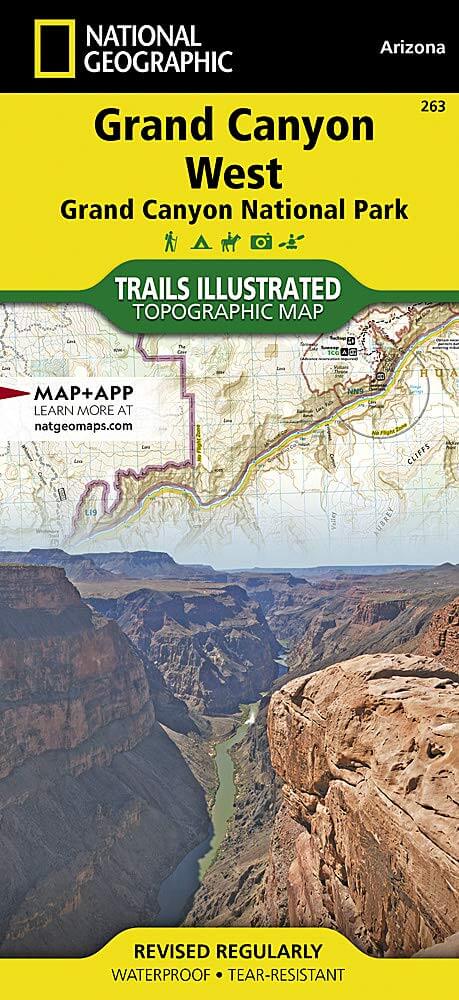
Engelse omschrijving : National Geographic's Trails Illustrated map of Grand Canyon West covers some of the less frequented but just as wondrous landscape of Grand Canyon National Park, from Powell Plateau to the park's western boundary. Expertly researched and created in partnership with the National Park Service, U.S. Forest Service, Bureau of Land Management and others, the map also covers the surrounding areas of Kaibab National Forest, Hualapai Havasupai Indian Reservations and Parashant National Monument. With so much of the area being backcountry, the map also includes useful backcountry information, regulations and safety tips, in addition to a backcountry use area guide, color-coded by degree of experience required.
Clearly marked trails, including unmaintained primitive trails, will guide you around the area, whether you're traveling by foot, horse, mountain bike, or motorized vehicle. The map base includes contour lines and elevations for summits, and river mileage is noted for the Colorado River. Backcountry zones within the park are marked with their boundaries and labeled with their National Park Service code. Some of the many recreation features include campgrounds and campsites, boat launches, ATV trails, scenic viewpoints, and interpretive trails. Every Trails Illustrated map is printed on "Backcountry Tough" waterproof, tear-resistant paper. A full UTM grid is printed on the map to aid with GPS navigation.
Other features found on this map include: Aubrey Cliffs, Grand Canyon, Grand Canyon National Park, Grand Wash Cliffs, Granite Gorge, Kaibab National Forest, Kanab Creek, Kanab Creek Wilderness, Kanab Plateau, Lake Mead National Recreation Area, Lower Granite Gorge, Mount Dellenbaugh, Parashant Canyon, Peach Springs Canyon, Sanup Plateau.
Locatie op kaart
Gekoppelde artikelen

Wandelkaart 262 Grand Canyon East NP- Arizona - Nat Geo • 9781566954945
standaard versieTOPO Wandelkaart 262 - Grand Canyon East NP - Arizona Productomschrijving: De Grand Canyon is een zeer brede en diepe kloof in het noorden van de Amerikaanse staat Arizona. In de loop van miljoenen jaren heeft het water van de Colorado deze kloof in het landschap doen ontstaan. Deze extreme erosie werd mogelijk doordat het gebied waarin de kloof ligt steeds verder omhoog rees. Engelse…

Wandelkaart 261 Grand Canyon NP - Bright Angel - Arizona • 9781566954952
standaard versieTOPO Wandelkaart 261 - Grand Canyon NP - Bright Angel- Arizona Productomschrijving: De Grand Canyon is een zeer brede en diepe kloof in het noorden van de Amerikaanse staat Arizona. In de loop van miljoenen jaren heeft het water van de Colorado deze kloof in het landschap doen ontstaan. Deze extreme erosie werd mogelijk doordat het gebied waarin de kloof ligt steeds verder omhoog rees. …
Overzichtskaarten

NAT GEO Arizona trail maps
NAT GEO Arizona trail maps

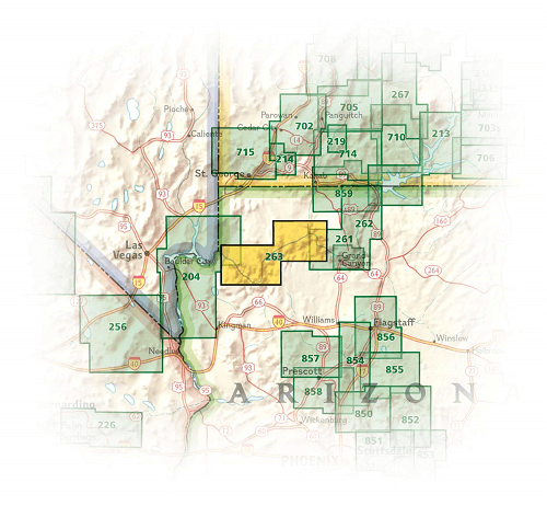
Producten op de overzichtskaart
Klik op een product om naar de detailpagina te gaan.
- Wandelkaart 213 Glen Canyon & Capitol Reef NP - Nat Geo
- Wandelkaart 224 Organ Pipe Cactus Nat. Monument Ariz. - Nat Geo
- Wandelkaart 261 Grand Canyon NP - Bright Angel - Arizona
- Wandelkaart 262 Grand Canyon East NP- Arizona - Nat Geo
- Wandelkaart 263 Grand Canyon West NP- Arizona - Nat Geo
- Wandelkaart 852 Hellsgate- Salome- Sierra Ancha Wilderness Areas
Artikelen uit dezelfde regio

Reisgids Arizona & the Grand Canyon - DK Eyewitness • 9780241278659
Reisgids Arizona & the Grand Canyon - DK Eyewitness Productomschrijving: Take a trip through the water-filled canyons of Lake Powell, tour the Mesa Verde National Park's Ancient Puebloan cliff dwellings, stroll the centuries-old cobbled alleys of San Xavier del Bac Mission or hike one of the Grand Canyon's many walking trails, everything you need to know is clearly laid out within colour-c…

Wandelkaart Apache Creek & Juniper Mesa Wilderness Area - Nat Geo • 9781566955164
Apache Creek - Juniper Mesa Arizona - Nat Geo Productomschrijving: De perfecte gezelschap voor al uw outdoor avonturen in Arizona. Met Prescott & Kaibab National Forests Op deze kaart staat ook: Big Chino Valley, Chino Valley, Granite Mountain, Granite Mountain (AZ) Wilderness, Juniper Mesa Wilderness, Juniper Mountains, Kaibab National Forest, Lonesome Valley, Prescott National Forest…

Reisgids Californië- Arizona- Nevada & Utah - Gottmer • 9789025779139
Californië- Arizona- Nevada & Utah van Gottmer Productomschrijving: Of je nu nieuwsgierig bent naar cultuurbepalende wereldsteden als San Francisco en Los Angeles dan wel je juist graag terugtrekt in de natuur: de zuidwestelijke hoek van de VS is voor iedereen een gebied vol hoogtepunten. Californië trekt het grootste aantal bezoekers, gevolgd door de Grand Canyon in Arizona, de nationale …

Wandelkaart 852 Hellsgate- Salome- Sierra Ancha Wilderness Areas • 9781566954860
Hellsgate- Salome- Sierra Ancha Wilderness Areas - Nat Geo Productomschrijving: Tonto National Forest is een van de grootste nationale bossen in de Verenigde Staten en staat niet alleen bekend om zijn diversiteit aan terrein, flora en fauna, maar ook om zijn vele recreatieve mogelijkheden het hele jaar door. Deskundig onderzocht en gemaakt in samenwerking met de U.S. Forest Service, Bureau…

Reisgids Arizona & the Grand Canyon - Insight Guides ENG • 9781839053122
Arizona & the Grand Canyon - Insight Guides Productomschrijving: Van het beslissen wanneer te vertrekken, tot het kiezen wat je wil zien als je er aankomt. Deze Insight Guides boek is alles wat je nodig hebt om uw reis te plannen en ervaar het beste van Arizona en de GrandCanyon, met diepgaande insider informatie over must-see, top attracties zoals Monument Valley, en verborgen culturele …