
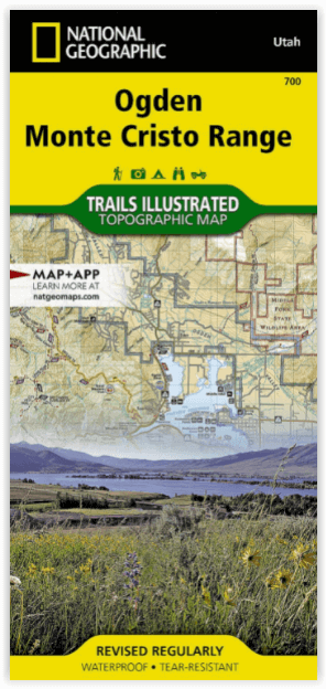
Wandelkaart 700 Ogden- Monte Cristo Range Utah USA - Nat Geo
Ontworpen voor echte de outdoor enthousiastelingen
Korte omschrijving
Ogden- Monte Cristo Range- Utah USA - Nat Geo Productomschrijving: Outdoor enthousiastelingen die willen genieten van de grenzeloze recreatieve mogelijkheden in het noorden van Utah net ten ...

Specificaties
- Uitgever: National Geographic
- ISBN-13: 9781566956345
- HOOFDCATEGORIEËN: Wandelkaart
- Activiteiten: Wandelen, Hiking & Trekking
- Regio: Utah, USA
- Land: Verenigde Staten van Amerika (USA)
- Schaal: 1:75000
- Afmeting: 11x24
- Taal: Engels
Volledige omschrijving
Ogden- Monte Cristo Range- Utah USA - Nat Geo
Productomschrijving: Outdoor enthousiastelingen die willen genieten van de grenzeloze recreatieve mogelijkheden in het noorden van Utah net ten oosten van Great Salt Lake zullen zich vergapen aan National Geographic's Trails Illustrated kaart van Ogden en de Monte Cristo Range. Ontworpen met een breed scala van bezoekers in het achterhoofd, werd deze deskundig onderzochte kaart gemaakt in samenwerking met de U.S. Forest Service en anderen.
De kaart omvat vele populaire recreatiepunten, waaronder Cache en Wasatch National Forests, Antelope Island, Willard Bay en East Canyon State Parks, East Canyon, Ogden Bay, Brigham Face en Middle Fork State Wildlife Areas, Wasatch en Bear River Ranges, Pineview Reservoir, en Ogden River. Een nauwkeurig wegennet tussen Brigham City en North Salt Lake wordt ook getoond.
Omvat eveneens: Antelope Island, Bountiful, Brigham City, Cache National Forest, Centerville, Clearfield, Clinton, Farmington, Kaysville, Layton, Little Bear River, Monte Cristo Range, North Ogden, North Salt Lake, Ogden, Pineview Reservoir, Roy, South Ogden, Syracuse, Wasatch National Forest, Weber River.
Engelse omschrijving: Outdoor enthusiasts looking to enjoy the limitless recreational opportunities in northern Utah just east of Great Salt Lake will marvel at National Geographic's Trails Illustrated map of Ogden and the Monte Cristo Range. Designed with a wide range of visitors in mind, this expertly researched map was created in cooperation with the U.S. Forest Service and others. The map covers many popular recreation points of interest, including Cache and Wasatch National Forests, Antelope Island, Willard Bay and East Canyon State Parks, East Canyon, Ogden Bay, Brigham Face and Middle Fork State Wildlife Areas, Wasatch and Bear River Ranges, Pineview Reservoir, and Ogden River. An accurate road network between Brigham City and North Salt Lake is also shown.
Select an area to explore with the aid of activity guides that list the location, elevation, available facilities and other information of various campgrounds, marinas and picnic grounds. Clearly mapped trails are shown with mileage markers, including part of the Great Western Trail, and are labeled according to designated usage, whether exploring on foot, horseback, mountain bike, motorcycle or ATV. Winter trails are also shown and labeled for ski or snowmobile use. To aid in your navigation, the map includes contour lines, elevations, labeled peaks and summits, and water features. Some of the other recreation features pinpointed are trailheads, paved biked roads, river access points, canoeing, kayaking and swimming areas, shooting ranges, ski areas, yurts and horse corrals.
Every Trails Illustrated map is printed on "Backcountry Tough" waterproof, tear-resistant paper. A full UTM grid is printed on the map to aid with GPS navigation.
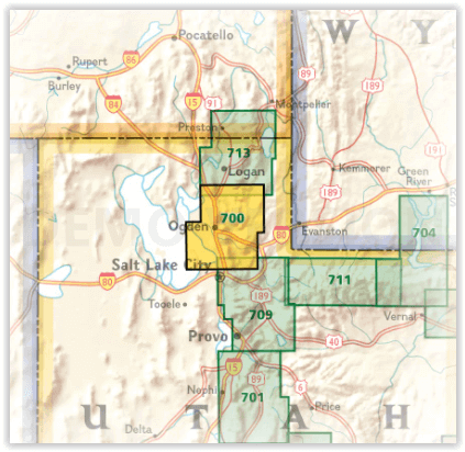
Locatie op kaart
Artikelen uit dezelfde regio

Wandelkaart 507 Moab Oost - Dewey Bridge & Sand Flats - Nat Geo • 9781566959025
Wandelkaart Moab Oost - Dewey Bridge & Sand Flats - Nat Geo Productomschrijving: Deze kaart omvat het Oostelijke gedeelte van het grote Moab recreatie gebied van het befamde National Geographic's Trails Illustrated. De kaart biedt een overzicht genummerd 507 op onderstaande kaart van het gebied. Het gebied omvat 3 kaarten met nummers, 505, 506 & 507. De 505 is de kaart die alles in één kee…

Reisgids Californië- Arizona- Nevada & Utah - Gottmer • 9789025779139
Californië- Arizona- Nevada & Utah van Gottmer Productomschrijving: Of je nu nieuwsgierig bent naar cultuurbepalende wereldsteden als San Francisco en Los Angeles dan wel je juist graag terugtrekt in de natuur: de zuidwestelijke hoek van de VS is voor iedereen een gebied vol hoogtepunten. Californië trekt het grootste aantal bezoekers, gevolgd door de Grand Canyon in Arizona, de nationale …

Wandelkaart 709 Wasatch Front North Utah - Nat Geo • 9781566953702
Wasatch Front North - Utah - Nat Geo Omvat: Bountiful, Centerville, Cottonwood Heights, Currant Creek Peak, Daniels Canyon, Deer Creek Reservoir, Draper, Highland, Holladay, Lindon, Lone Peak Wilderness, Midvale, Mount Olympus Wilderness, Mount Timpanogos, Mount Timpanogos Wilderness, Murray, North Salt Lake, Orem, Pleasant Grove, Provo, Provo River, Rockport Lake, Salt Lake City, South Sa…

Wandelkaart 214 Zion National Park - Natgeo • 9781566952972
Wandelkaart Zion National Park - Nat Geo Productomschrijving: Ontdek de schoonheid en het geologische wonder van Utah's aller eerste nationale park met National Geographic's Trails Illustrated kaart van Zion National Park. Deze deskundige kaart combineert ongeëvenaarde details met nuttige informatie om u te helpen het meeste uit uw bezoek te halen, inclusief een kaart met details over de b…

Wandelkaart 213 Glen Canyon & Capitol Reef NP - Nat Geo • 9781566953436
Wandelkaart Glen Canyon & Capitol Reef NP - Nat Geo Omvat: Bullfrog Creek, Cataract Canyon, Dirty Devil River, Escalante River, Glen Canyon, Glen Canyon Dam, Glen Canyon National Recreation Area, Kaibito Creek, Lake Powell, Mount Hillers, Navajo Creek, Paria River, Rainbow Plateau, Red Canyon, San Juan River, Smoky Mountain, Wahweap Creek, Wilson Mesa. Engelse omschrijving: Let Nationa…