
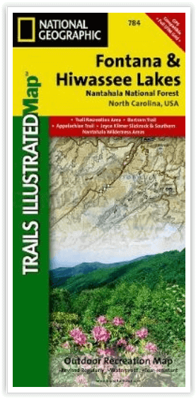
Wandelkaart 784 Fontana and Hiwassee Lakes - Nat Geo
Between Cherokee- Chattahoochee in the Nantahala National Forest
Korte omschrijving
Fontana lake and Hiwassee Lake - Nat Geo Productomschrijving: Genesteld tussen de Cherokee en Chattahoochee National Forests, ligt Nantahala National Forest met zijn overvloed aan recreatie...

Specificaties
- Uitgever: National Geographic
- ISBN-13: 9781566953337
- HOOFDCATEGORIEËN: Wandelkaart
- Activiteiten: Wandelen, Hiking & Trekking
- Regio: North Carolina, USA
- Land: Verenigde Staten van Amerika (USA)
- Schaal: 1:70000
- Afmeting: 10x19, 11x24
- Taal: Engels
Volledige omschrijving
Fontana lake and Hiwassee Lake - Nat Geo
Productomschrijving: Genesteld tussen de Cherokee en Chattahoochee National Forests, ligt Nantahala National Forest met zijn overvloed aan recreatieve mogelijkheden. National Geographic's Trails Illustrated kaart van Fontana en Hiwassee Lakes levert ongeëvenaarde details en waardevolle informatie om u te helpen bij uw verkenning van dit bos. Deskundig onderzocht en gemaakt in samenwerking met de U.S. Forest Service en anderen, bevat deze kaart populaire punten van belang, waaronder Nantahala en Chatuge Lakes, Joyce Kilmer Slickrock en Citico Creek Wilderness gebieden, en Snowbird en Unicoi Mountains.
Engelse omschrijving: Nestled in between the Cherokee and Chattahoochee National Forests, lies Nantahala National Forest with its abundance of recreational opportunities. National Geographic's Trails Illustrated map of Fontana and Hiwassee Lakes delivers unmatched detail and valuable information to assist you in your exploration of this forest. Expertly researched and created in cooperation with the U.S. Forest Service and others, this map features popular points of interest including Nantahala and Chatuge Lakes, Joyce Kilmer Slickrock and Citico Creek Wilderness areas, and Snowbird and Unicoi Mountains.
Handy activity guides with help you narrow down areas to visit according to your needs and interests. Trail charts, with hundreds of miles of trails, will help you choose a trail that's right for your activity level and recreation use whether you're hiking, horseback riding, mountain biking, or ATVing, The Appalachian, Benton MacKaye and Bartram Trails are all highlighted. Mountain Waters, Indian Lakes, Nantahala and Cherohala Skyway Scenic Byways are noted for those wishing to explore the region by car. To aid in your navigation, the map also displays shaded relief, contour lines with elevations, water features and areas of private land. Some of the many recreation features noted include campgrounds and campsites, boat ramps and marinas, river and whitewater access points, fishing and swimming areas, lookout towers, wildlife viewing areas and scenic overlooks. Provided also are background information of Nantahala National Forest and Appalachian Trail, bear safety tips and essential contact information.
Every Trails Illustrated map is printed on "Backcountry Tough" waterproof, tear-resistant paper. A full UTM grid is printed on the map to aid with GPS navigation.
Other features found on this map include: Chattahoochee National Forest, Chatuge Lake, Cheoah Mountains, Cherokee National Forest, Citico Creek Wilderness, Fontana Lake, Great Smoky Mountains, Haw Knob, Hiwassee Lake, Joyce Kilmer-Slickrock Wilderness, Nantahala Mountains, Nantahala National Forest, Snowbird Mountains, Southern Nantahala Wilderness, Unicoi Mountains, Valley River Mountains.
Locatie op kaart
Artikelen uit dezelfde regio

Wandelkaart 1501 Appalachian Trail - Deel 1 - Natgeo • 9781597756389
TOPO Wandelkaart 1501 - Springer Mt to Davenport Gap - Natgeo Productomschrijving: Deel 1 - 3500 km wonderbaarlijke route van Main tot in Atlan. Deze kaart omvat het eerste deel van 13 van Springer mountain tot aan Davenport Gap. Omvat de regio's Georgia, North Carolina & Tennessee. Engelse omschrijving: The Springer Mountain to Davenport Gap Topographic Map Guide makes a perfect trav…

Wandelkaart 317 Clingman's Dome & Cataloochee - Natgeo • 9781566955010
TOPO Wandelkaart 317 - Clingman's Dome & Cataloochee - Nat Geo Productomschrijving: Clingmans Dome is een bergtop in de Great Smoky Mountains van Tennessee en North Carolina, in het zuidoosten van de United States. Cataloochee is dan weer een vallei in de Great Smoky Mountains van North Carolina, gelegen in het zuidoosten van de United States, en is nu een recreatieve regio en historische …

Wandelgids Florida & the South National Parks - Lonely Planet • 9781838696092
Florida & the South National Parks - Lonely Planet Productomschrijving: Lonely Planet's Florida and the South's National Parks is uw paspoort voor het meest relevante, up-to-date advies over wat je moet zien en overslaan. Kampeer in Congaree, peddel door de Everglades en beklim de Great Smoky Mountains, allemaal met je vertrouwde reisgenoot. Duik in het hart van Florida en de nationale par…

Wandelkaart 779 Linville Gorge & Mt. Mitchell - Nat Geo • 9781566954228
TOPO Wandelkaart 779 - Linville Gorge & Mt. Mitchell - National Geographic Productomschrijving: De Linville Gorge Wilderness ("Grand Canyon of North Carolina") is het derde grootste wildernis regio in North Carolina. Engekse omschrijving: Expertly researched and created in partnership with local land management agencies, National Geographic's Trails Illustrated map of Linville Gorge an…

Wandelkaart 1502 Appalachian Trail - Deel 2 - NatGeo • 9781597756396
Wandelkaart 1502 > Appalachian Trail deel 4 > Davenport Gap-Damascus (9781597756396) Nat Geo Productomschrijving: Deze trail is een wonderbaarlijke route die van Main tot in Atlanta loopt, en ettelijke duizenden Km lang is. De route loopt door de mooiste delen van Oost USA, meerbepaald Virginia e.d. De route wordt jaarlijke door duizenden liefhebbers afgelopen, maar aangezien de route dusd…