
Plano Politieke Wandkaart Europa 136 x 100 - Lovell Johns
Geplastificeerd


Korte omschrijving
Wandkaart Europa 136 x100 - Lovell Johns Productomschrijving: Duidelijke politieke kaart van Europa. Elk land heeft een verschillende kleur waardoor het gemakkelijk is om de internationale g...

Specificaties
- Uitgever: Lovell Johns
- ISBN-13: 9781903030677
- HOOFDCATEGORIEËN: Planokaart/opgerold
- Activiteiten: Plano politieke Wandkaart
- Regio: Europa
- Land: Europa
- Waterafstotende kaart: Lovell Johns Gelamineerd
- Schaal: 1:4300000
- Taal: Engels
- Reeks/Serie: Planokaart/opgerold
- Wandkaarten & Planokaarten: Wandkaarten & Planokaarten
Volledige omschrijving
Wandkaart Europa 136 x100 - Lovell Johns
Productomschrijving: Duidelijke politieke kaart van Europa. Elk land heeft een verschillende kleur waardoor het gemakkelijk is om de internationale grenzen te zien. Schaduweffecten worden gebruikt om de bergen en diepten in de zeeën en oceanen aan te duiden. Alle grote Europese steden zijn op de kaart te vinden en de hoofdsteden van de landen zijn duidelijk gemarkeerd. De vlaggen van de verschillende Europese landen worden weergegeven in een inzet onderaan.
Gekoppelde artikelen

Plano Politieke Wandkaart Europe 140 x 100 - Lovell Johns • 9781903030806
weatherproof versieWandkaart Europe 136 x 100 - Lovell Johns Productomschrijving: Duidelijke politieke kaart van Europa. Elk land heeft een verschillende kleur waardoor het gemakkelijk is om de internationale grenzen te zien. Schaduweffecten worden gebruikt om de bergen en diepten in de zeeën en oceanen aan te duiden. Alle grote Europese steden zijn op de kaart te vinden en de hoofdsteden van de landen z…

Plano Wandkaart Europa Gelamineerd - 124 x 88 cm - F&B • 5425013060271
standaard versiePlano Wandkaart Europa - F&B Productomschrijving: Politiek overzicht,elk land in een verschillende kleur. Met inzet: Scandinavië, Ijsland - Plaatsnamenregister op rugzijde van de kaart - Internationaal vliegveld, vliegveld - Vaarroutes
Artikelen uit dezelfde regio

Wandelgids Big Trails DEEL 3 Heart of Europe - Vertebrate Publ. • 9781839810022
Big Trails DEEL 3 Heart of Europe - Vertebrate Productomschrijving: The best long-distance trails in Western Europe and the Alps Big Trails: Heart of Europe features 25 long-distance trails in France, Belgium, Netherlands, Luxembourg, Germany, Switzerland, Austria and Italy, and includes a general overview of the trails, specific technical information, overview mapping, key information…

La Bible du Trek - Du trek à l'expédition - Editions Glénat • 9782365451932
La Bible du Trek - Editions Glénat Productomschrijving: Du trek à l'expédition en haute altitude Ce guide de référence traite tous les aspects concernant la préparation d'un trek ou d'une expédition en haute altitude (plus de 2 500 m). Organisation avant le départ, équipement, entraînement, nutrition, problèmes médicaux liés à l'altitude, premiers soins, préparation mentale, les femmes et …

Reisgids Europe on a budget - Rough guides • 9781835292280
Europe on a budget - Rough guides Productomschrijving: The Rough Guide to Europe on a Budget has all you need to know for an out-of-this-world trip that won’t affect your credit rating. Leave financial woes behind and get to grips with every corner of the continent, from awe-inspiring Stonehenge to the jaw-dropping Sistine Chapel, blissful beaches on Croatia’s Brac and cool beers in Budape…
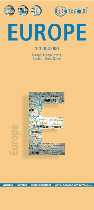
Landkaart Europa - Borch • 9783866093379
Wandelkaart Landkaart Europa - Borch Productomschrijving: Our soft-laminated folded map of Europe in the 14th edition shows: Europe 1:4 000 000, Europe North 1:5 000 000, the cities of London and Paris 1:15 000, Rome 1:13 000 and their Regions each in 1:700 000. In addition you find the Top 15 sights and airports of this three cities and a map of the European Union with time zones. Borch M…

Reisgids Lonely Planet, De LGBTQ+ Community - Lannoo • 9789020930016
Reisgids De LGBTQ+ Community - Lannoo Productomschrijving: De LGBTQ+ reisgids - Inspiratie en insider tips uit de queer community voor meer dan 50 bestemmingen. Met inspiratie & reistips uit de regenbooggemeenschap voor meer dan 50 bestemmingen - Lonely Planet - Reis met trots, ontdek met vrijheid Meer dan 50 LGBTQ+-vriendelijke bestemmingen wachten je op! En deze inspirerende r…