

Reisgids Anwb Extra Dublin - Anwb
Hippe Dublin’s Dockland - Trinity college - Grafton Street

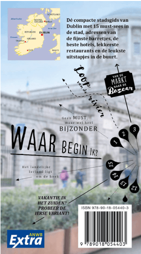
Korte omschrijving
Reisgidsen Dublin, Ierland en Ierland van anwb. Ideaal voor tochten in Ierland.
Reisgids Dublin - Anwb Productomschrijving: Door de combinatie van de Ierse gezelligheid, de hippe Dublin’s Dockland en stranden op steenworpafstand, is Dublin een perfecte bestemming voor ...

Specificaties
- Uitgever: anwb
- ISBN-13: 9789018054403
- HOOFDCATEGORIEËN: Reisgids
- Activiteiten: Toerisme
- Auteur: Bernd Biege
- Regio: Dublin, Ierland, Ierland
- Land: Ierland
- Editie: 3
- Taal: Nederlands
- Reeks/Serie: Anwb Extra
Volledige omschrijving
Reisgids Dublin - Anwb
Productomschrijving: Door de combinatie van de Ierse gezelligheid, de hippe Dublin’s Dockland en stranden op steenworpafstand, is Dublin een perfecte bestemming voor een leuke citytrip.
De compacte ANWB Extra reisgids Dublin biedt naast divere routes door de stad en veel praktische tips over hotels en vervoer ook 15 inspirerende bezienswaardigheden die je tijdens je stedentrip niet mag missen. Bezoek de eeuwenoude complexen van het Trinity college, shop je portemonnee leeg op Grafton Street of volg een route langs de vele literaire pubs.
Deze kleine reisgids past gemakkelijk in de handtas en heeft een handige uitneembare kaart met daarop de beste tips voor winkelen, eten en drinken en uitgaan.
Artikelen uit dezelfde regio

Landkaart Wegenkaart 2026 Ireland Road Map - Harper Collins • 9780008719241
Wegenkaart Ireland Road Map - Harper Collins Productomschrijving: Full-colour map of Ireland at 9 miles to 1 inch (1:570,240), with clear, detailed road network and counties and new administrative areas shown in colour. This double-sided map covers the whole of Ireland, and is ideal for reference or route planning. This map of Ireland shows the road network in detail. It is ideal for busin…
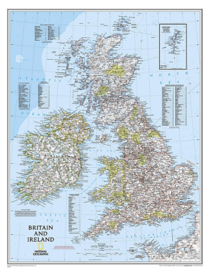
Plano Wandkaart Groot-Brittannië & Ierland 60 x 76 cm - Nat Geo • 9780792250234
Wandkaart Groot-Brittannië & Ierland 60 x 76 cm - Nat Geo Productomschrijving: National Geographic's Classic political map of Britain and Ireland is both an attractive addition to any study or classroom and an informative tool for exploring these fascinating countries. The map features thousands of place names, major highways and roads, airports, ferry routes, bodies of water, and more. Ha…
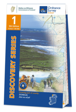
Wandelkaart 1 County Donegal North West - OSI Ireland • 9781912140206
Wandelkaart Donegal N.w. - OSI Productomschrijving: Discovery Series Sheet 1 includes an array of coastal settlements, many of which can be reached while travelling along the Wild Atlantic Way. Dunglow, Burtonport, Bunbeg, and Derrybeg all feature on Irelands West Coast. The N56 provides an excellent route north, passing along the coast before heading inland through Gweedore. A series …
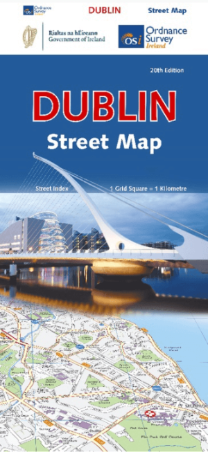
Stadsplattegrond Dublin street map - Ordnance Survey • 9781912140657
Stadskaart Dublin street map - Ordnance Survey Productomschrijving: This map is a large, double-sided street plan from the Ordnance Survey of Ireland covering the city beyond its motorway ring, with an enlargement showing the centre in greater detail, plus an index in a separate booklet. The map is double-sided, dividing Dublin east/west with a good overlap between the sides, and provides…
Wandelkaart 38 County Galway & South Central County Mayo - OSI • 9781912140084
Wandelkaart County Galway & South Central County Mayo - OSI Productomschrijving: Productomschrijving: Ontdek Ierland met de Discovery Series Wandelkaarten van Ordnance Survey Ireland De Discovery Series wandelkaarten van Ordnance Survey Ireland (OSi) zijn dé keuze voor wandelaars, fietsers en avonturiers die Ierland echt willen verkennen. Deze hoogwaardige topografische kaarten bieden…