
Wandelkaart 101 Scarborough Bridlington & Filey - OSI
Omat de zuidoostelijke hoek van het North York Moors NP
Korte omschrijving
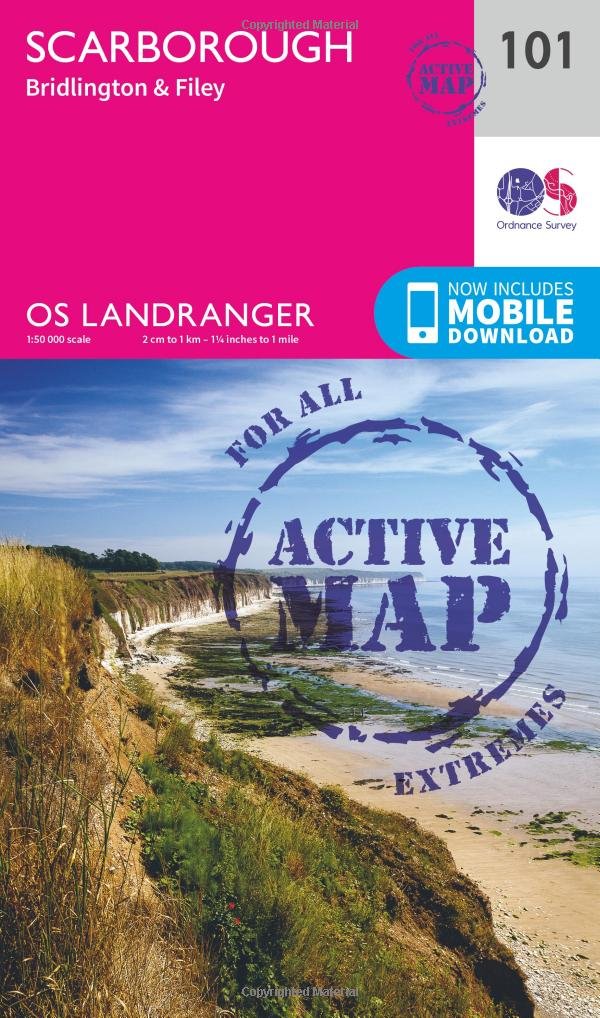
Wandelkaart Scarborough- Bridlington & Filey - North Yorkshire Productbeschrijving: Kaart OS Landranger 101 beslaat de kust stad van Scarborough, evenals de zuidoostelijke hoek van het North...

Specificaties
- Uitgever: Ordnance Survey
- ISBN-13: 9780319474242
- HOOFDCATEGORIEËN: Wandelkaart
- Activiteiten: Wandelen, Hiking & Trekking
- Regio: North Yorkshire, Engeland
- Land: England
- Waterafstotende kaart: Ordnance Survey ACTIVE Landranger Weatherproof Maps
- Schaal: 1:50000
- Afmeting: 13x23
- Taal: Engels
- Reeks: Landranger ACTIVE
Volledige omschrijving
Wandelkaart Scarborough- Bridlington & Filey - North Yorkshire
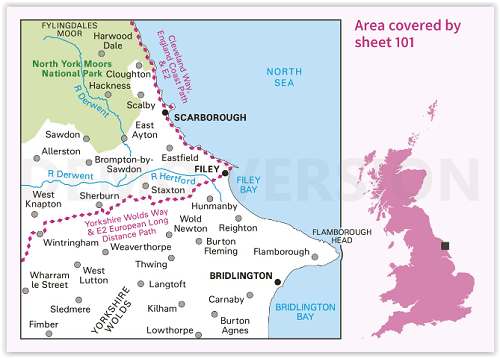
Productbeschrijving: Kaart OS Landranger 101 beslaat de kust stad van Scarborough, evenals de zuidoostelijke hoek van het North York Moors National Park. De Wolds Way en Cleveland way (onderdeel van het Europese lange pad E2) ontmoeten hier, en u vindt er ook de steden Bridlington en Filey. Hoogtepunten van het gebied zijn het samenvallen met de Cleveland en Wolds way's E2 Europese lange afstand paden. De route loopt door de traditionele Engelse badplaats van Filey die het Bempton Cliffs RSPB-natuurreservaat is.
De OS Landranger kaarten reeks heeft betrekking op Groot-Brittannië met 204 gedetailleerde kaarten, perfect voor dagtochten en korte pauzes. Elke kaart bevat alle informatie die u nodig heeft om dit lokaal gebied te leren kennen en omvat plaatsen van belang, toeristische informatie, picknickplaatsen en campings, plus doorgangsrechten informatie voor Engeland en Wales.
Productdiscription: OS Landranger map 101 covers the coastal town of Scarborough, as well as the south-eastern corner of the North York Moors National Park. The Wolds Way and Cleveland way (part of the E2 European long-distance path) meet here, and you can also find the towns of Bridlington and Filey. Highlights of the area include the E2 European Long Distance Path coincident with the Cleveland and Wolds Ways. The route passes through the traditional English seaside resort of Filey which is home to Bempton Cliffs RSPB nature reserve, Filey museum and hosts an annual fishing festival. Further up the coast is the town of Scarborough where the lighthouse and Scarborough Castle dominate the coastal skyline with the North York Moors National Park not far to the west.
The OS Landranger Map series covers Great Britain with 204 detailed maps, perfect for day trips and short breaks. Each map provides all the information you need to get to know your local area and includes places of interest, tourist information, picnic areas and camp sites, plus Rights of Way information for England and Wales.
Locatie op kaart
Gekoppelde artikelen

Wandelkaart 101 Scarborough North Yorkshire - OSI • 9780319261996
standaard versieWandelkaart Scarborough- North Yorkshire - Ordnance Survey Productbeschrijving: OS Landranger kaart 101 beslaat de kust stad van Scarborough, evenals de zuidoostelijke hoek van het North York Moors National Park. De OS Landranger kaarten reeks heeft betrekking op Groot-Brittannië met 204 gedetailleerde kaarten, perfect voor dagtochten en korte pauzes. Elke kaart bevat alle informatie die u…

Wandelkaart 101 Scarborough Bridlington & Filey - OSI • 9780319474242
weatherproof versieWandelkaart Scarborough- Bridlington & Filey - North Yorkshire Productbeschrijving: Kaart OS Landranger 101 beslaat de kust stad van Scarborough, evenals de zuidoostelijke hoek van het North York Moors National Park. De Wolds Way en Cleveland way (onderdeel van het Europese lange pad E2) ontmoeten hier, en u vindt er ook de steden Bridlington en Filey. Hoogtepunten van het gebied zijn het …
Overzichtskaarten

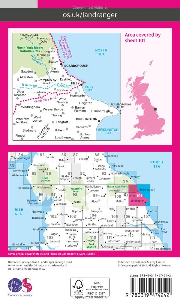
OSI Landranger & Landranger Active - Noord Engeland - Lake District
OSI Landranger & Landranger Active - Noord Engeland - Lake District

Producten op de overzichtskaart
Klik op een product om naar de detailpagina te gaan.
- Wandelkaart 108 Liverpool & Southport - England - OSI
- Wandelkaart 108 Liverpool- Merseyside England - OSI
- Wandelkaart 109 Greater Manchester England - OSI
- Wandelkaart 109 Manchester- Bolton & Warrington - OSI
- Wandelkaart 110 Sheffield & Huddersfield - Glossop - OSI
- Wandelkaart 110 Sheffield & Huddersfield - Yorkshire - OSI
- Wandelkaart 111 Sheffield & Doncaster England - OSI
- Wandelkaart 111 Sheffield & Doncaster- Rotherham - OSI
- Wandelkaart 112 Scunthorpe & Gainsborough - OSI
- Wandelkaart 112 Scunthorpe & Gainsborough - OSI
- Wandelkaart 113 Grimsby- Louth & Market Rasen - OSI
- Wandelkaart 113 Grimsby- North East Lincolnshire - OSI
- Wandelkaart 102 Preston & Blackpool- Lancashire - OSI
- Wandelkaart 102 Preston & Blackpool- Lytham - OSI
- Wandelkaart 103 Blackburn & Burnley- N.W. England - OSI
- Wandelkaart 103 Blackburn- Burnley & Clitheroe - OSI
- Wandelkaart 104 Leeds & Bradford - West Yorkshire - OSI
- Wandelkaart 104 Leeds & Bradford & Harrogate - OSI
- Wandelkaart 105 York & Selby- North Yorkshire - OSI
- Wandelkaart 105 York & Selby- North Yorkshire - OSI
- Wandelkaart 106 Market Weighton- East Riding of Yorkshire - OSI
- Wandelkaart 106 Market Weighton- Goole- England - OSI
- Wandelkaart 107 Kingston upon Hull- Beverley - OSI
- Wandelkaart 107 Kingston upon Hull- Yorkshire - OSI
- Wandelkaart 100 Malton & Pickering- Yorkshire - OSI
- Wandelkaart 100 Malton & Pickering- Yorkshire - OSI
- Wandelkaart 101 Scarborough- Bridlington & Filey - OSI
- Wandelkaart 101 Scarborough- North Yorkshire - OSI
- Wandelkaart 95 Isle of Man- England - OSI
- Wandelkaart 95 Isle of Man- England - OSI
- Wandelkaart 96 Barrow-in-Furness & South Lakeland - OSI
- Wandelkaart 96 Barrow-in-Furness & South Lakeland - OSI
- Wandelkaart 97 Kendal & Morecambe- Cumbria - OSI
- Wandelkaart 97 Kendal & Morecambe- Cumbria - OSI
- Wandelkaart 99 Northallerton & Ripon- N. Yorkshire - OSI
- Wandelkaart 99 Northallerton & Ripon- N. Yorkshire - OSI
- Wandelkaart 89 West Cumbria England - OSI
- Wandelkaart 89 West Cumbria England - OSI
- Wandelkaart 90 Penrith & Keswick - Lake District NP - OSI
- Wandelkaart 91 Appleby-in-Westmorland - OSI
- Wandelkaart 91 Appleby-in-Westmorland - OSI
- Wandelkaart 92 Barnard Castle Teesdale - England - OSI
- Wandelkaart 92 Barnard Castle Teesdale - England - OSI
- Wandelkaart 93 Middlesbrough & Darlington- England - OSI
- Wandelkaart 93 Middlesbrough & Darlington- England - OSI
- Wandelkaart 94 Whitby & Esk Dale- North Yorkshire - OSI
- Wandelkaart 94 Whitby & Esk Dale- North Yorkshire - OSI
- Wandelkaart 82 Stranraer & Glenluce - Schotland - OSI
- Wandelkaart 82 Stranraer & Glenluce - Schotland - OSI
- Wandelkaart 83 Newton Stewart & Kirkcudbright- Schotland - OSI
- Wandelkaart 83 Newton Stewart & Kirkcudbright- Schotland - OSI
- Wandelkaart 84 Dumfries & Castle Douglas- Schotland - OSI
- Wandelkaart 84 Dumfries & Castle Douglas- Schotland - OSI
- Wandelkaart 85 Carlisle & Solway Firth- Cumbria England - OSI
- Wandelkaart 85 Carlisle & Solway Firth- Cumbria England - OSI
- Wandelkaart 86 Haltwhistle & Brampton - OSI
- Wandelkaart 86 Haltwhistle & Brampton - OSI
- Wandelkaart 87 Hexham & Haltwhistle- England - OSI
- Wandelkaart 87 Hexham & Haltwhistle- England - OSI
- Wandelkaart 88 Newcastle upon Tyne- N.E. England - OSI
- Wandelkaart 76 Girvan- South Ayrshire-Schotland - OSI
- Wandelkaart 76 Girvan- South Ayrshire- Schotland - OSI
- Wandelkaart 79 Hawick & Eskdale - Schotland - OSI
- Wandelkaart 80 Cheviot Hills & Kielder Water- England - OSI
- Wandelkaart 80 Cheviot Hills & Kielder Water- England - OSI
- Wandelkaart 81 Alnwick & Morpeth - Northumberland - OSI
- Wandelkaart 77 Dalmellington & New Galloway- Schotland - OSI
- Wandelkaart 77 Dalmellington & New Galloway- Schotland - OSI
- Wandelkaart 78 Nithsdale & Annandale- Schotland - OSI
- Wandelkaart 78 Nithsdale & Annandale- Schotland - OSI
- Wandelkaart 79 Hawick & Eskdale- Schotland - OSI
- Wandelkaart 69 Isle of Arran- Inner Hybrids - OSI
- Wandelkaart 69 Isle of Arran- Inner Hybrids - OSI
- Wandelkaart 70 Ayr- Kilmarnock & Troon- Schotland - OSI
- Wandelkaart 70 Ayr- Kilmarnock & Troon- Schotland - OSI
- Wandelkaart 71 Lanark & Upper Nithsdale- Schotland - OSI
- Wandelkaart 71 Lanark & Upper Nithsdale- S. Lanarkshire - OSI
- Wandelkaart 72 Upper Clyde Valley- Lanarkshire - OSI
- Wandelkaart 72 Upper Clyde Valley- Lanarkshire - OSI
- Wandelkaart 73 Peebles- Galashiels & Selkirk - Schotland - OSI
- Wandelkaart 73 Peebles- Galashiels & Selkirk - Schotland - OSI
- Wandelkaart 74 Kelso & Coldstream - Schotland - OSI
- Wandelkaart 74 Kelso & Coldstream - Schotland - OSI
- Wandelkaart 75 Berwick-upon-Tweed- England - OSI
- Wandelkaart 75 Berwick-upon-Tweed- Northumberland - OSI
- Wandelkaart 90 Lake Distrist NP - Penrith & Keswick - OSI
Artikelen uit dezelfde regio

Wandelkaart Coast to Coast - Harvey maps • 9781851376186
Wandelkaart Coast to Coast - Keld to Robin Hood's Bay - Harvey maps Productomschrijving: Toont de gehele oostelijke helft van de route op één vel. Heeft betrekking op het gedeelte van Keld naar Robin Hood's Bay. Omvat alle alternatieve routes. Gedetailleerde kaart met aanvullende informatie en handige telefoonnummers. Nieuwe generatie HARVEY Superwalker, XT25 waterproof, werden ontworp…

Wandelkaart 301 Scarborough- Bridlington - OSI • 9780319471739
Wandelkaart Scarborough- Bridlington & Flamborough Head Productbeschrijving: Kaart nummer 301 in de OS Explorer kaarten reeks heeft betrekking op de oostkust van Yorkshire rond Scarnorough, Bridlington en Flamborough Head. Hoogtepunten van het gebied zijn onder andere: Cleveland Way, de Yorkshire Wolds Way, Het nationall park zelf, en de North Sea Trail. De OS Explorer kaart voor Scarborou…

Wandelkaart OL26 North York Moors NP England - OSI • 9780319468302
Wandelkaart North York Moors NP - England Productomschrijving: OL26 - North York Moors, Western area - kaart nummer OL26 in de OS Explorer reeks heeft betrekking op de Cleveland Hills, het westelijke deel van de North York Moors en een klein deel van de Howardian Hills. Hoogtepunten van het gebied zijn onder andere: Saltburn-by-the-Sea, Guisborough, Helmsley en Hunt Topping. OL26 -…

Wandelkaart 302 Northallerton & Thirsk North Yorkshire - OSI • 9780319245545
Wandelkaart Northallerton & Thirsk - North Yorkshire England Omvat ook: Catterick & Bedale Productomschrijving: Kaart nummer 302 in de OS Explorer kaarten reeks is ideaal voor het ontdekken North Yorkshire rond Thirsk en Northallerton. Dit gebied maakt deel uit van de Vale van Mowbray, en heeft meanderende rivieren en golvende landschappen te verkennen, die in detail op deze kaart word…

Wandelkaart 302 Northallerton & Thirsk- England - OSI • 9780319471746
Wandelkaart Northallerton & Thirsk - North Yorkshire England Omvat ook: Catterick & Bedale. Productbeschrijving: Kaart nummer 302 in de OS Explorer kaarten reeks is ideaal voor het ontdekken North Yorkshire rond Thirsk en Northallerton. Dit gebied is onderdeel van de Vale van Mowbray, en heeft zwoele rivieren en golvende landschappen om te ontdekken, die in detail op deze kaart worden …