

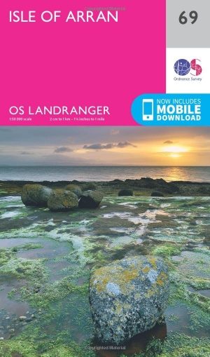
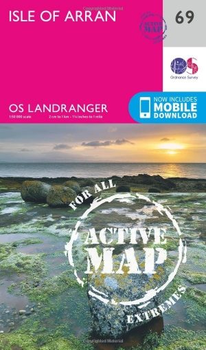
Wandelkaart 69 Isle of Arran- Inner Hybrids - OSI
Het eiland Arran aan de Firth of Cylde op de westkust


Korte omschrijving
Wandelkaarten Inner hybrids (Binnen-Hebriden), Schotland van Ordnance Survey. Ideaal voor tochten in Schotland.
Wandelkaart Isle of Arran - Inner Hybrids Schotland Productbeschrijving: Het eiland Arran nestelt zich in de Firth of Cylde aan de westkust van Schotland, en is de focus van OS Landranger ka...

Specificaties
- Uitgever: Ordnance Survey
- ISBN-13: 9780319261675
- HOOFDCATEGORIEËN: Wandelkaart
- Activiteiten: Wandelen, Hiking & Trekking
- Regio: Inner hybrids (Binnen-Hebriden), Schotland
- Land: Schotland
- TOPO's & Stafkaarten: Topografisch wandelen
- Schaal: 1:50000
- Taal: Engels
- Reeks/Serie: Landranger Series OSI
- De beroemdste Eilandengroepen: Inner Hybrids (Schotland)
Volledige omschrijving
Wandelkaart Isle of Arran - Inner Hybrids Schotland
Productbeschrijving: Het eiland Arran nestelt zich in de Firth of Cylde aan de westkust van Schotland, en is de focus van OS Landranger kaart 69. Arran word geacht de vertegenwoordigen te zijn van al de verschillende soorten landschappen is Schotland, van ruige kusten tot vlaktes en grillige pieken, waardoor het een populaire bestemming is. Toptips: Brodick kasteel bezoeken, een gemakkelijke wandeling nemen om één van de Glenashdale watervallen in de buurt van wijting Bay te gaan bekijken.
De OS Landranger kaarten reeks heeft betrekking op Groot-Brittannië met 204 gedetailleerde kaarten, perfect voor dagtochten en korte pauzes. Elke kaart bevat alle informatie die u nodig heeft om dit lokaal gebied te leren kennen en omvat plaatsen van belang, toeristische informatie, picknickplaatsen en campings, plus doorgangsrechten informatie voor Engeland en Wales.
Productdiscription: The Isle of Arran nestles in the Firth of Cylde off the west coast of Scotland, and is the focus of OS Landranger map 69. Arran is supposed to represent all the various types landscape is Scotland, from rugged coastlines to plains and jagged peaks, making it a popular destination. Top tips: visit Brodick Castle, or take an easy walk to view the Glenashdale Falls near Whiting Bay.
The OS Landranger Map series covers Great Britain with 204 detailed maps, perfect for day trips and short breaks. Each map provides all the information you need to get to know your local area and includes places of interest, tourist information, picnic areas and camp sites, plus Rights of Way information for England and Wales.
Locatie op kaart
Gekoppelde artikelen
Wandelkaart 69 Isle of Arran- Inner Hybrids - OSI • 9780319261675
standaard versieWandelkaart Isle of Arran - Inner Hybrids Schotland Productbeschrijving: Het eiland Arran nestelt zich in de Firth of Cylde aan de westkust van Schotland, en is de focus van OS Landranger kaart 69. Arran word geacht de vertegenwoordigen te zijn van al de verschillende soorten landschappen is Schotland, van ruige kusten tot vlaktes en grillige pieken, waardoor het een populaire bestemming i…
Wandelkaart 69 Isle of Arran- Inner Hybrids - OSI • 9780319473924
weatherproof versieWandelkaart Isle of Arran - Inner Hybrids Schotland Productbeschrijving: Het eiland Arran nestelt zich in de Firth of Cylde aan de westkust van Schotland, en is de focus van OS Landranger kaart 69. Arran word geacht al de verschillende soorten landschap is Schotland te vertegenwoordigen, van ruige kusten tot vlaktes en grillige pieken, waardoor het een populaire bestemming is geworden. …
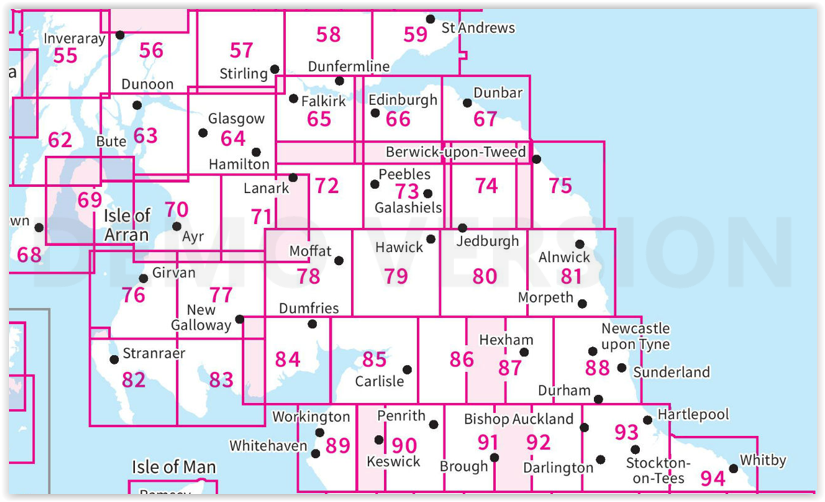
Overzichtskaarten
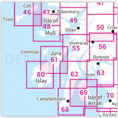
OSI Landranger & Landranger Active - Zuid-West Schotland - Schotse eilanden & Highland's
OSI Landranger & Landranger Active - Zuid-West Schotland - Schotse eilanden & Highland's

Producten op de overzichtskaart
Klik op een product om naar de detailpagina te gaan.
- Wandelkaart 46 Coll & Tiree Isles- Inner hybriden - OSI
- Wandelkaart 46 Coll & Tiree Isles- Binnen hybriden - OSI
- Wandelkaart 47 Tobermory & North Mull - Schotland - OSI
- Wandelkaart 47 Tobermory & North Mull- Argyl & Bute - OSI
- Wandelkaart 48 Iona & West Mull - Inner Hybrids - OSI
- Wandelkaart 48 Iona & West Mull - Schotland - OSI
- Wandelkaart 49 Oban & East Mull- Schotland - OSI
- Wandelkaart 49 Oban & East Mull- Argyl & Bute Schotland - OSI
- Wandelkaart 50 Glen Orchy & Loch Etive- Argyl & Bute - OSI
- Wandelkaart 50 Glen Orchy & Loch Etive- Schotland - OSI
- Wandelkaart 55 Lochgilphead & Loch Awe - OSI
- Wandelkaart 55 Lochgilphead & Loch Awe - OSI
- Wandelkaart 56 Loch Lomond & Inveraray- Trossachs NP - OSI
- Wandelkaart 56 Loch Lomond & Inveraray- Trossachs NP - OSI
- Wandelkaart 60 Islay- Inner Hybrids Schotland - OSI
- Wandelkaart 60 Islay- Inner Hybrids Schotland - OSI
- Wandelkaart 61 Jura & Colonsay - Inner Hybrids - OSI
- Wandelkaart 61 Jura & Colonsay - Schotland - OSI
- Wandelkaart 62 North Kintyre & Tarbert - Schotland - OSI
- Wandelkaart 62 North Kintyre & Tarbert - Schotland - OSI
- Wandelkaart 63 Firth of Clyde- Argyl & Bute - Schotland - OSI
- Wandelkaart 63 Firth of Clyde- Argyl & Bute - Schotland - OSI
- Wandelkaart 68 South Kintyre & Campbeltown - OSI
- Wandelkaart 68 South Kintyre & Campbeltown - OSI
- Wandelkaart 69 Isle of Arran- Inner Hybrids - OSI
- Wandelkaart 69 Isle of Arran- Inner Hybrids - OSI
- Wandelkaart 70 Ayr- Kilmarnock & Troon- Schotland - OSI
- Wandelkaart 70 Ayr- Kilmarnock & Troon- Schotland - OSI
OSI Landranger & Landranger Active - Zuid Schotland & Scotisch Borders
OSI Landranger & Landranger Active - Zuid Schotland & Scotisch Borders
Producten op de overzichtskaart
Klik op een product om naar de detailpagina te gaan.
- Wandelkaart 55 Lochgilphead & Loch Awe - OSI
- Wandelkaart 55 Lochgilphead & Loch Awe - OSI
- Wandelkaart 56 Loch Lomond & Inveraray- Trossachs NP - OSI
- Wandelkaart 56 Loch Lomond & Inveraray- Trossachs NP - OSI
- Wandelkaart 57 Stirling & The Trossachs NP - Highland's - OSI
- Wandelkaart 57 Stirling & The Trossachs NP - Schotland - OSI
- Wandelkaart 58 Perth & Alloa - Perth & Kinross - OSI
- Wandelkaart 58 Perth & Alloa - perth & Kinross - OSI
- Wandelkaart 59 St-Andrews- Fife Schotland - OSI
- Wandelkaart 59 St-Andrews- Fife- Schotland - OSI
- Wandelkaart 62 North Kintyre & Tarbert - Schotland - OSI
- Wandelkaart 62 North Kintyre & Tarbert - Schotland - OSI
- Wandelkaart 63 Firth of Clyde- Argyl & Bute - Schotland - OSI
- Wandelkaart 63 Firth of Clyde- Argyl & Bute - Schotland - OSI
- Wandelkaart 64 Glasgow City Schotland - OSI
- Wandelkaart 64 Glasgow City Schotland- OSI
- Wandelkaart 65 Falkirk & Linlithgow - Edinburgh - OSI
- Wandelkaart 65 Falkirk & Linlithgow - West Schotland - OSI
- Wandelkaart 66 Edinburgh - Western Schotland - OSI
- Wandelkaart 66 Edinburgh - Western Schotland - OSI
- Wandelkaart 67 Duns- Dunbar & Eyemouth- Schotland - OSI
- Wandelkaart 67 Duns- Dunbar & Eyemouth- Schotland - OSI
- Wandelkaart 68 South Kintyre & Campbeltown - OSI
- Wandelkaart 68 South Kintyre & Campbeltown - OSI
- Wandelkaart 69 Isle of Arran - Inner Hybrids - OSI
- Wandelkaart 69 Isle of Arran - Inner Hybrids - OSI
- Wandelkaart 70 Ayr- Kilmarnock & Troon- Schotland - OSI
- Wandelkaart 70 Ayr- Kilmarnock & Troon- Schotland - OSI
- Wandelkaart 71 Lanark & Upper Nithsdale - OSI
- Wandelkaart 71 Lanark & Upper Nithsdale - OSI
- Wandelkaart 72 Upper Clyde Valley- Lanarkshire - OSI
- Wandelkaart 72 Upper Clyde Valley- Lanarkshire - OSI
- Wandelkaart 73 Peebles- Galashiels & Selkirk - Schotland - OSI
- Wandelkaart 73 Peebles- Galashiels & Selkirk - Schotland - OSI
- Wandelkaart 74 Kelso & Coldstream - Schotland - OSI
- Wandelkaart 74 Kelso & Coldstream - Schotland - OSI
- Wandelkaart 75 Berwick-upon-Tweed- England - OSI
- Wandelkaart 75 Berwick-upon-Tweed - OSI
- Wandelkaart 76 Girvan- South Ayrshire - Schotland - OSI
- Wandelkaart 76 Girvan- South Ayrshire -Schotland - OSI
- Wandelkaart 77 Dalmellington & New Galloway- Schotland - OSI
- Wandelkaart 77 Dalmellington & New Galloway- Schotland - OSI
- Wandelkaart 78 Nithsdale & Annandale- Schotland - OSI
- Wandelkaart 78 Nithsdale & Annandale- Schotland - OSI
- Wandelkaart 79 Hawick & Eskdale - Schotland - OSI
- Wandelkaart 79 Hawick & Eskdale - Schotland - OSI
- Wandelkaart 80 Cheviot Hills & Kielder Water - England - OSI
- Wandelkaart 80 Cheviot Hills & Kielder Water - England - OSI
- Wandelkaart 81 Alnwick & Morpeth - Northumberland - OSI
- Wandelkaart 82 Stranraer & Glenluce - Schotland - OSI
- Wandelkaart 82 Stranraer & Glenluce - Schotland - OSI
- Wandelkaart 83 Newton Stewart & Kirkcudbright- Schotland - OSI
- Wandelkaart 83 Newton Stewart & Kirkcudbright- Schotland - OSI
- Wandelkaart 84 Dumfries & Castle Douglas- Schotland - OSI
- Wandelkaart 84 Dumfries & Castle Douglas- Schotland - OSI
- Wandelkaart 85 Carlisle & Solway Firth- Cumbria England - OSI
- Wandelkaart 85 Carlisle & Solway Firth- Cumbria England - OSI
- Wandelkaart 86 Haltwhistle & Brampton - OSI
- Wandelkaart 86 Haltwhistle & Brampton - OSI
- Wandelkaart 87 Hexham & Haltwhistle- England - OSI
- Wandelkaart 87 Hexham & Haltwhistle- England - OSI
- Wandelkaart 88 Newcastle upon Tyne- N.E. England - OSI
- Wandelkaart 88 Newcastle upon Tyne- N.E. England - OSI
- Wandelkaart 89 West Cumbria England - OSI
- Wandelkaart 89 West Cumbria England - OSI
- Wandelkaart 91 Appleby-in-Westmorland - OSI
- Wandelkaart 91 Appleby-in-Westmorland - OSI
- Wandelkaart 92 Barnard Castle Teesdale - England - OSI
- Wandelkaart 92 Barnard Castle Teesdale - England - OSI
- Wandelkaart 93 Middlesbrough & Darlington- England - OSI
- Wandelkaart 93 Middlesbrough & Darlington- England - OSI
- Wandelkaart 94 Whitby & Esk Dale- North Yorkshire - OSI
- Wandelkaart 94 Whitby & Esk Dale- North Yorkshire - OSI
Artikelen uit dezelfde regio

Landkaart Wegenkaart 2 Schotland West & Western Isles - OSI • 9780319263747
Wegenkaart Schotland West & Western Isles - OSI Productomschrijving: Plan your journey with this series of road maps from OS. Showing all major road, rail and ferry links as well as settlements and selected features in 1: 250 000 scale, this is the ideal map for planning trips and holidays by car or cycle. OS Road 2 covers: Scotland's west coast, including the Western Isles (Hebrides)…
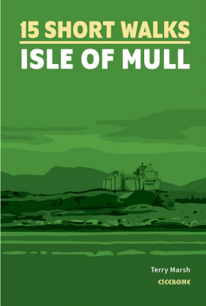
Wandelgids 15 short walks on the Isle of Mull - Cicerone • 9781786311955
Short walks on the Isle of Mull - Cicerone Productomschrijving: Wil je het beste van Isle of Mull ontdekken op de Inner-Hybrids? in Schotland. Deze gids bevat 15 van de beste korte wandelingen in het gebied (tussen 1,5 en 10,5 km), waaronder Tobermory, Aros Park, Glengorm Castle, Treshnish en de stranden van Langamull, Kilvickeon en Tireragan. Engelse omschrijving: Would you like to ex…

Wandelkaart 373 Iona- Staffa & Ross of Mull - OSI • 9780319472408
Wandelkaart Iona- Staffa & Ross of Mull Inner Hybrids - Schotland Productbeschrijving: Kaart nummer 373 in de OS Explorer kaarten reeks heeft betrekking op de westkust van het eiland Mull en eiland van Iona. Hoogtepunten van het gebied zijn onder andere: Loch na Keal nationale Scenic area, Knockan en Fionnphort. De OS Explorer kaart voor Iona, Staffa & Ross van Mull is beschikbaar in zowel…
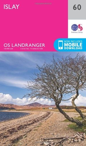
Wandelkaart 60 Islay- Inner Hybrids Schotland - OSI • 9780319261583
Wandelkaart Islay- Inner - Hybrids Schotland Productbeschrijving: Het eiland Islay wordt gedekt door OS Landranger kaart 60, met inbegrip van de 'hoofdstad', Port Ellen. De plaats is misschien het best bekend om zijn whisky distilleerderijen, er zijn ook natuurreservaten en een paar verbazende zandstranden. De OS Landranger kaarten reeks heeft betrekking op Groot-Brittannië met 204 ged…
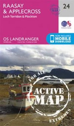
Wandelkaart 24 Raasay & Applecross- Inner Hybrids - OSI • 9780319473474
Wandelkaart Raasay & Applecross - Inner Hybrids Schotland Productbeschrijving: OS Landranger kaart 24 heeft betrekking op het eiland Raasay, evenals Applecross en de omliggende gebieden & het vasteland. Applecross zelf is een bergachtige schiereiland, en biedt tal van mogelijkheden om in een rustige regio van de Schotse Hooglanden te wandelen. De noordkust is afgesneden van het vasteland d…