

Wandelgids King Charles III England Coast Path Map Booklet
Cumbria, from Gretna on the Scottish border to Grange-over-Sands


Korte omschrijving
Wandelgidsen Cumbria & Lake District, England van CICERONE Press. Ideaal voor tochten in England.
Wandelgids King Charles III England Coast Path Map Booklet Productomschrijving: This map booklet to the Cumbrian section of the England Coast Path contains detailed mapping for walking the r...

Specificaties
- Uitgever: CICERONE Press
- ISBN-13: 9781786310293
- HOOFDCATEGORIEËN: Wandelgids
- Activiteiten: Wandelen, Hiking & Trekking
- Auteur: Ange Harker
- Regio: Cumbria & Lake District, England
- Land: England
- TOPO's & Stafkaarten: Topografisch wandelen
- Editie: 1
- Taal: Engels
- Reeks/Serie: National Trails, UK
- De Engelse Graafschappen: Cumberland (Cumbria)
Volledige omschrijving
Wandelgids King Charles III England Coast Path Map Booklet
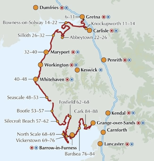
Productomschrijving: This map booklet to the Cumbrian section of the England Coast Path contains detailed mapping for walking the route in either direction. With easy access at many points along the way, the Cumbrian section can be enjoyed as a trek of around 15 days or in shorter sections.
- Full route shown on 1:25,000 OS maps
- Map booklet can be used to walk the path in either direction
- Covers the England Coast Path from Gretna on the Scottish border to Grange-over-Sands
- Conveniently sized for slipping into a jacket pocket or top of a rucksack
- An accompanying Cicerone guidebook - Walking the England Coast Path: North West - is available separately
Gekoppelde artikelen

Wandelgids King Charles III England Coast Path - Cicerone • 9781786310279
standaard versieKing Charles III England Coast Path - Cicerone Productomschrijving: A guidebook to walking the northwest section of the King Charles III England Coast Path between Gretna and Chester. Covering 590km (367 miles), this straightforward trail along the Cumbria, Lancashire and Merseyside coast takes around 1 month to hike. The route is described from north to south in 28 stages between 13 a…

Wandelgids King Charles III England Coast Path Map Booklet • 9781786310415
standaard versieKing Charles III England Coast Path Map Booklet - Cicerone Productomschrijving: This map booklet to the Lancashire and Merseyside section of the England Coast Path contains detailed mapping for walking the route in either direction. With easy access at many points along the way, the Lancashire/Merseyside section can be enjoyed as a trek of around 12 days or in shorter sections. - Full…
Artikelen uit dezelfde regio

Wandelgids Mountain Walks Helvellyn - Vertebrate Publ. • 9781839812521
Mountain Walks Helvellyn - Vertebrate Publ. Productomschrijving: 15 routes to enjoy on and around Helvellyn Mountain Walks Helvellyn by Tina Codling is a guide to walking routes to the summit of Helvellyn in the Lake District National Park. Alongside the summit routes, there are also lower-level alternatives for mixed weather or shorter days and those new to mountain walking. Amon…
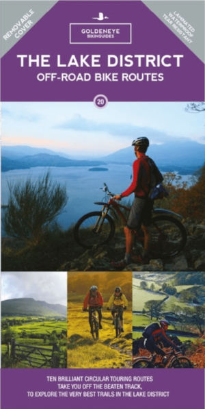
Mountainbike kaart Lake District NP - Goldeneye • 9781859653005
MTB kaart Lake District NP - Goldeneye Productomschrijving: The routes are graded with approximate time & mileage. Unsurprisingly, the mountainous landscape of the Lake District has some of the toughest mountain biking in the UK and, on major routes crossing the steep sided ridges between major valleys, long pushes or carries are inescapable - even for the fittest. This is only one asp…
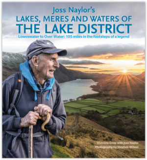
Wandelgids Lakes- Meres and Waters of the Lake District • 9781786310873
Lakes- Meres and Waters of the Lake District - CIcerone Productomschrijving: Koning van de Fells. Iron man. Lake District bergloop legende. Joss Naylor is al deze dingen en meer. Zijn prestaties zijn verbluffend, zijn records blijven de tand des tijds doorstaan. In 1983 voltooide hij de Lakes, Meres and Waters (LMW) route van 105 mijl in maar liefst 19 uur en 14 minuten en tot op de dag va…
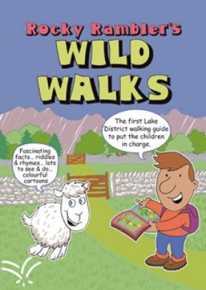
Wandelgids Rocky Rambler's wild walks - Cicerone • 9781852843472
Wandelgids - Rocky Rambler's wild walks - Cicerone Productomschrijving: Een gids over familiewandelen in het Lake District. Rocky Rambler's Wild Walks stimuleert kinderen om uit te kiezen, en de wandelingen te leiden. Gericht op kinderen van 6 tot 14 jaar, de gids bevat duidelijke instructies en heldere illustraties, die iedere wandeling gemakkelijk en leuk maakt om te volgen. 10 wandeling…
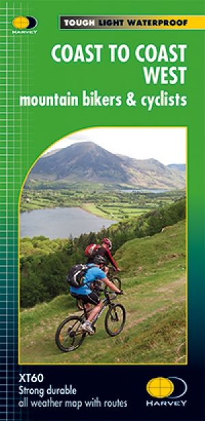
Fietskaart Coast to Coast West & St Bees to Kirkby - Harvey maps • 9781851375318
Fietskaart- Coast to Coast West & St Bees to Kirkby - Harvey maps Productomschrijving: De route van kust tot kust, is bedekt met twee kaarten. De doortocht van kust naar kust is ongeveer 200 mijl. Er is geen één definitieve route. Deze kaarten suggereren twee belangrijkste alternatieven, St Bees naar Robin Hoods Bay (bedacht door Tim Woodcock) of Bicester aan Wykeham (bedacht door pedaal N…