

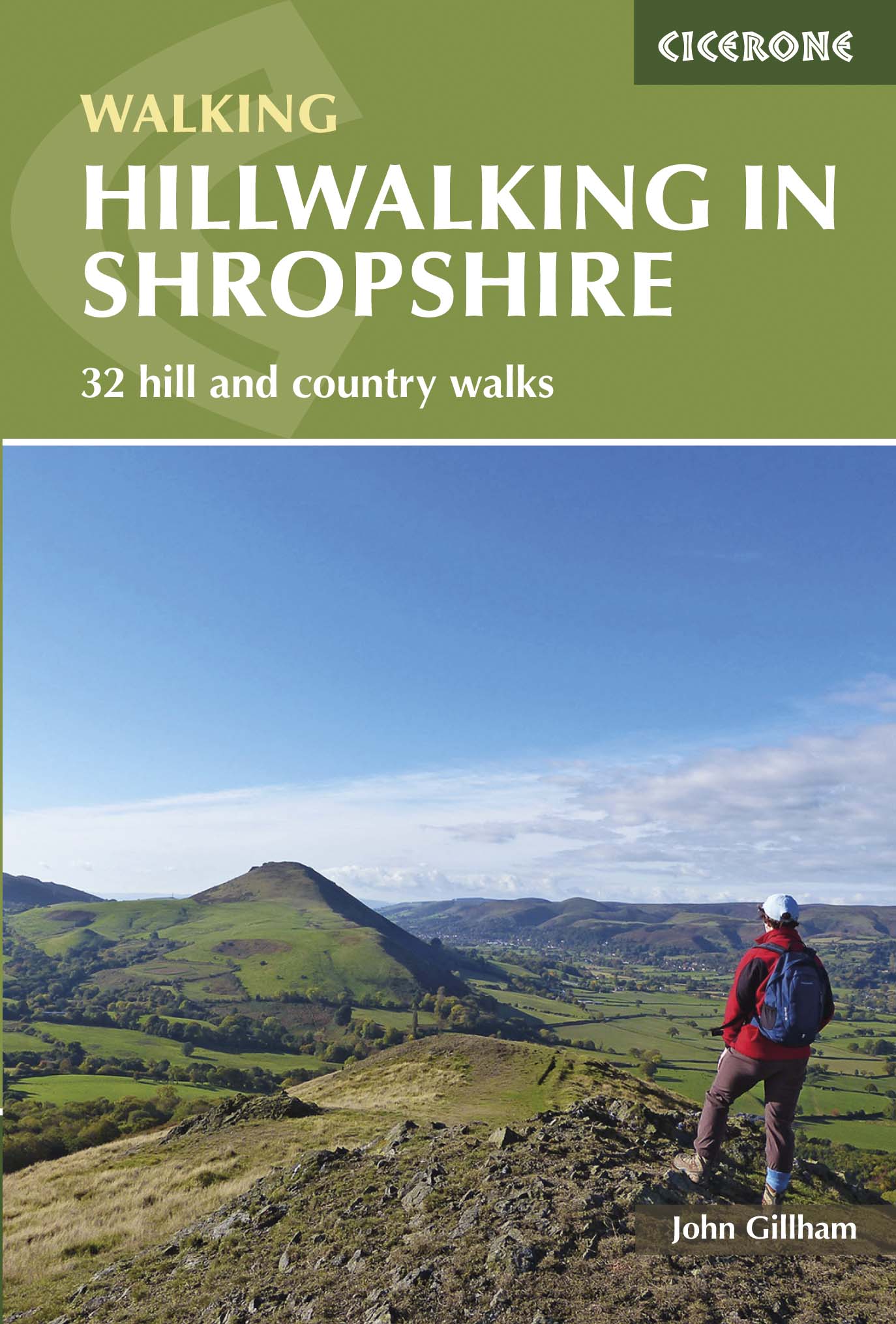
Wandelgids Shropshire Hillwalking guide - Cicerone
32 wandelroutes in het graafschap Shropshire in de West Midland's
Korte omschrijving
Wandelgidsen Shropshire West Midlands van CICERONE Press. Ideaal voor tochten in England.
Wandelgids - Shropshire Hillwalking guide - Cicerone Productomschrijving: Wandelgids over 32 wandelroutes in Shropshire in het graafschap West Midlands. De routes variëren van 5km tot 19km, ...

Specificaties
- Uitgever: CICERONE Press
- ISBN-13: 9781852848071
- HOOFDCATEGORIEËN: Wandelgids
- Activiteiten: Wandelen, Hiking & Trekking
- Regio: Shropshire West Midlands
- Land: England
- Editie: 1
- Taal: Engels
- De Engelse Graafschappen: Shropshire
Volledige omschrijving
Wandelgids - Shropshire Hillwalking guide - Cicerone
Productomschrijving: Wandelgids over 32 wandelroutes in Shropshire in het graafschap West Midlands. De routes variëren van 5km tot 19km, en neemt de hoogtepunten mee zoals de The Wrekin, Wenlock rand, long Mynd en Stiperstones,Castle Ring en Bury Ditches. Vele fietsroutes starten in de buurt van de prachtige steden en dorpen met inbegrip van Church Stretton, Ludlow en bisschoppen Castle
Productdescription: Guidebook to 32 walking routes in Shropshire in the West Midlands. The routes range from 3 miles (5km) to 12 miles (19km), taking in highlights such as The Wrekin, Wenlock Edge, Long Mynd and Stiperstones, Castle Ring and Bury Ditches. Many routes start near delightful towns and villages including Church Stretton, Ludlow and Bishops Castle.
Seasons:
All the routes can be done in all seasons, with Autumn being best for those in woodland. August, when the heather is out, is best for Stiperstones and the Long Mynd.
Centres:
Llanymynech, Telford, Church Stretton, Craven Arms, Clun, Ludlow, Bridgnorth and Much Wenlock.
Difficulty:
Shropshire's summits are generally easy to climb. Being such a fertile county its low level paths can become overgrown in Summer. Lightweight boots are the best footwear and if you're wearing shorts, take make sure you have waterproof trousers to protect your legs from nettles and dew covered long grasses.
Must See:
The volcanic peaks of Stiperstones and Caer Caradoc, steep-sided, crag-fringed Batches of the Long Mynd, numerous Iron and Bronze Age hilltop forts, and charming little towns and villages with half-timbered buildings and fascinating historical heritage make Shropshire a hillwalkers paradise.
Locatie op kaart
Artikelen uit dezelfde regio

Wandelkaart 240 Oswestry & Croesoswallt- Shropshir - OSI • 9780319244333
Wandelkaart Oswestry & Croesoswallt - Shropshire England Omvat ook: Chirk, Ellesmere & Pant. Productomschrijving: Explorer map 240 is gericht op Oswestry (Croesoswallt) en heeft een deel van de "Severn Way" en de "Offa's Dyke Path" (Llwybr Clawdd Offa) die de grens van Engeland & Wales volgen. Er zijn een aantal kleinere steden en dorpen in het gebied, waaronder Chirk (Y Waun), broek, …

Wandelgids Offa's Dyke path - Prestatyn to Chepstow - Trailblazer • 9781912716425
Wandelgids Offa's Dyke path, Prestatyn to Chepstow - Trailblazer Productomschrijving: (British Walking Guide) The Offa's Dyke Path is a superb National Trail that runs from the North Wales coast to the Severn Estuary following the line of Offa's Dyke (283 km), an impressive 8th-century earthwork along the English/Welsh border. The ever-changing landscape – the Clwydian Range, the Shropshi…

Wandelkaart 203 Ludlow Tenbury Wells - OSI • 9780319470756
Wandelkaart Ludlow- Tenbury Wells & Cleobury Mortime Omvat ook: de Shropshire Hills AONB Productbeschrijving: Na de rivier Teme, en met het zuiden van de Shropshire Hills Area of Outstanding Natural Beauty AONB, kunt u onder meer de Hertfordshire Trail en Shropshire Way, verkennen. Ook vindt u de middeleeuwse ommuurde stad van Ludlow en Ludlow kasteel uit de 11e eeuw. De OS Explorer ka…
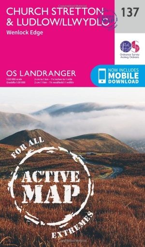
Wandelkaart 137 Ludlow & Church Stretton - England - OSI • 9780319474600
Wandelkaart Ludlow - Church Stretton & Wenlock Edge Shropshire Productbeschrijving: Kaart nummer 137 in de reeks van de OS Landranger kaarten, Omvat een AONB, een Area of Outstanding Natural Beauty, en de steden Church Stretton en Ludlow hebben veel te bieden als gevolg daarvan. Hoogtepunten van de regio zijn ongerepte natuur, heuvel forten, kastelen, boerenmarkten en uitstekend wandelen e…
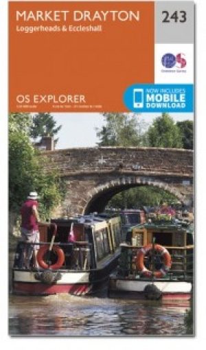
Wandelkaart 243 Market Drayton & Loggerheads - OSI • 9780319471159
Wandelkaart Market Drayton- Loggerheads & Eccleshall - Shropshire Productbeschrijving: OS Explorer kaart 243 dekt Market Drayton, Loggerheads, Eccleshall en de omliggende dorpen. De meeste wandel- en fietsroutes in dit gebied zijn redelijk plat, waardoor ze ideaal zijn voor gezinnen of degenen die wat minder fit zijn. De OS Explorer kaart voor Market Drayton is beschikbaar in zowel de stan…