

Wandelkaart 295 Bridlington- Driffield & Hornsea - OSI
Omvat landtong way- Hornsea Rail Trail & Minster way
Korte omschrijving
Wandelkaarten Yorkshire-Humberside van Ordnance Survey. Ideaal voor tochten in England.
Wandelkaart Bridlington- Driffield & Hornsea - Yorkshire Productbeschrijving: Van Hornsea omhoog langs de kust naar Bridlington en inwaarts naar Driffield. OS Explorer kaart 295 is de perfec...

Specificaties
- Uitgever: Ordnance Survey
- ISBN-13: 9780319471678
- HOOFDCATEGORIEËN: Wandelkaart
- Activiteiten: Wandelen, Hiking & Trekking
- Regio: Yorkshire-Humberside
- Land: England
- Waterafstotende kaart: Ordnance Survey ACTIVE Explorer Weatherproof Maps
- TOPO's & Stafkaarten: Topografisch wandelen
- Schaal: 1:25000
- Taal: Engels
- Reeks/Serie: Explorer ACTIVE Series OSI
Volledige omschrijving
Wandelkaart Bridlington- Driffield & Hornsea - Yorkshire
Productbeschrijving: Van Hornsea omhoog langs de kust naar Bridlington en inwaarts naar Driffield. OS Explorer kaart 295 is de perfecte partner voor al uw outdoor avonturen. Het omvat ook delen van vier recreatieve paden: landtong way, Hornsea Rail Trail, Minster wayen de Trans Pennine way. De OS Explorer kaart voor Bridlington, Driffield & Hornsea is beschikbaar in zowel de standaard papieren versie als de weerbestendige 'Actief' versie.
Productdiscription: From Hornsea up the coast to Bridlington and inland to Driffield. OS Explorer Map 295 is the perfect partner for all your outdoor adventures. It also includes parts of four Recreational Paths: Headland Way, Hornsea Rail Trail, Minster Way and the Trans Pennine Way. The OS Explorer map for Bridlington, Driffield & Hornsea is available in both the standard paper version and weatherproof 'Active' version.
Locatie op kaart
Gekoppelde artikelen

Wandelkaart 295 Bridlington- Driffield & Hornsea - OSI • 9780319245477
standaard versieWandelkaart Bridlington- Driffield & Hornsea - Yorkshire Productbeschrijving: 295 / Bridlington, Driffield & Hornsea, East Riding of Yorkshire, England - Van Hornsea langs de kust naar Bridlington en de binnenvaart tot Driffield. OS Explorer kaart 295 is de perfecte partner voor al uw outdoor avonturen. Het omvat ook delen van vier recreatieve paden: landtong way, Hornsea Rail Trail,…

Wandelkaart 295 Bridlington- Driffield & Hornsea - OSI • 9780319471678
weatherproof versieWandelkaart Bridlington- Driffield & Hornsea - Yorkshire Productbeschrijving: Van Hornsea omhoog langs de kust naar Bridlington en inwaarts naar Driffield. OS Explorer kaart 295 is de perfecte partner voor al uw outdoor avonturen. Het omvat ook delen van vier recreatieve paden: landtong way, Hornsea Rail Trail, Minster wayen de Trans Pennine way. De OS Explorer kaart voor Bridlington, Drif…
Artikelen uit dezelfde regio
Wandelkaart 281 Ancholme Valley- Lincolnshire - OSI • 9780319471531
Wandelkaart Ancholme Valley - Lincolnshire Yorkshire & The Humber Omvat ook: Barton-upon-Humber, Brigg, Scunthorpe & Kirton in Lindsey. Productbeschrijving: OS Explorer kaart 281 is een dubbel zijdig kaart, en omvat Barton-upon-Humber tot bisschop Norton. Het omvat delen van de Viking way (onderdeel van het E2 Europese Long Distance pad), evenals de New River Ancholme, en een door de m…
Wandelgids Map Booklet Pennine Way - Cicerone • 9781786311412
Map Booklet Pennine Way - Cicerone Productomschrijving: Map of the 270 miles (435km) Pennine Way National Trail, between Edale in the Peak District and Kirk Yetholm in the Scottish Borders. This booklet is included with the Cicerone guidebook to the trail, and shows the full route on OS 1:25,000 maps. This popular long-distance route typically takes three weeks to complete. Seasons: …
Wandelkaart 290 York- Yorkshire and the Humber - OSI • 9780319471623
Wandelkaart York- Yorkshire and the Humber England Omvat ook: Selby & Tadcaster. Productbeschrijving: Deze twee-zijdige kaart (OS Explorer 290) toont York tot Selby, met inbegrip van de Trans Pennine Way en de Ebor Way. U kunt er de historische stad verkennen, of verder weg gaan en de rivier de Ouse volgen. De OS Explorer kaart voor York is beschikbaar in zowel de standaard papieren ve…
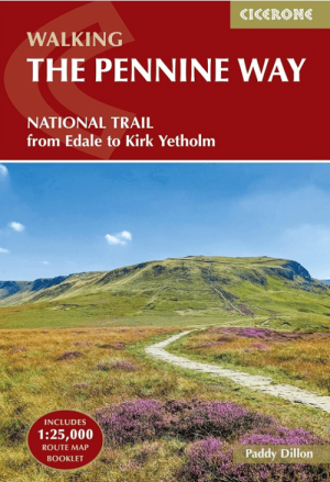
Wandelgids The Pennine Way from Edale to Kirk Yetholm - Cicerone • 9781786311313
The Pennine Way from Edale to Kirk Yetholm - Cicerone Productomschrijving: Guidebook to the Pennine Way National Trail with OS map booklet. The 420 km route from Edale to Kirk Yetholm takes three weeks to walk and is suitable for fit and experienced long distance walkers. The route crosses the Peak District, Yorkshire Dales and North Pennines National Parks. Includes separate OS 1:25,000 …

Wandelkaart 293 Kingston upon Hull & Beverley - OSI • 9780319471654
Wandelkaart Kingston upon Hull & Beverley - Yorkshire Productbeschrijving: Kaart nummer 293 in de OS Explorer reeks heeft betrekking op een gebied ten noorden van de rivier de Humber rond Kingston Upon Hull en Beverley. Hoogtepunten van het gebied zijn onder andere: Yorkshire Wolds Way, Wilberforce way, Trans Pennine Way en Beverley 20. De OS Explorer kaart voor Kingston upon Hull & Beverl…