
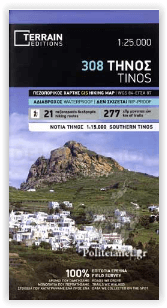
Wandelkaart 308 Tinos Egeïsche eilanden - Terrain Editions
Een gloednieuwe kaart voor het eerst in de geschiedenis
Korte omschrijving
Wandelkaarten Griekse eilanden en Egeische eilanden, Griekenland van Terrain Editions. Ideaal voor tochten in Griekenland.
Wandelkaart Tinos Egeïsche eilanden - Terrain Editions Productomschrijving: Het is de eerste keer dat de hele kustlijn van het eiland in kaart is gebracht. De cartografie is uitgevoerd met h...

Specificaties
- Uitgever: Terrain Editions
- ISBN-13: 9786185160241
- HOOFDCATEGORIEËN: Wandelkaart
- Activiteiten: Wandelen, Hiking & Trekking
- Regio: Egeische eilanden, Griekenland, Griekse eilanden
- Land: Griekenland
- Schaal: 1:25000
- Taal: Engels
- De Griekse Eilanden: Egeische eilanden
Volledige omschrijving
Wandelkaart Tinos Egeïsche eilanden - Terrain Editions
Productomschrijving: Het is de eerste keer dat de hele kustlijn van het eiland in kaart is gebracht. De cartografie is uitgevoerd met het speciaal uitgeruste en bemande cartografische schip van TERRAIN. Dit betekent dat je alle stranden van het eiland kunt vinden, tot aan de kleinste inham! In feite zijn de speciale kenmerken van elk strand vastgelegd: of het zand- of kiezelstrand is, of het natuurlijke schaduw van bomen, water, een strandbar of georganiseerde watersporten heeft, of de zeebodem voor het strand zanderig of rotsachtig is (zodat je weet waar je moet anker
Engelse omschrijving: It is the first time the island’s entire coastline is mapped. Cartography was done with TERRAIN’s specially equipped and staffed cartographic vessel. This means that you can locate all beaches of the island, down to the tiniest cove! In fact, the special features of every single beach are recorded: whether it is sandy or pebbled, whether it features natural tree shade, water, a beach bar or organized water sports, whether the seabed in front of the beach is sandy or rocky (so that you will know where to anchor).
It features the most complete road network. The dirt road approaching Lia beach, the dirt road going down to Aghios Sostis beach, and the dirt road leading to Kalogeros beach are just a few of the roads appearing on a map of Serifos for the first time. It also features more trails than any other map on the market. For example, take a look at the trails north of Kionia and you will understand what it’s all about! Tinos possibly features the biggest trail network in the Cycladic islands. Most trails, however, are not marked nor maintained, making the TERRAIN map of Tinos an indispensable tool for hikers. Recording the trails of Tinos was a month-long joint effort between 5 TERRAIN cartographers! The 9 most important trails of Tinos are described on the back of the map. Moreover, there are detailed descriptions of 9 trails on the back, including their total length in kilometers and the duration of the hike.
Rock climbing. This is the first map of Tinos featuring all bouldering crags, plus detailed information about sport climbing routes and sectors at the crag of Xombourgho. It indicates the boundaries of NATURA 2000 areas so that you will know which parts of the island are of special environmental interest and beauty – thus you can enjoy traveling through them, but also take care to protect them.
The whole island is shown in one piece. There is another map of Tinos on the market at a more detailed scale, but part of the island is cut out and appears in a separate box. With our map at its current scale, we can depict the whole island without ‘amputating’ it, while at the same time we do not compromise the clarity of information
Locatie op kaart
Artikelen uit dezelfde regio
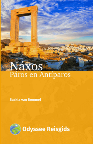
Reisgids Naxos, Paros en Antiparos Griekenland - Odyssee • 9789461231970
Reisgids Naxos, Paros en Antiparos - Odyssee Productomschrijving: Náxos, het grootste eiland van de Cycladen, wordt minder druk bezocht dan het bekende buureiland Mikonos. Maar het eiland heeft veel meer te bieden aan natuurschoon, stranden, eigenheid en cultuur. De hoofdstad Chóra (Náxos-stad) heeft een prachtige waterkant en een netwerk van steile steegjes aan de voet van het oude kaste…
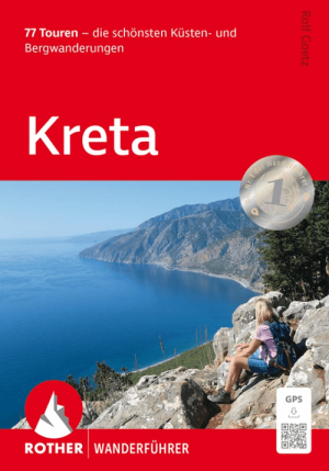
Wandelgids Kreta Griekse eilanden - Rother Bergverlag • 9783763314096
Wandelgids Kreta - Rother Bergverlag Productomschrijving: Kreta is perfect voor vakantiegangers die op zoek zijn naar ontspanning. Het eiland is niet alleen heerlijk om te zwemmen, maar ook een geweldige wandelbestemming! Grote delen van het eiland zijn wild en ongerept, met drie machtige bergketens die zijn uitgesleten door diepe kloven die het landschap domineren. De stranden nodige…

Reisgids Wat & Hoe Kreta - Kosmos Uitegevrij • 9789043941037
Reisgids Kreta - Kosmos Productomschrijving: Met deze Wat & Hoe Reisgids Kreta ga je voorbereid onderweg. Het Griekse eiland heeft haar eigen, unieke tradities. Het kleurrijke landschap van Kreta omvat besneeuwde bergtoppen, olijfgaarden, tijdloze dorpen, antieke steden en levendige badplaatsen. Met het heerlijke klimaat van Griekenland is het een waar vakantieparadijs. Wat krijg je: …

Landkaart Wegenkaart 326 Kos - Orama Editions • 9789608385887
Wegenkaart Kos - Orama Editions Productomschrijving: Gedetaillieerde wegenkaart van het eiland Kos, in het oosten van de Egeische zee. De kaart omvat hotels en campings, met toeristische symbolen die allerhande historische plaatsen, kloosters, museas aangeven. De kaart is meertalig, met belangrijke steden met hun centrum kaart en register, en degelijk kleurengebruik. Ook hoogteverschil…
Wandelgids Samos Griekenland - Terrain maps • 9786185160043
Wandelgids Samos Griekenland Productomschrijving: Samos is een wandel- & trekkers paradijs, met honderden km'ers aan bos routes en gepavijde routes in de countryside. Deze gids brengt u door traditionele dorpjes & kloosters, bergtoppen en kammen, afgezonderde stranden en bezienswaardigheden.