

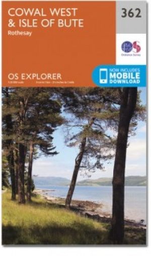
Wandelkaart 362 Cowal West & Isle of Bute- Argyl & Bure
Kyles of Bute & de Trossarchs National Park

Korte omschrijving
Wandelkaarten Argyll & Bute, Schotland van Ordnance Survey. Ideaal voor tochten in Schotland.
Wandelkaart Cowal West & Isle of Bute - Argyl & Bute Schotland Omvat ook: Rothesay. Productbeschrijving: Kaart nummer 362 omvat Cowal West, Rothesay en the Isle of Bute. Hoogtepunten zij...

Specificaties
- Uitgever: Ordnance Survey
- ISBN-13: 9780319472330
- HOOFDCATEGORIEËN: Wandelkaart
- Activiteiten: Wandelen, Hiking & Trekking
- Regio: Argyll & Bute, Schotland
- Land: Schotland
- Waterafstotende kaart: Ordnance Survey ACTIVE Explorer Weatherproof Maps
- Nationale parken: The Trossarchs National Park, Schotland
- TOPO's & Stafkaarten: Topografisch wandelen
- Schaal: 1:25000
- Taal: Engels
- Reeks/Serie: Explorer ACTIVE Series OSI
Volledige omschrijving
Wandelkaart Cowal West & Isle of Bute - Argyl & Bute Schotland
Omvat ook: Rothesay.
Productbeschrijving: Kaart nummer 362 omvat Cowal West, Rothesay en the Isle of Bute. Hoogtepunten zijn Kyles of Bute, Loch Riddon en Loch Lomond en de Trossarchs National Park. Omvat ook Loch Fyne, Garbhallt en Kingarth. De OS Explorer kaart voor Cowal West & Isle of Bute is beschikbaar in zowel de standaard papieren versie als de weerbestendige 'Actief' versie.
Productdiscription: Map sheet number 362 covers Cowal West, Rothesay and the Isle of Bute. Highlights include Kyles of Bute, Loch Riddon and Loch Lomond and The Trossarchs National Park. Also includes Loch Fyne, Garbhallt and Kingarth. The OS Explorer map for Cowal West & Isle of Bute is available in both the standard paper version and weatherproof 'Active' version.
Locatie op kaart
Gekoppelde artikelen
Wandelkaart 362 Cowal West & Isle of Bute - OSI • 9780319246139
standaard versieWandelkaart Cowal West & Isle of Bute - Schotland Productbeschrijving: Rothesay. 362 / Cowal West & Isle of Bute, Scotland - Kaart nummer 362 dekt Cowal West, Rothesay en het Isle of Bute. Hoogtepunten zijn Kyles of Bute, Loch Riddon en Loch Lomond en de Trossarchs National Park. Omvat ook Loch Fyne, Garbhallt en Kingarth. De OS Explorer kaart voor Cowal West & Isle of Bute is beschikb…

Wandelkaart 362 Cowal West & Isle of Bute- Argyl & Bure • 9780319472330
weatherproof versieWandelkaart Cowal West & Isle of Bute - Argyl & Bute Schotland Omvat ook: Rothesay. Productbeschrijving: Kaart nummer 362 omvat Cowal West, Rothesay en the Isle of Bute. Hoogtepunten zijn Kyles of Bute, Loch Riddon en Loch Lomond en de Trossarchs National Park. Omvat ook Loch Fyne, Garbhallt en Kingarth. De OS Explorer kaart voor Cowal West & Isle of Bute is beschikbaar in zowel de sta…
Artikelen uit dezelfde regio

Wandelkaart 49 Oban & East Mull- Schotland - OSI • 9780319261477
Wandelkaart Oban & East Mull - Schotland Productbeschrijving: Oban, zei de zeevruchten hoofdstad van Schotland, is een bloeiende vissersdorpje met veel te bieden. Het bergachtige terrein biedt fantastische wandel mogelijkheden en ongerepte zandstranden langs de kust. De OS Landranger kaarten reeks heeft betrekking op Groot-Brittannië met 204 gedetailleerde kaarten, perfect voor dagtoch…


Wandelkaart 50 Glen Orchy & Loch Etive- Argyl & Bute - OSI • 9780319473733
Wandelkaart Glen Orchy & Loch Etive - Argyl & Bute Schotland Productbeschrijving: OS Landranger 50 van de kaart serie is de ideale kaart moet worden gebruikt bij het verkennen van het noorden van Loch Fyne tot Black Mount. Deze kaart dekt een deel van Loch Lomond and The Trossachs National Park en een deel van de West highland way door Glen Orchy en Loch Etvie naar het westen De OS Lan…

Wandelkaart 47 Tobermory & North Mull- Argyl & Bute - OSI • 9780319473702
Wandelkaart Tobermory & North Mull - Argyl & Bute Schotland Productbeschrijving: OS Landranger kaart 47 heeft betrekking op het eiland Mull, onderdeel van Coll, en omvat Tobermory en Ardnamurchan. De OS Landranger kaarten reeks heeft betrekking op Groot-Brittannië met 204 gedetailleerde kaarten, perfect voor dagtochten en korte pauzes. Elke kaart bevat alle informatie die u nodig heeft om …

Wandelkaart 68 South Kintyre & Campbeltown - OSI • 9780319473917
Wandelkaart South Kintyre & Campbeltown - Schotland Productbeschrijving: OS Landranger kaart 68 toont de Zuidelijke Kintyre, met inbegrip van Campbeltown, Southend, Carradale, Sanda Island en het Kilbrannan Sound. Het schiereiland Kintyre bied luswandelingen voor wandelaars. De OS Landranger kaarten reeks heeft betrekking op Groot-Brittannië met 204 gedetailleerde kaarten, perfect voor da…

Wandelkaart 359 Oban- Kerrera & Loch Melfort- Schotland • 9780319472309
Wandelkaart Oban- Kerrera & Loch Melfort - Argyl & Bute Schotland Omvat ook: The Garvellachs. Productbeschrijving: Kaart nummer 359 omvat Oban, Kerrera en Loch Melfort. Hoogtepunten zijn de nationale Scenic Area van Scarba, de Lunga en de Garvellachs. Ook Luing, Seil, Loch Scammadale en Loch Tralaig. De OS Landranger kaarten reeks heeft betrekking op Groot-Brittannië met 204 gedeta…