

Fietsgids Hadrian's Cycleway - Cicerone
A 174 mile from Ravenglass to South Shields

Korte omschrijving
Fietsgidsen Cumbria, England en North East England van CICERONE Press. Ideaal voor tochten in England.
Fietsgids - Hadrian's Cycleway - Cicerone Productomschrijving: Hadrian's Cycleway, een dikke 250 km lange kust tot kust fietsroute over noordelijk Engeland, die de route volgt voor zover mog...

Specificaties
- Uitgever: CICERONE Press
- ISBN-13: 9781786310422
- HOOFDCATEGORIEËN: Fietsgids
- Activiteiten: Wandelen, Hiking & Trekking
- Auteur: Carl Mc-keating, Rachel Crolla
- Regio: Cumbria, England, North East England
- Land: England
- Editie: 1
- Taal: Engels
- Fietsen: Fietsen in het Buitenland
- Iconische Wandelroutes: Hadrians Wall Path, UK
- National Trails UK, England & Wales: Hadrians Wall, England
Volledige omschrijving
Fietsgids - Hadrian's Cycleway - Cicerone
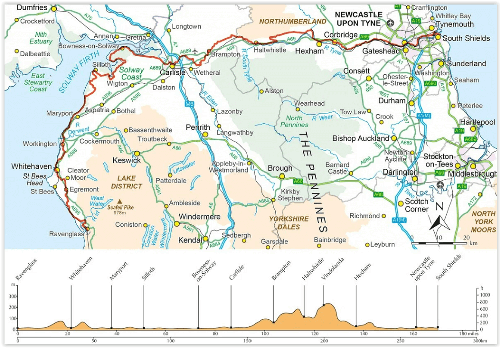
Productomschrijving: Hadrian's Cycleway, een dikke 250 km lange kust tot kust fietsroute over noordelijk Engeland, die de route volgt voor zover mogelijk natuurlijk, langs de bekende Hadrian's Wall World Heritage Site. Deze route loopt van Ravenglass in Cumbria doorheen Northumberland to South Shields aan de oostkust van Engeland, met een eventuele alternatieve finish in Tynemouth. De route volgt stille landelijke routes perfect voor de gemiddelde fietsers.
Engelse omschrijving: Guidebook to Hadrian's Cycleway, a 174 mile coast-to-coast route across northern England, following the corridor of the Hadrian's Wall World Heritage Site. From Ravenglass in Cumbria through Northumberland to South Shields, with an alternative Tynemouth finish, on cycle paths and quiet country roads suitable for cyclists of all abilities.
SeasonsHadrian's Cycleway can be cycled all year round, but preferably April-October. Centres
Ravenglass, Whitehaven, Maryport, Silloth, Bowness-on-Solway, Carlisle, Brampton, Haltwhistle, Once and Twice Brewed, Hexham, Corbridge, Newcastle-upon-Tyne, South Shields Difficulty
This 174 mile ride is within the reach of cyclists of all abilities, via varying itineraries. The guide describes a suggested three-day of 50-60 miles per day and outlines shorter and longer options to suit all abilities. For enjoyment it is worth being saddle fit and completed some training. Must See
Hadrian's Wall; milecastles; Sycamore Gap; Cumbrian west coast; Solway Coast and AONB; Sellafield nuclear facility; Maryport's octagonal lighthouse; Holmcultram Abbey; Burgh Marsh; Cawfield Quarry; Roman forts of Birdoswald, Vindolanda, Housesteads, Chesters, Glannaventa, Segedunum and Arbeia; Lanercost Priory; Carlisle Castle; Edward I memorial; Steel Rigg; Corbridge; Roman Army Museum; Tyne Bridge; Conversation Piece installation at South Shields.
Artikelen uit dezelfde regio

Scramblegids Lake District North 110 scrambles - Cicerone • 9781852848323
Scramblegids / Lake District North - 110 scrambles (9781852848323) Cicerone Press Productomschrijving: Gids naar 110 scramble (klauter/wandel) routes in het Engelse Lake District. Graded scrambles routes op de rotsen in ghylls Road, Ennerdale, Newlands, Buttermere, Borrowdale, Thirlmere, Patterdale, Mardale & Swindale. Routes variëren van rang 1 door rangen 2 tot en met 4, waar het gebruik…
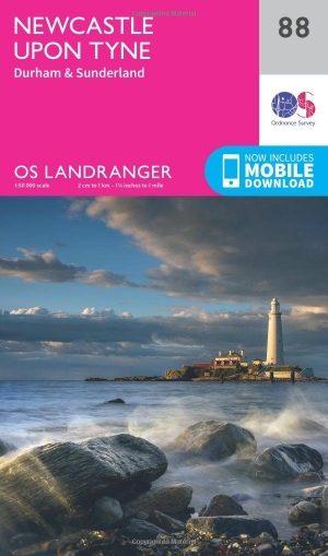
Wandelkaart 88 Newcastle upon Tyne- N.E. England - OSI • 9780319261866
Wandelkaart Newcastle upon Tyne - NE England Productbeschrijving: Verken het oostelijke deel van Hadrian's Wall path, samen met de historische steden van Newcastle upon Tyne en Durham. Omvat ook Gateshead, Sunderland, Seaham, Tynemouth, North Shields, South Shields, Blyth en Whitley Bay. De OS Landranger kaarten reeks heeft betrekking op Groot-Brittannië met 204 gedetailleerde kaarten,…
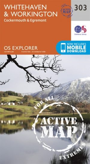
Wandelkaart 303 Whitehaven & Workington- England - OSI • 9780319471753
Wanedlkaart Whitehaven & Workington - Cumbria England Omvat ook: Cockermouth & Egremont Productbeschrijving: OS Explorer kaart 303 toont omvat Workington en Cockermouth tot Calderbridge, de westelijke rand van het Lake District National Park. Hoogtepunten zijn Ennerdale Water, Whitehaven Harbour en Lank Rigg, op 541 m. De OS Explorer kaart voor Whitehaven & Workington is beschikbaar in…
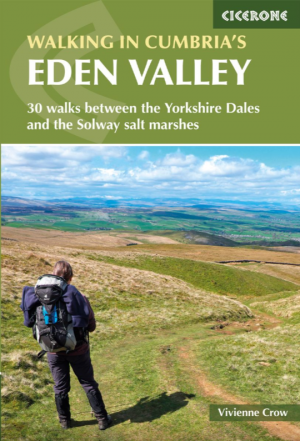
Wandelgids Cumbria's Eden Valley - Cicerone • 9781852849016
Wandelgids - Cumbria's Eden Valley - Cicerone Productomschrijving: Een locatie gelegen heel dicht bij het nationale park dat de regio van Cumbria in principe helemaal beïnvloed en domineert, het "Lake district National Park". Eden is een lokaal district in Cumbria, England, en genaamd achter de River Eden, die noordelijk vloeid door het district richting Carlisle. Een enorme open landsch…
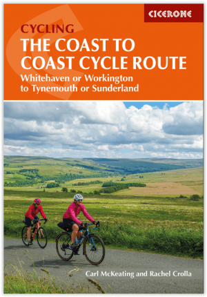
Fietsgids The Coast to Coast Cycle Route - Cicerone • 9781786311184
The Coast to Coast Cycle Route - Cicerone Press Productomschrijving: Coast to Coast fietsroute of Sustrans fietsroute. De 140 mijl (160 km) lange route van Whitehaven of Workington naar Tynemouth of Sunderland gaat voornamelijk over fietspaden, bospaden en secundaire wegen, maar er worden ook off-road mogelijkheden en dagtochten beschreven. De fietsvriendelijke route is geschikt voor alle …