
Landkaart Australië Great Desert Tracks (West) - Hema Maps
Great Desert Tracks Western Sheet - Derby - Norseman- Halls Creek


Korte omschrijving
Wandelkaarten Western Australia en Centraal Australië van Hema Maps. Ideaal voor tochten in Australië.
Australië Great Desert Tracks (West) - Hema Productomschrijving: Great Desert Tracks Western Sheet (9th edition) - covering from beyond Derby in the north to Norseman in the south, and from ...

Specificaties
- Uitgever: Hema Maps
- ISBN-13: 9781922668059
- HOOFDCATEGORIEËN: Wegenkaart - Landkaart
- Activiteiten: Street/Road maps & city plans, Toerisme
- Regio: Centraal Australië, Western Australia
- Land: Australië
- Schaal: 1:1250000
- Editie: 9
- Taal: Engels
- De Australische Regio's: Western Australia
Volledige omschrijving
Australië Great Desert Tracks (West) - Hema
Productomschrijving: Great Desert Tracks Western Sheet (9th edition) - covering from beyond Derby in the north to Norseman in the south, and from Halls Creek in the east to Marble Bar in the west, the Great Desert Tracks Western Sheet is essential for anyone travelling to this remote part of the Australian outback.
Hema's Great Desert Tracks maps are essential for anyone travelling in the Australian outback. The mapping features roads and 4WD tracks field-checked by the Hema Map Patrol, Points of Interest for remote area travellers and touring information for learning more about the region and planning your journey.
The Great Desert Tracks Western Sheet covers from beyond Derby in the north to Norseman in the south, and from Halls Creek in the east to Marble Bar in the west. Marked on the mapping are roads and 4WD tracks checked by the Hema Map Patrol, distance markers, topographical relief and touring points of interest including 24-hour fuel, camping areas and caravan parks, facilities, services and more. Also included is information on travelling in the desert, what you need for the trip and relevant contact information.
Key tracks include:
- Gunbarrel Highway
- Great Central Road
- Connie Sue Highway
- Anne Beadell Highway (West)
- Nullabor Plain
- Canning Stock Route
- Talawana Track
- Great Sandy Desert
KEY FEATURES
- All maps field checked by the Hema Map Patrol
- Printed on durable, waterproof paper
- Camping areas
- Fuel supplies
- GPS surveyed roads and tracks
- Historical explorer routes
- Points of Interest
Artikelen uit dezelfde regio

Landkaart Wegenkaart Great Desert Tracks Simpson Desert - Hema • 9781922668073
Wegenkaart Great Desert Tracks Simpson Desert - Hema Productomschrijving: Great Desert Tracks Simpson Desert (9th edition) - discover the Simpson Desert with detailed mapping, relevant points of interest and essential touring information for the journey. Hema's Great Desert Tracks maps are essential for anyone travelling in the Australian outback. The mapping features roads and 4WD tr…

Landkaart Wegenkaart Western Australia state handy map - Hema • 9321438001560
Wegenkaart Western Australia state handy map - Hema Productomschrijving: A compact map of Western Australia (WA) for touring throughout the state with a distance grid and index for planning and reference. Marked on the mapping are highways, major and minor roads, camping and rest areas, 24-hour fuel, information centres, picnic areas, caravan parks and lookouts.

Landkaart Australiës Great Desert Tracks (4 kaarten) - Hema Maps • 9781922668189
Australiës Great Desert Tracks (4 kaarten) - Hema Productomschrijving: 4 maps for your desert adventure plus map wallet. The Great Desert Tracks Map Pack presents Hema's iconic Great Desert Tracks series in a soft and durable map wallet. Ideal for arid explorers looking to traverse Australia's arid centre, each waterproof and tear proof map is field-checked by the Hema Map Patrol to e…
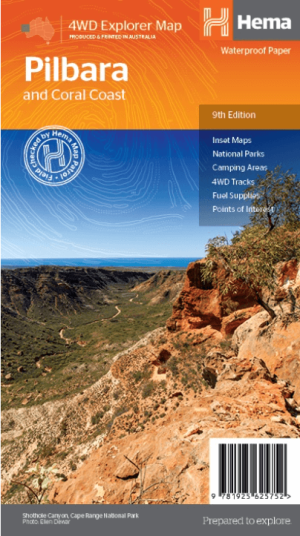
Landkaart Wegenkaart Pilbara & Coral Coast - Hema Maps • 9781925625752
Wegenkaart Pilbara & Coral Coast - Hema Productomschrijving: This regional waterproof map of the Pilbara and Coral Coast is ideal for discovering the northern reaches of Western Australia. The main map covers the diverse marine attractions around Shark Bay, François Peron National Park and the Ningaloo Reef. It also stretches to the gorges of Karijini, lush habitats of Millstream Chichest…
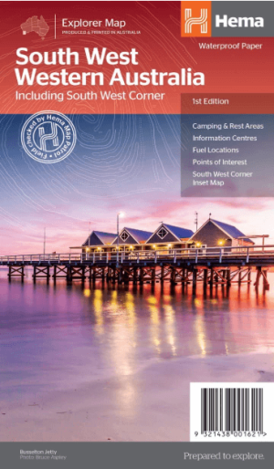
Landkaart Wegenkaart West & Zuidwest-Australië NP's - Hema • 9321438001621
Landkaart West & Zuidwest-Australië - Hema Productomschrijving: A regional map for discovering South West & Western Australia (WA). On the reverse side of the map are detailed inset maps of Nambung National Park, Avon Valley National Park, Lane Poole Reservation, the South West Corner, Stirling Range National Park, D'Entrecastreaux National Park and Albany Coast. Also included is tourist …