

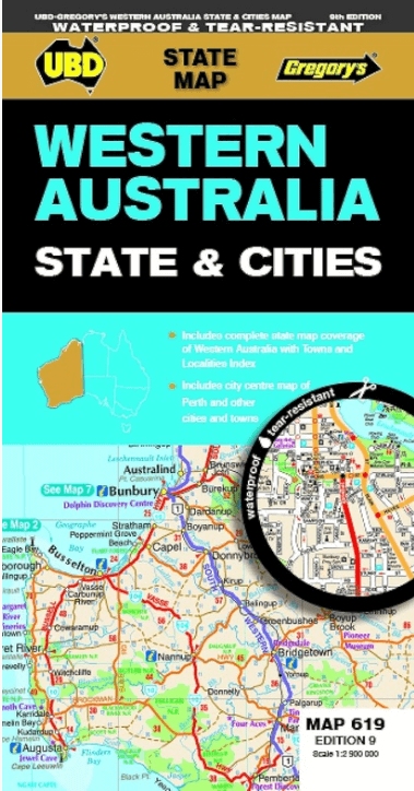
Landkaart Wegenkaart 619 Western Australia State & Cities - UBD
Mandurah- Busselton- Carnarvon- Broome- Albany- Geraldton

Korte omschrijving
Wegenkaart Western Australia State & Cities - Gregory's Productomschrijving: The latest edition of the Western Australia State and Cities map has been fully revised and updated. It incl...

Specificaties
- Uitgever: UBD Gregory's Universal Publishers
- ISBN-13: 9780731933198
- HOOFDCATEGORIEËN: Wegenkaart - Landkaart
- Activiteiten: Street/Road maps & city plans
- Regio: West Australië, Western Australia
- Land: Australië
- Schaal: 1:2900000
- Editie: 9
- Taal: Engels
- De Australische Regio's: Western Australia
Volledige omschrijving
Wegenkaart Western Australia State & Cities - Gregory's
Productomschrijving: The latest edition of the Western Australia State and Cities map has been fully revised and updated.
It includes a comprehensive state map with an index to the towns and localities at a scale of 1: 2.900.000 plus more detailed coverage of South West Western Australia at a scale of 1 : 1.870.000 on one side.
On the other side there are street level maps for Perth city at a scale of 1:5.000, a Fremantle map at a scale of 1:15.000, and town maps for Mandurah, Busselton, Carnarvon, Broome, Albany, Geraldton, Esperance, Bunbury and Kalgoorlie–Boulder at a scale of 1 : 25 000.
There is also touring information included for the state.
With all this information contained in this handy fold out map it is an essential tool to keep by your side when travelling Western Australia.
Artikelen uit dezelfde regio

Stadsplattegrond 661Perth Pocket map - UBD Gregory's • 9780731932696
Stadskaart Perth Pocket map - UBD Gregory's Productomschrijving: A Perth city map in handy pocket size. Includes: Suburban coverage north to Yanchep and Bullsbrook, south to Rockingham and Mt Barker Suburbs and localities index Suburban Highlights 1 : 5000 coverage of CBD 1 : 10 000 coverage of Fremantle Index to CBD buildings Perth Airport map

Reisgids Australië - een reis door Zuid en West - Edicola • 9789492920997
Reisgids Australië - een reis door Zuid en West - Edicola Productomschrijving: Na het succes van Australië - Een rondreis door het zuiden van Lisanna Weston heeft zij nu samen met Sanne de Groot een tweede reisgids geschreven: Een reis door Zuid- en West. Lisanna Weston, succesvol reisorganisatie-onderneemster in Australië en Sanne de Groot, onderdeel van Dutchies Travel en veelvoudig Aust…
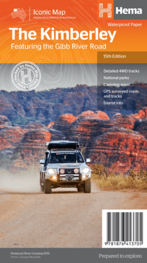
Landkaart Wegnkaart Kimberley Iconic Map, Gibb River road - Hema • 9781876413705
Wegnkaart Kimberley Iconic Map, The Gibb River road Productomschrijving: Een 660 km lange prachtige avontuurlijke route genaamd, The Kimberley Gibb River road. Engelse omschrijving: A regional map of the Kimberley that features the iconic Gibb River Road. On the reverse are inset maps for Purnululu National Park, the Dampier Peninsula and the Parry Creek area. There is also extensive …

Landkaart Wegenkaart Western Australia state handy map - Hema • 9321438001560
Wegenkaart Western Australia state handy map - Hema Productomschrijving: A compact map of Western Australia (WA) for touring throughout the state with a distance grid and index for planning and reference. Marked on the mapping are highways, major and minor roads, camping and rest areas, 24-hour fuel, information centres, picnic areas, caravan parks and lookouts.

Landkaart Wegenkaart Australië Indigenous Journeys Map - Hema Map • 9781922668936
Wegenkaart Australië Indigenous Journeys Map - Hema Maps Productomschrijving: Australië Indigenous Journeys Map hema 1:5.5M Ontdek de zanglijnen van de oudste levende cultuur ter wereld Al meer dan 65.000 jaar bewandelen Aboriginals en Torres Strait Islanders - de traditionele eigenaars van Australië - het land, smeden handelsroutes, delen kennis en zorgen voor het land. De Indigenou…