

Landkaart Wegnkaart Kimberley Iconic Map, Gibb River road - Hema
Purnululu National Park- Dampier Peninsula- Parry Creek area-
Korte omschrijving
Wegnkaart Kimberley Iconic Map, The Gibb River road Productomschrijving: Een 660 km lange prachtige avontuurlijke route genaamd, The Kimberley Gibb River road. Engelse omschrijving: A r...

Specificaties
- Uitgever: Hema Maps
- ISBN-13: 9781876413705
- HOOFDCATEGORIEËN: Wegenkaart - Landkaart
- Activiteiten: Street/Road maps & city plans
- Regio: Western Australia
- Land: Australië
- Schaal: 1:1000000
- Editie: 15
- Taal: Engels
- Reeks/Serie: Iconic Maps, Hema
Volledige omschrijving
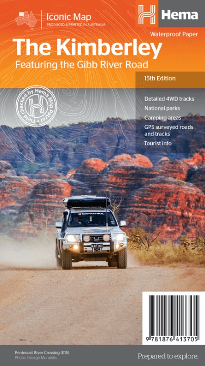
Wegnkaart Kimberley Iconic Map, The Gibb River road
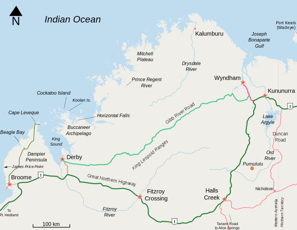
Productomschrijving: Een 660 km lange prachtige avontuurlijke route genaamd, The Kimberley Gibb River road.
Engelse omschrijving: A regional map of the Kimberley that features the iconic Gibb River Road. On the reverse are inset maps for Purnululu National Park, the Dampier Peninsula and the Parry Creek area. There is also extensive drive detail and trip coverage for the Gibb River Road.
•Waterproof paper
•Detailed 4WD tracks
•National parks
•Camping areas
•GPS surveyed roads & tracks
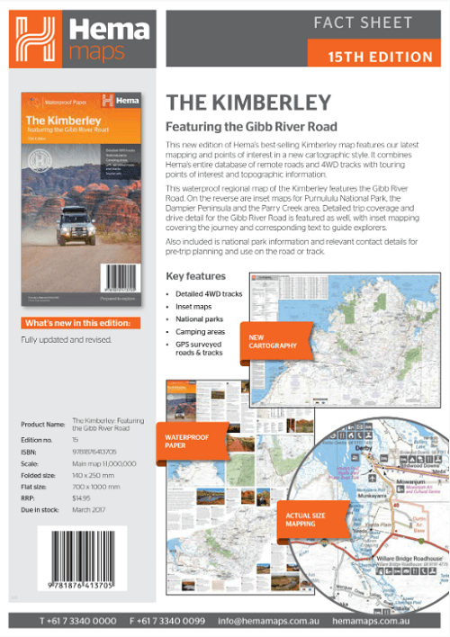
This new edition of Hema’s best-selling Kimberley map features our latest mapping and points of interest in a stunning new cartographic style. It combines Hema’s entire database of remote roads and 4WD tracks with touring points of interest and topographic information.
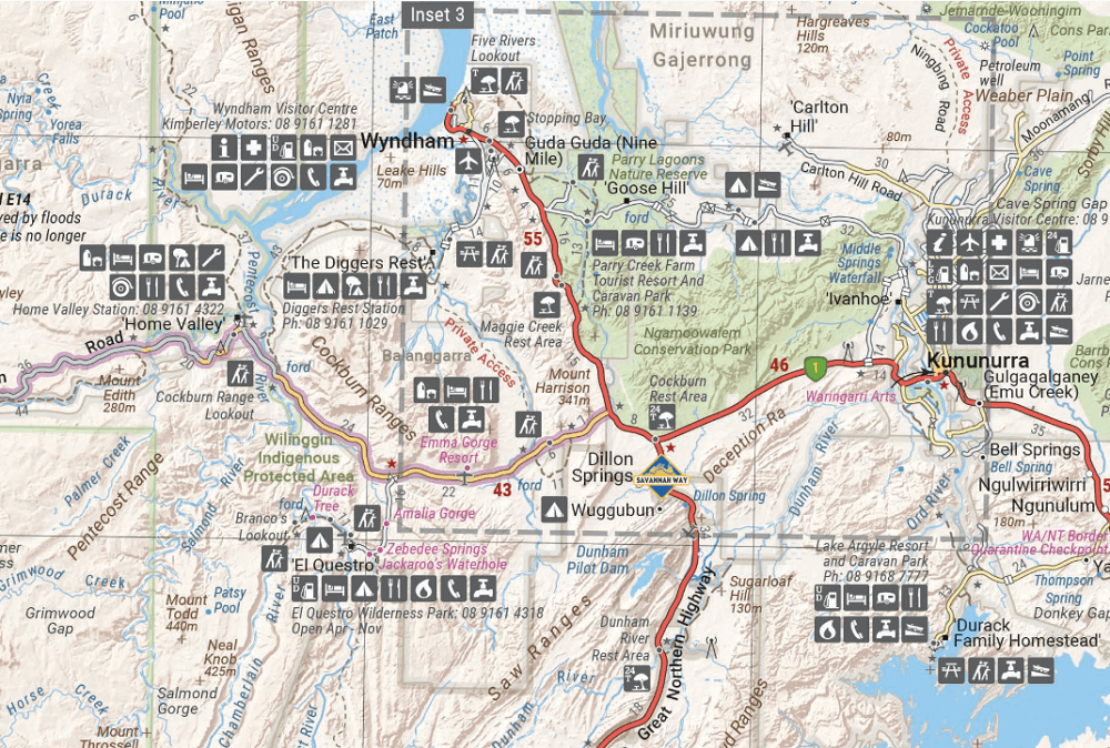
This waterproof regional map of the Kimberley features the Gibb River Road. On the reverse are inset maps for Purnululu National Park, the Dampier Peninsula and the Parry Creek area. Detailed trip coverage and drive detail for the Gibb River Road is featured as well, with inset mapping covering the journey and corresponding text to guide explorers.
Also included is national park information and relevant contact details for pre-trip planning and use on the road or track.
Artikelen uit dezelfde regio
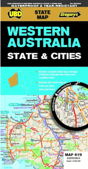

Landkaart Wegenkaart 619 Western Australia State & Cities - UBD • 9780731933198
Wegenkaart Western Australia State & Cities - Gregory's Productomschrijving: The latest edition of the Western Australia State and Cities map has been fully revised and updated. It includes a comprehensive state map with an index to the towns and localities at a scale of 1: 2.900.000 plus more detailed coverage of South West Western Australia at a scale of 1 : 1.870.000 on one side. …

Kampinggids Perth & The South West 4WD + Camping escapes - Hema • 9781865006215
Wegenatlas Kampinggids Perth & The South West Productomschrijving: 4WD + Camping Escapes – Perth & the South West is a guide to the best four-wheel driving and camping locations in South West Western Australia. Each regional section outlines the area’s 4WD Tracks and Featured Camping Areas, with a Camping Directory at the end to provide comprehensive coverage of other camping areas. T…

Landkaart Wegenkaart 670 Western Australia State & Suburban - UBD • 9780731933297
Wegenkaart Western Australia State & Suburban - Gregory's Productomschrijving: The latest edition of the Western Australia State and Suburban map has been fully revised and updated and includes: - Suburban map coverage of Perth and surrounds, north to Ridgewood, south to Halls Head and North Dandalup, and east to the Lakes, Karragullen and Gleneagle (including insets of Yanchep and Pi…

Landkaart Wegenkaart West & Midden-Westen Australië NP's - Hema • 9321438002109
Landkaart West & Midden-Westen Australië - Hema Produductomschrijving: A regional map of Mid West Western Australia that covers from Cape Range National Park south to Mandurah and as far as Kalgoorlie at a scale of 1:1,250,000 that has camping areas, national parks, fuel supplies and facility symbols marked on the map. On the reverse is region-specific touring information for Wildflower c…
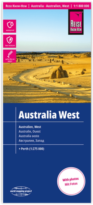
Landkaart Wegenkaart Australië West - Reise Know How • 9783831774739
Wegenkaart West Australië - Reise Know How Productomschrijving: Reis Know-How-kaarten (wereldkaart-projectreeks) zijn gemakkelijk te lezen, waterdichte en zeer duurzame reiskaarten die speciaal zijn ontworpen voor dagelijks gebruik op de weg. Omvat: The Northern Territories, Western Australia & Southern Australia. Onze kaarten combineren state-of-the-art, GPS-compatibele cartograf…