

Reisgids Ireland Ierland - Lonely Planet
Dublin- Wicklow- Kildare- Wexford- Waterford- Carlow- Kilkenny

Korte omschrijving
Reisgidsen Ierland van Lonely Planet Publications. Ideaal voor tochten in Ierland.
Reisgids Ireland - Lonely Planet Productomschrijving: Een klein land met een grote reputatie, adembenemende landschappen en fascinerende, vriendelijke mensen, wiens lyrische aard tot uiting ...

Specificaties
- Uitgever: Lonely Planet Publications
- ISBN-13: 9781838698058
- HOOFDCATEGORIEËN: Reisgids
- Auteur: Brian Barry, Catherine Le Nevez, Fionn Davenport, Isabel Albiston, Neil Wilson, Noelle Kelly
- Regio: Ierland
- Land: Ierland
- Editie: 16
- Taal: Engels
Volledige omschrijving
Reisgids Ireland - Lonely Planet
Productomschrijving: Een klein land met een grote reputatie, adembenemende landschappen en fascinerende, vriendelijke mensen, wiens lyrische aard tot uiting komt in de warmte van hun welkom. Lonely Planet brengt u naar het hart van Ierland, met verbazingwekkende reiservaringen en het beste planningsadvies:
Omvat: Dublin, Wicklow, Kildare, Wexford, Waterford, Carlow, Kilkenny, Cork, Kerry, Limerick, Tipperary, Clare, Galway, Mayo, Donegal, Belfast, Armagh, Londonderry, Antrim, Fermanagh, Tyrone.
Engelse omschrijving: A small country with a big reputation, breathtaking landscapes and fascinating, friendly people, whose lyrical nature is expressed in the warmth of their welcome. Lonely Planet will get you to the heart of Ireland, with amazing travel experiences and the best planning advice.
- Colour maps and images throughout
- Highlights and itineraries help you tailor your trip to your personal needs and interests
- Insider tips to save time and money and get around like a local, avoiding crowds and trouble spots
- Essential info at your fingertips - hours of operation, phone numbers, websites, transit tips, prices
- Honest reviews for all budgets - eating, sleeping, sight-seeing, going out, shopping, hidden gems that most guidebooks miss
- Cultural insights give you a richer, more rewarding travel experience - history, art, literature, music, architecture, landscapes, wildlife.
Artikelen uit dezelfde regio

Reisgids Simpelweg Ierland - Lannoo • 9789401490795
Simpelweg Ierland - Lannoo Productomschrijving: Ierland is in deze gloednieuwe reeks reisgidsen van de uitgever Lannoo, niet in 2 delen verdeeld. Zowel Ierland als Noord Iermand zijn opgenomen in deze prachtige Simpelweg reeks van Lannoo. Omvat: Dublin, Kilkenny, Cork, Killarney, Limerick, Galway, Belfast, Londonderry, Letterkenny, Enniskillen - De mooiste plekken en leukste activi…
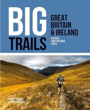
Wandelgids Big Trails DEEL 1 Great Britain & Ireland - Vertebrate • 9781839810008
Big Trails, Great Britain & Ireland - Vertebrate Productomschrijving: The best long-distance trails Big Trails: Great Britain & Ireland features 25 long-distance trails in England, Scotland, Wales, Northern Ireland and Ireland, and includes a general overview of the trails, specific technical information, overview mapping, key information and stunning photography. Big Trails: Great…

Wandelkaart 23 County Mayo North Coast Discovery Series - OSI Ireland • 9781912140527
Wandelkaart Mayo North - OSI Productomschrijving: Ontdek Ierland met de Discovery Series Wandelkaarten van Ordnance Survey Ireland. De Discovery Series wandelkaarten van Ordnance Survey Ireland (OSi) zijn dé keuze voor wandelaars, fietsers en avonturiers die Ierland echt willen verkennen. Deze hoogwaardige topografische kaarten bieden een gedetailleerd en nauwkeurig overzicht van het I…
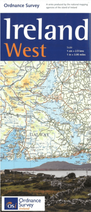
Landkaart Wegenkaart H2 Ierland West - OSI • 9781908852878
Wegenkaart West Ierland - OSI Productomschrijving: Wegenkaart West Ierland - OSI - Ordnance Survey Ireland West Road map at 1:250,000 approx 4 miles to the Inch. This map shows detailed road classification, altitude colouring and tourist information, published by OSI, the Ordnance Survey of Ireland. Topography of the island is shown by altitude colouring, with additional spot …

Landkaart Wegenkaart 2026 Ireland Road Map - Harper Collins • 9780008719241
Wegenkaart Ireland Road Map - Harper Collins Productomschrijving: Full-colour map of Ireland at 9 miles to 1 inch (1:570,240), with clear, detailed road network and counties and new administrative areas shown in colour. This double-sided map covers the whole of Ireland, and is ideal for reference or route planning. This map of Ireland shows the road network in detail. It is ideal for busin…