

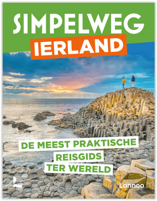
Reisgids Simpelweg Ierland - Lannoo
Dublin- Kilkenny- Cork- Killarney- Limerick- Galway- Belfast
Korte omschrijving
Reisgidsen Ierland en Noord Ierland van Uitgeverij Lannoo. Ideaal voor tochten in Ierland.
Simpelweg Ierland - Lannoo Productomschrijving: Ierland is in deze gloednieuwe reeks reisgidsen van de uitgever Lannoo, niet in 2 delen verdeeld. Zowel Ierland als Noord Iermand zijn opgenom...

Specificaties
- Uitgever: Uitgeverij Lannoo
- ISBN-13: 9789401490795
- HOOFDCATEGORIEËN: Reisgids
- Activiteiten: Toerisme
- Regio: Ierland, Noord Ierland
- Land: Ierland
- Editie: 1
- Taal: Nederlands
- Reeks/Serie: Simpelweg, Lannoo
Volledige omschrijving
Simpelweg Ierland - Lannoo
Productomschrijving: Ierland is in deze gloednieuwe reeks reisgidsen van de uitgever Lannoo, niet in 2 delen verdeeld. Zowel Ierland als Noord Iermand zijn opgenomen in deze prachtige Simpelweg reeks van Lannoo.
Omvat: Dublin, Kilkenny, Cork, Killarney, Limerick, Galway, Belfast, Londonderry, Letterkenny, Enniskillen
- De mooiste plekken en leukste activiteiten in Ierland
- De beste adressen van locals
- Inclusief route voor een rondreis vanuit Dublin, via Cork, de kliffen in het westen tot in Connemara.
- Route doorheen het noorden van Ierland, een reis langs het minder bekende Ierland.
Simpelweg Ierland
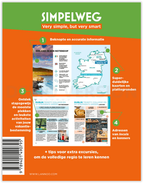
SIMPELWEG: Very simple, but very smart
Beknopte en accurate informatie
Superduidelijke kaarten en plattegronden
Ontdek stapsgewijs de mooiste plekken en leukste activiteiten van jouw vakantiebestemming
Adressen van locals en kenners + tips voor extra daguitstappen, om de volledige regio te leren kennen
Locatie op kaart
Artikelen uit dezelfde regio
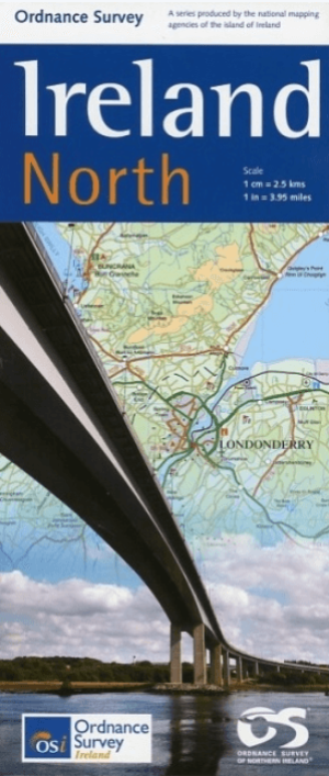
Landkaart Wegenkaart H1 Ierland Noord - OSI • 9781905306619
Wegenkaart Noord Ierland - OSI Productomschrijving: Ordnance Survey Ireland North Road map at 1:250,000 approx 4 miles to the Inch This map shows detailed road classification, altitude colouring and tourist information, published by OSI, the Ordnance Survey of Ireland. Topography of the island is shown by altitude colouring, with additional spot heights and names of mountain or hi…
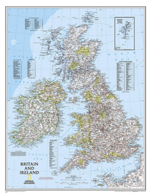
Plano Wandkaart Groot-Brittannië & Ierland 60 x 76 cm - Nat Geo • 9780792250234
Wandkaart Groot-Brittannië & Ierland 60 x 76 cm - Nat Geo Productomschrijving: National Geographic's Classic political map of Britain and Ireland is both an attractive addition to any study or classroom and an informative tool for exploring these fascinating countries. The map features thousands of place names, major highways and roads, airports, ferry routes, bodies of water, and more. Ha…
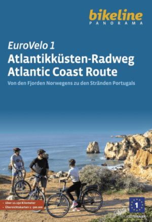
Fietsgids Eurovélo 1 Atlantikküsten-Radweg - Bikeline • 9783711102171
Eurovélo-route 1 - Atlantikküsten-Radweg - Bikeline Productomschrijving: Fietstochten zijn al tientallen jaren een populaire manier om op vakantie te gaan en worden steeds populairder. Er zijn talloze langeafstandsfietsroutes en fietsregio's waar je zorgeloos kunt fietsen. De variatie is enorm, want er zijn fietsroutes langs rivieren, langs zeekusten, over voormalige spoorlijnen, in en ron…

Plano Wandkaart Ierland 76 x 91 cm - Nat Geo • 9781597752565
Wandkaart Ierland 76 x 91 cm - Nat Geo Productomschrijving: The Classic style Ireland map is one of the most authoritative maps yet published of the Emerald Isle. Of the nearly 1,000 place-names shown on this map, all within the Republic of Ireland adhere to that nation's constitution—that the Irish and English language share official status. Thus, Gaelic (Irish) place-names, along with th…

Wandelgids Big Trails DEEL 2 Great Britain & Ireland - Vertebrate • 9781839810459
Big Trails DEEL 2 Great Britain & Ireland - Vertebrate Publ. Productomschrijving: More of the best long-distance trails Big Trails: Great Britain & Ireland Volume 2 features twenty-five long-distance trails in England, Scotland, Wales, Northern Ireland and Ireland, and includes a general overview of the trails, specific technical information, overview mapping, key information and stun…