

Stadskaart plattegrond Brussel - Borch
NATO - Eurocontrol - Grande Place - Atomium - Manneken Pis


Korte omschrijving
Wandelkaart Brussel - Borch Productomschrijving: Our soft-laminated folded map of Brussels in the 8th edition shows: Brussels 1:12 000, Brussels Center 1: 10 900, Grand Place, Brussels Regio...
Specificaties
- Uitgever: Borch GmbH
- ISBN-13: 9783866093553
- HOOFDCATEGORIEËN: Stadskaart plattegrond, Wandelkaart
- Activiteiten: Street/Road maps & city plans
- Regio: Waals Brabant
- Land: België
- Schaal: 1:12000
- Editie: 9
- Taal: Duits, Engels, Frans, Itailaans, Spaans
- Reeks/Serie: Borch Stadskaart - City map
Volledige omschrijving
Wandelkaart Brussel - Borch
Productomschrijving: Our soft-laminated folded map of Brussels in the 8th edition shows: Brussels 1:12 000, Brussels Center 1: 10 900, Grand Place, Brussels Region 1:100 000, Public Transport Brussels and Belgium administrative. Borch maps are easy to fold, durable and water-repellent with a wipeable surface. Borch Maps show hotels, museums, monuments, markets, top sights and points of interest, useful statistics, conversion charts for temperatures, weights and measurements, climate charts showing temperatures, sunshine hours, precipitation and humidity, overview maps, time zones, and much more...
Brussels is considered the capital city of the European Union because of the numerous EU institutions headquartered here. Organisations with their main seat in Brussels include the North Atlantic Treaty Organisation (NATO) and the European Organisation for the Safety of Air Navigation (Eurocontrol). Apart from being the capital city of Belgium, Brussels is the capital of the French Community of Belgium and the capital of Flanders.
Brussels is a European metropolis situated almost directly in the center of the small country. Notable trademarks of Brussels include the Grande Place, a beautiful gothic market ensemble, the recently renovated Atomium from the 1958 World Expo and "Manneken Pis" - the child of the city. Brussels stands for exquisite cuisine, delicious Belgian chocolates and intricate lacework. Interesting museums, galleries, art-deco architecture, fine shopping and nightlife, all distinctly European, await the visitor. Europe par excellance!

Artikelen uit dezelfde regio
Fietskaart 5 Vlaams-Brabant - Sportoena • 9789078976271
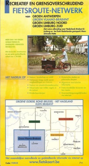
De Groene gordel rond Brussel - het Hageland & Klein Brabant Productomschrijving: Fietskaart van de kaartenmaker Sportoena die Vlaams-Brabant beslaat. Groene gordel Ronde Brussel, Het Hageland, Klein Brabant: Dendermonde, Mechelen, Brussel, Waterloo, Tervuren, Bornem, Sint-Amands, Leuven, Tienen, Aarschot, Diest, Hoegaarden, Westerlo, Tongerlo, waar routes en vrijetijdsinformatie zijn op a…
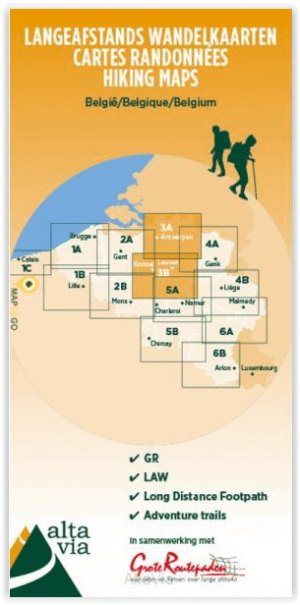
Wandelkaart 3 GR Antwerpen- Brussel & VL+W Brabant - ALTA VIA • 9789082844368
Wandelkaart 3 - GR Antwerpen- Brussel & VL+W Brabant Productomschrijving: Deze wandelkaart met schaal 1:80.000 is een overzichtskaart van alle GR- en langeafstandswandelroutes in Antwerpen, Brussel, Waals & Vlaams Brabant. De kaart omvat GR routes, de befaamde LAW's en Adventure trails. De kaarten werden ontwikkelt in samenwerking met Grote Routepaden. De opgegeven GR-routes zijn: …
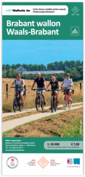
Fietsknooppuntenkaart F190 Waals-Brabant - NGI • 9789462356290
Fiets & wandelkaart Waals-Brabant - NGI Productomschrijving: Omgeving Zuid Brusselse streken, meer bepaald Vlaams Brabant, biedt u met deze kaart allerhande routes, voor het eerst ook met Ravelroutes. Omvat: Fietsroutes, LF-routes, RAVEL-routes, Rando Vélo-routes, bezienswaardigheden, toeristische faciliteiten, kaart en/of info op voor- en achterkant.

Wandelgids Randonnées sur les GR de la prov. du Brabant Wallon • 9782931078150
Randonnées en Boucle sur les GR de la provence du brabant Wallon Productomschrijving: De luswandelingen (RB) bieden wandelaars dagetappes gebaseerd op de beroemde wit en rood gemarkeerde Grande Randonnée paden, de GR. De in deze gids voorgestelde routes zijn allemaal gebaseerd op één van de vier langeafstandswandelpaden die Waals-Brabant doorkruisen (de GR 12 Amsterdam - Brussel - Parijs, …

TOPO Wandelkaart 39/1-2 Rebecq - Tubize - NGI • 9781129301889
Wandelkaart Rebecq - Tubize - NGI Productomschrijving: De kaart is perfect aangewezen voor outdoor-activiteiten zoals wandel- of fietstochten. Het kaartblad bedekt een gebied van 16 km op 10 km (160 km²). De symbolisatie maakt de kaarten leesbaar en overzichtelijk. Deze kaart biedt u een overzicht van deel nr. 39/1-2 van de topografische TOPO25 reeks van onze eigen Nationaal geografisch in…