
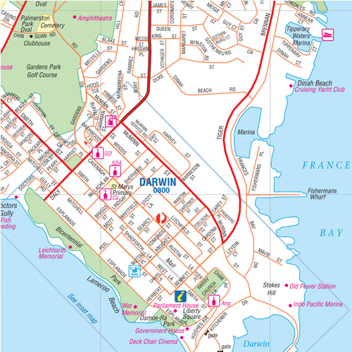
Stadskaart plattegrond Darwin & omgeving - Hema Maps
Darwin city - Suburbs - Palmerston - Howard Springs - Humpty Doo

Korte omschrijving
Wandelkaarten Australië, Northern Territories en Darwin, Australië van Hema Maps. Ideaal voor tochten in Australië.
Stadskaart Darwin & omgeving - Hema Productomschrijving: Darwin CBD, City & Suburbs Map A map that has Darwin city (1:25,000) and suburbs on one side and maps of Palmerston (1:25,000), ...

Specificaties
- Uitgever: Hema Maps
- ISBN-13: 9781865006338
- HOOFDCATEGORIEËN: Stadskaart plattegrond
- Activiteiten: Street/Road maps & city plans, Toerisme
- Regio: Australië, Northern Territories, Darwin, Australië
- Land: Australië
- Schaal: 1:25000
- Editie: 9
- Taal: Engels
Volledige omschrijving
Stadskaart Darwin & omgeving - Hema
Productomschrijving: Darwin CBD, City & Suburbs Map
A map that has Darwin city (1:25,000) and suburbs on one side and maps of Palmerston (1:25,000), Howard Springs to Humpty Doo (1:75:000) and the Darwin region on the reverse. Originally known as Palmerston (the name was changed to Darwin in 1911), it used to be a dusty, sleepy savannah town. Today it’s a bustling, multi-cultural, tropical city – albeit with a laid-back attitude.
Darwin offers many good fishing spots, including Stokes Hill Wharf for queenies, Spanish mackerel, trevally and long-tailed tuna, and Mandorah Jetty on the opposite side of the harbour. The rock walls at Dinah Beach are good for mud crabs, and casting at night on a high tide can yield bream and barramundi. Sunset picnics are extremely popular in Darwin, particularly on the cliff tops at Fanny Bay, East Point, Nightcliff and Casuarina.
There are some great beaches including Mindil Beach and 8km-long Casuarina Beach. One of Darwin’s favourite recreation venues, the Casuarina Coastal Reserve stretches along 8km of sandy beach between Rapid Creek and Buffalo Creek. Within its 1500 hectares are colourful cliffs, eucalypt woodlands, mangroves and monsoon forest. You’ll find shaded picnic areas at Dripstone Cliffs, Dripstone Park, Lee Point and Buffalo Creek. Dripstone Cliffs is a popular venue for cliff-top picnic dinners with sunset views. The reserve also has Darwin’s free (nude) beach, where a 1km stretch of sand has been reserved for naturists. From the beach car park, shared dirt paths allow access to the mouth of Sandfly Creek and Lee Point. Much of the track to Lee Point winds through dense bush, with occasional gutters, steep descents and sharp corners waiting for the unwary cyclist. There are a couple of interesting WWII sites along the bike path to Lee Point and more at Buffalo Creek.
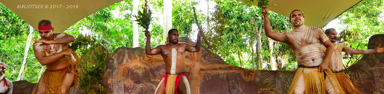
Around Darwin, nature enthusiasts should check out Howard Springs, Berry Springs and Territory/Nature & Wildlife Parks for a great place to spend a day outdoors. Shoal Bay is a popular spot for crabbing and barra fishing. Dundee Beach has a bush resort and camping area and a concrete ramp and is very popular with Darwinians.
Places of interest included on this map:
• Aboriginal Fine Arts Gallery
• Aquascene Fish Feeding
• The Cenotaph/ War Memorial
• Chung Wah Temple and Museum
• Crocosaurus Cove
• Darwin Convention Centre
• Darwin Entertainment Centre
• Darwin Theatre Company
• The Deckchair Cinema
• Indo Pacific Marine
• Leichhhardt Memorial
• Lyons Cottage (B.A.T Cottage)
• Old Admiralty House
• The Old Court House
• The Old Town Hall
• Survivors Lookout
• USS Peary Memorial / USAAF Memorial
• WWII Oil Storage Tunnels
Artikelen uit dezelfde regio
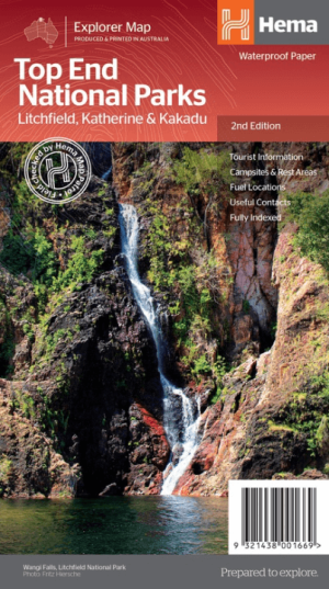
Landkaart Wegenkaart Explorer Map Top End National Parks - Hema • 9321438001669
Explorer Map Top End National Parks - Hema Productomschrijving: A regional map that features Litchfield National Park(1:160,000), Katherine Gorge and Kakadu (1:350,000) national parks. A Darwin region map is included (1:850,000) along with extensive tourist information for Darwin and the surrounding region, Arnhem Highway to Kakadu, Mary River, Stuart Highway to Katherine, Litchfield …
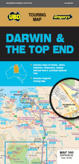
Landkaart Wegenkaart 590 Darwin & the Top End - UBD Gregory's • 9780731933310
Wegenkaart Darwin & the Top End - UBD Gregory's Productomschrijving: The 21st edition of the Darwin & Top End touring map is a useful tool when travelling in the area. There are regional touring maps covering Darwin in the north, Katherine and Mataranka in the south, as well as Daly River, Kakadu & Litchfield National Parks. Contains maps and a street index of Darwin & Palmerston city…