

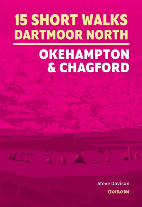
Wandelgids 15 Short Walks in North Dartmoor NP - Cicerone
Okehampton and Chagford
Korte omschrijving
Wandelgidsen Devon, England van CICERONE Press. Ideaal voor tochten in England.
Wandelgids 15 Short Walks in North Dartmoor - Cicerone Productomschrijving: Would you like to explore the best of Okehampton and Chagford? This guidebook covers 15 of Dartmoor's best short w...

Specificaties
- Uitgever: CICERONE Press
- ISBN-13: 9781786311917
- HOOFDCATEGORIEËN: Wandelgids
- Activiteiten: Wandelen, Hiking & Trekking
- Auteur: Steve Davison
- Regio: Devon, England
- Land: England
- Editie: 1
- Taal: Engels
Volledige omschrijving
Wandelgids 15 Short Walks in North Dartmoor - Cicerone
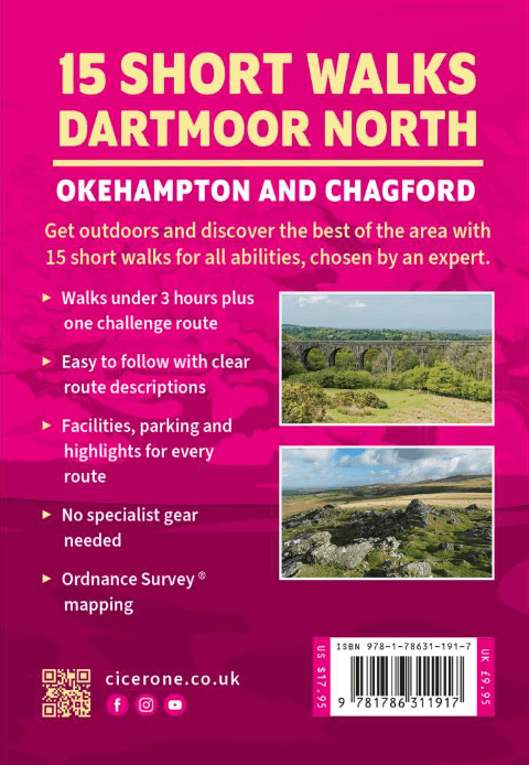
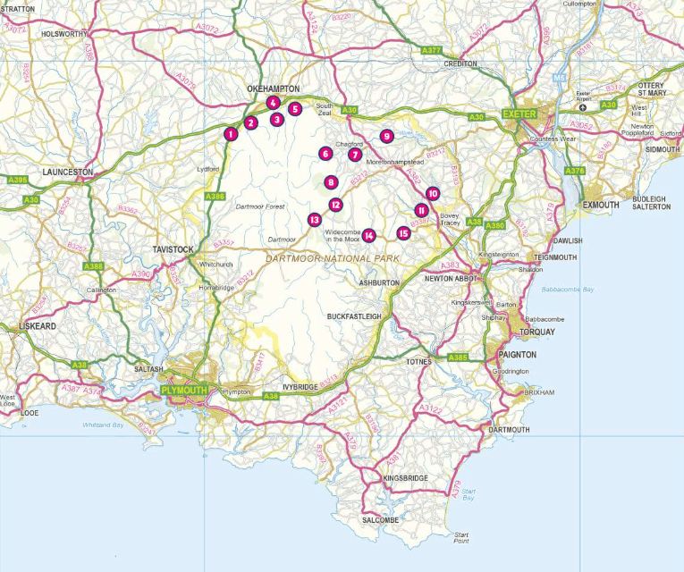
Productomschrijving: Would you like to explore the best of Okehampton and Chagford? This guidebook covers 15 of Dartmoor's best short walks including Chagford, Belstone, Hound Tor and Bowerman's Nose, High Willhays and Yes Tor, and Meldon Reservoir.
Why choose this guidebook?
- Walks under three hours, plus one challenge route
- Easy to follow with clear route descriptions
- Facilities, parking and highlights for every route
- No specialist gear needed, walk all year round
- Ordnance Survey mapping
- Cicerone’s Short Walks guidebooks contain everything you need to get outdoors and discover the best of an area. The routes are perfect if you’re -new to walking or looking for something you can enjoy with the whole family. Let the adventures begin!
Artikelen uit dezelfde regio

Wandelkaart North Devon coastal walks - Goldeneye • 9781859652534
North Devon coastal walks - Goldeneye Productomschrijving: Devon, evenals Cornwall, hebben elk het zelfde detail gemeen. Ze bevinden zich bijden op het zogenaamde uitsteeksel van Engeland. Een soort "Land's end" van het continent van Groot Brittanië. Deze wandelkaart spitst zich toe op het gedeelte van Devon, en meerbepaald zijn kust wandelroutes. Er zijn er heel wat en ze zijn stuk voor s…

Wandelgids 009 Pathfinder guides Exmoor NP & the Quantocks - OS • 9780319090114
Wandelgids Exmoor National Park & the Quantocks - OS Productomschrijving: Exmoor National Park comprises 265 square miles, of which about two-thirds lie in west Somerset and the remaining third in north Devon. This walking guidebook contains 28 circular, graded walks in Exmoor, all tried and tested by seasoned walkers. The routes range from extended strolls to longer hikes, so there is som…

Wandelgids Part 2 SWCP Map Booklet St Ives to Plymouth - Cicerone • 9781786312785
Map Booklet Part 2 SWCP - St Ives to Plymouth - Cicerone Productomschrijving: Map of part of the southern section of the 630 mile (1014km) South West Coast Path National Trail. Covers: the trail from St Ives to Plymouth along the west Cornwall and Devon coastline. This convenient and compact booklet of Ordnance Survey 1:25,000 maps shows the route, providing all of the mapping you ne…
Wandelgids Walking the Jurassic Coast - Cicerone • 9781852847418
Wandelgids - Walking the Jurassic Coast - Cicerone Discover the Jurassic Coast of Devon and Dorset with a Cicerone guide. Productomschrijving: Deze gids bevat 30 wandelingen naar de Jurassic Coast van Devon en Dorset. Dekking van de kust tussen Exmouth en Bournemouth, deze prachtige routes variëren van 3 tot 16 mijl (5 tot 24km). De gids verkent en geeft uitleg over de spectaculaire ge…

Wandelkaart 113 Okehampton- Devon England - OSI • 9780319243145
Wandelkaart Okehampton - Devon England - OSI Omvat ook: Hatherleigh, North Tawton & Lapford Productomschrijving: Kaart nummer 113 in de OS Explorer kaarten reeks is ideaal voor het ontdekken van het Hatherleigh, North Tawton en Lapford gebied rond het noorden van Dartmoor national park. Dit gebied van Devon is rijk aan natuur en daarom perfect voor al degenen die gepassioneerd zijn ove…