Wandelgids - Alpine Pass Route across Switzerland - Cicerone
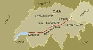
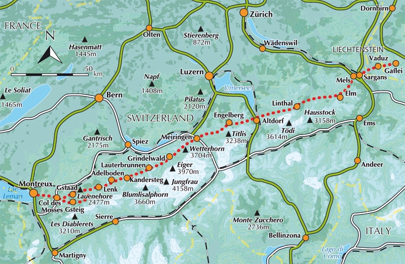
De Via Alpina 1 route volgt voor 360km van Sargans tot Monteux

Korte omschrijving
Wandelgids - Alpine Pass Route across Switzerland - Cicerone Productomschrijving: Wandelgids of de Alpine route, die de Via Alpina 1 route volgt voor 360km van oost naar west, van Sargans op...

Stockactie
Specificaties
- Uitgever: CICERONE Press
- ISBN-13: 9781852849276
- HOOFDCATEGORIEËN: Wandelgids
- Activiteiten: Wandelen, Hiking & Trekking
- Land: Zwitserland
- Blz.: 224
- Afmeting: 12x17
- Editie: 3
- Taal: Engels
Volledige omschrijving
Wandelgids - Alpine Pass Route across Switzerland - Cicerone
Productomschrijving: Wandelgids of de Alpine route, die de Via Alpina 1 route volgt voor 360km van oost naar west, van Sargans op de grens met Lichtenstein, tot Monteux. Een lastige 3 weken durende trektocht met 18 ettapes, over 16 cols incl de 2778m hoge Hohtürli. Voor deze route heeft u een goeie fitness niveau nodig
Detail: Guidebook to the Alpine Pass Route following the Swiss Via Alpina 1, a 360km trek east-west across Switzerland, from Sargans, on the border of Liechtenstein, to Montreux, including prologue from Liechtenstein. A demanding 3-week trek described in 18 stages, crossing 16 passes including the 2778m Hohtürli. Requires good fitness and experience.
Seasons:
From the start of July through to September. August can be wet, and an early trek may find snow on the higher passes, so suitable additional equipment would be essential.
Centres:
Sargans, Elm, Linthal, Altdorf, Engelberg, Meiringen, Grindlewald, Lauterbrunnen, Kandersteg, Adelboden, Lenk, Gstaad, Col des Mosses, Montreux.
Difficulty:
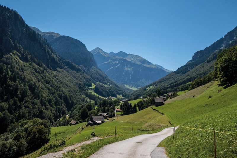
It's pretty tough: the route amasses over 20,000m of ascent and nearly every day involves a pass crossing. Some higher passes and ridges present occasional exposure and technical difficulty.Must See Must SeeThe Eiger, Monch and Jungfrau near Grindlewald, valley-pass landscapes every day, the Lauterbrunnen valley, the Oeschinensee above Kandersteg.