

Wandelgids Day New Walks in the Peak District - Vertebrate Publ.
20 New circular routes between 14 and 20.6 km


Korte omschrijving
Wandelgidsen Derbyshire & Peak District, England van Vertebrate Publishing. Ideaal voor tochten in England.
Day New Walks in the Peak District - Vertebrate Productomschrijving: Day Walks in the Peak District – 20 new circular routes features 20 circular walks, between 8.7 and 12.8 miles (14km and...

Specificaties
- Uitgever: Vertebrate Publishing
- ISBN-13: 9781839810237
- HOOFDCATEGORIEËN: Wandelgids
- Activiteiten: Wandelen, Hiking & Trekking
- Auteur: Norman Taylor
- Regio: Derbyshire & Peak District, England
- Land: England
- Nationale parken: Peak District NP, Derbyshire UK
- Taal: Engels
- Reeks/Serie: Day walks in, vertebrate Publishing
- De Engelse Graafschappen: Derbyshire, South Yorkshire
- De Nationale Parken: Peak District Nationaal Park, England
Volledige omschrijving
Day New Walks in the Peak District - Vertebrate
Productomschrijving: Day Walks in the Peak District – 20 new circular routes features 20 circular walks, between 8.7 and 12.8 miles (14km and 20.6km), suitable for hillwalkers of all abilities. Local authors Norman Taylor and Barry Pope share walks in their favourite areas of the Peak District National Park including Derwent Edge, Dove Dale and Eyam.
The routes are split into three geographical areas – The High Moors, including the Kinder plateau and Bleaklow, Hills, Tors and Edges, including walks around the Eastern Edges such as Stanage and Burbage, and Limestone Country, with walks in the beautiful limestone dales and valleys of the Peak. Written by Peak District hillwalkers Norman Taylor and Barry Pope, each route features Ordnance Survey 1:25,000 maps, easy-to-follow directions, details of distance and navigation information, and refreshment stops and local information.

Artikelen uit dezelfde regio

Wandelgids Malvern Hills Short walks - Cicerone • 9781786311399
Wandelgids Malvern Hills Short walks - Cicerone Productomschrijving: Julia Goodfellow-Smith heeft 15 van de beste korte wandelingen in de Malvern Hills AONB gekozen, waaronder Worcestershire Beacon. Elke wandeling is voorzien van goed leesbare Ordnance Survey-kaarten, een duidelijke routebeschrijving en veel afbeeldingen, plus informatie over mooie plekjes en rustplaatsen. Geen moeilijk te…

Wandelgids The Pennine Way - Trailblazer • 9781912716333
The Pennine Way 420 km - Trailblazer Productomschrijving: De Pennine Way, het bekendste nationale pad van Groot-Brittannië, slingert zich 420 km over woeste heidevelden en door stille dalen langs de ruggengraat van Noord-Engeland. Het begint in Edale in het Peak District en eindigt net over de grens in Schotland bij Kirk Yetholm. Dit prachtige wandelpad doorkruist 3 nationale parken - het …
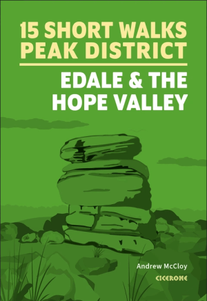
Wandelgids Peak District, Edale and the Hope Valley - Cicerone • 9781786312587
Peak District National Park - Edale and the Hope Valley - Cicerone Productomschrijving: Would you like to explore the best of Edale and the Hope Valley in the Peak District? This guidebook covers 15 of the best short walks in the area, including Hollins Cross and Mam Tor, Castleton, Ladybower Reservoir, Stanage Edge and North Lees, Kinder Scout and Castleton. Why choose this guidebook?…

Wandelgids Derbyshire walking guide - Cicerone • 9781852846336
Wandelgids - Derbyshire walking guide - Cicerone Productomschrijving: Een handige gids die 60 circulaire dagwandelingen beschrijft, variërend van eenvoudig tot matig, in termen van moeilijkheden en terrein, die geschikt zijn voor het hele gezin. Derbyshire beschikt over een interessante geschiedenis die ook door middel van deze routes onderzocht kan worden, en elk thema rond een specifieke…

Wandelkaart White Peak - Peak District NP - Harvey maps • 9781851375134
Wandelkaart White Peak" Alle witte piekheuvels en dales op een enkele kaart. De achterzijde van de kaart omvat: Oost-Matlock en Noord naar Edale, geologische kaart. Productomschrijving: Nieuwe generatie HARVEY Superwalker, XT25 waterproof, werden ontworpen om de meest praktische tools te zijn voor GPS-navigatie. Het formaat geeft meer toewijzingen op het blad zonder de kaart zwaarder e…