

Wandelgids Day Walks in the North York Moors - Vertebrate Publ.
The Cleveland Hills - Hambleton Hills - Central Moors


Korte omschrijving
Wandelgidsen Yorkshire, England van Vertebrate Publishing. Ideaal voor tochten in England.
Day Walks in the North York Moors - Vertebrate Productomschrijving: 20 circular routes in North Yorkshire Day Walks on the North York Moors showcases 20 circular walks, between 5 and 13...

Specificaties
- Uitgever: Vertebrate Publishing
- ISBN-13: 9781906148324
- HOOFDCATEGORIEËN: Wandelgids
- Activiteiten: Wandelen, Hiking & Trekking
- Auteur: Tony Harker
- Regio: Yorkshire, England
- Land: England
- Nationale parken: North York Moors NP, England
- Taal: Engels
- Reeks/Serie: Day walks in, vertebrate Publishing
- De Engelse Graafschappen: North Yorkshire
- De Nationale Parken: North Yorkshire Moors National Park, England
Volledige omschrijving
Day Walks in the North York Moors - Vertebrate
Productomschrijving: 20 circular routes in North Yorkshire
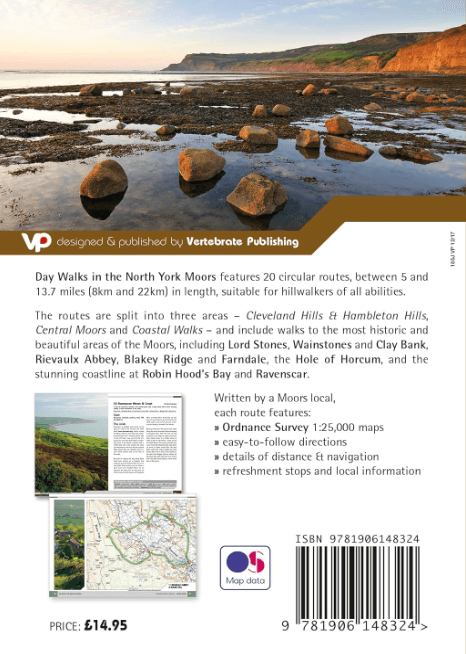
Day Walks on the North York Moors showcases 20 circular walks, between 5 and 13.7 miles (8 and 22 kilometres) in length, suitable for hillwalkers of all abilities. The routes are split into three areas – The Cleveland Hills and Hambleton Hills, Central Moors and Coastal Walks – and include walks to the most historic and beautiful areas of the Moors, including: Lord Stones, Wainstones and Clay Bank, Rievaulx Abbey, Blakey Ridge and Farndale, the Hole of Horcum, and the stunning coastline at Robin Hood’s Bay and Ravenscar.
The author of this guidebook, Tony Harker, is a Moors local and keen hillwalker. Each route in this guide is described with easy-to-follow directions and details of distance, navigation information and refreshment stops, and is plotted on clear and easy to use Ordnance Survey 1:25,000 maps. The walks are illustrated with stunning photography by Adam Long. Also included is a detailed Appendix.

Artikelen uit dezelfde regio
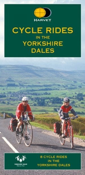
Fietskaart Yorkshire Dales - Harvey maps • 9781851374014
Fietskaart Yorkshire Dales - Harvey maps Productomschrijving: 8 ritten in de Yorkshire Dales variërend in lengte van 11 tot 23 mijl. Bevat gedetailleerde kaarten en geschreven routebeschrijving. Informatie over lokale punten van belang en sites om te bezoeken. Telefoonnummers van toeristische informatiecentra en andere nuttige contacten. Nieuwe generatie HARVEY Superwalker, XT25 water…
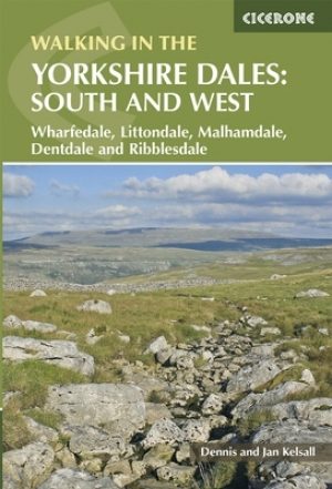
Wandelgids Yorkshire Dales South & West walking guide- Cicerone • 9781852848859
Wandelgids - Yorkshire Dales South & West walking guide- Cicerone Productomschrijving: Deel 2 van een 2-delige gidsen set omvat 44 wandelingen in het zuiden en het west van de Yorkshire Dales, incl het 23km lange "Three Peak cicuit" door Pen-y-Ghent, Whernside & Ingleborough. De andere, meestal bezienswaardige routes van ongeveer 13km ovatten de regio's tussen Sedbergh, Kirkby Lonsdale, Se…
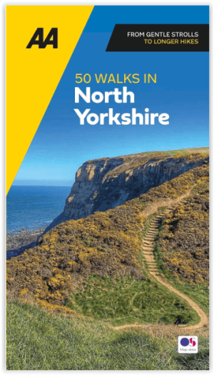
Wandelgids 50 walks in North Yorkshire - AA Publi. • 9780749583781
50 walks in North Yorkshire - AA Publishing Productomschrijving: North Yorkshire, met zijn uitgestrekte landschappen en rijke geschiedenis, is een paradijs voor wandelaars. De wandelgids "50 Walks in North Yorkshire" biedt routes door enkele van de mooiste plekken in het Verenigd Koninkrijk. Wat Kun Je Er Vinden? Adembenemende Landschappen: Yorkshire Dales en North York Moors b…

Wandelgids North Yorkshire historic walks - Cicerone • 9781852843892
Wandelgids - North Yorkshire historic walks - Cicerone Productomschrijving: Een gids over historische wandelingen in North Yorkshire, in 20 meestal circulaire routes. Zij brengen u van open heidegebied en blootgestelde delen van heuvel en kliffen naar de meer beschutte dales en de straten van York. Wandelingen bevatten Skipton Castle, Ripon en Fountains Abbey, Ripley Castle, Castle Howard,…

Fietsgids West Yorkshire Mountain Biking - Vertebrate Publ. • 9781906148157
West Yorkshire Mountain Biking - Vertebrate Productomschrijving: West Yorkshire Mountain Biking - South Pennine Trails features 23 of the best mountain bike rides in West Yorkshire, between 10.5km and 32km in length, suitable for all levels of mountain bikers. Written by local expert and MTB journalist Benjamin Haworth, each route features clear and easy to use Ordnance Survey 1:50,000 map…