

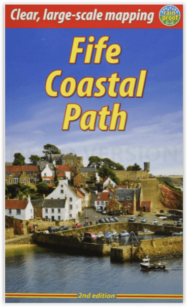
Wandelgids Fife Coastal Path 187 km - Rucksack Readers
From Kincardine on the Forth to Newburgh on the Tay
Korte omschrijving
Wandelgidsen Fife, Schotland van RUCKSACK READERS. Ideaal voor tochten in Schotland.
Wandelgids Fife Coastal Path - Rucksack Readers Productomschrijving: Het kustpad van Fife loopt langs de kustlijn van oostelijk Schotland over een afstand van 117 mijl (187 km) van Kincardin...

Specificaties
- Uitgever: RUCKSACK READERS
- ISBN-13: 9781913817008
- HOOFDCATEGORIEËN: Wandelgids
- Activiteiten: Wandelen, Hiking & Trekking
- Regio: Fife, Schotland
- Land: Schotland
- Lange afstand wandelroutes: Fife Coastal Path, Schotland (187 km)
- Schaal: 1:50000
- Editie: 2
- Taal: Engels
Volledige omschrijving
Wandelgids Fife Coastal Path - Rucksack Readers
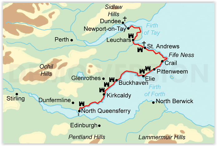
Productomschrijving: Het kustpad van Fife loopt langs de kustlijn van oostelijk Schotland over een afstand van 117 mijl (187 km) van Kincardine aan de Forth tot Newburgh aan de Tay. De route begint ten westen van de prachtige bruggen van de Forth en loopt door voormalige mijnstadjes naar de dorpen in de East Neuk (hoek) van Fife, met hun rijke traditie van smokkel en visserij. Na het ronden van Fife Ness volgt de route de kustlijn in noordwestelijke richting door St-Andrews, voormalig religieus centrum van Schotland en golfhoofdstad van de wereld.
Fife heeft lang een belangrijke rol gespeeld in de Schotse geschiedenis en de route passeert vele kastelen, torens en kerken. Er zijn prachtige uitzichten langs de kust en over de Firths of Forth en Tay, met grote kansen om zeevogels, zeehonden en dolfijnen te zien. In de dorpen vindt u gezellige pubs, beroemde fish-and-chip winkels en goede B&B's. Vervoer per trein en bus zorgt voor een gemakkelijke bereikbaarheid van het hele gebied.
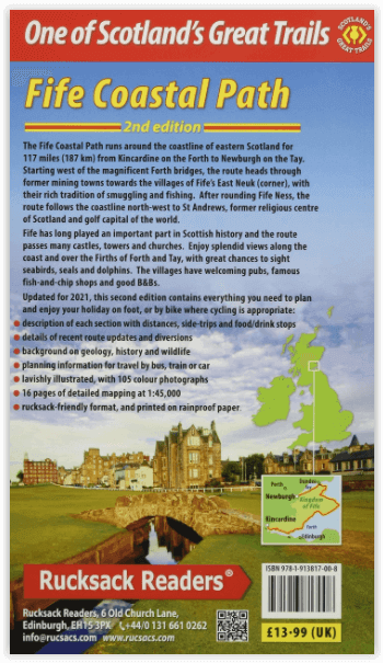
Engelse omschrijving: The Fife Coastal Path runs around the coastline of eastern Scotland for 117 miles (187 km) from Kincardine on the Forth to Newburgh on the Tay. Starting west of the magnificent Forth bridges, the route heads through former mining towns towards the villages of Fife’s East Neuk (corner), with their rich tradition of smuggling and fishing. After rounding Fife Ness, the route follows the coastline north-west through St Andrews, former religious centre of Scotland and golf capital of the world.
Fife has long played an important part in Scottish history and the route passes many castles, towers and churches. There are splendid views along the coast and over the Firths of Forth and Tay, with great chances to sight seabirds, seals and dolphins. The villages have welcoming pubs, famous fish-and-chip shops and good B&Bs. Transport by train and bus makes for easy access throughout.
Features:
The guidebook contains everything you need to plan and enjoy the Fife Coastal Path – on foot, or on a bike where cycling is appropriate:
- Detailed directions for each section (walked anticlockwise from Kincardine)
- Summaries showing distance, side-trips and food/drink stops
- Background on history, landscapes and wildlife
- Planning information for travel by bus, train, car and plane
- Lavishly illustrated, with 100 colour photographs
- Includes 16 pages of mapping at 1:45,000
- Rucksack-friendly format, and printed on rainproof paper.
Artikelen uit dezelfde regio
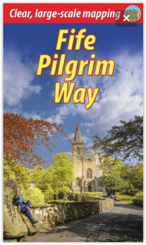
Wandelgids Fife Pilgrim Way - Rucksack Readers • 9781913817183
Wandelgids Fife Pilgrim Way - Rucksack Readers Productomschrijving: Deze route loopt van de Firth of Forth bij Edinburgh naar de beroemde pelgrimsbestemming St Andrews. Andrews. De route is rijk aan industrieel erfgoed en voert langs voormalige mijnbouwgemeenschappen, spoorwegen, textielcentra en kastelen, maar bovenal viert de route het pelgrimskoninkrijk en de geschiedenis van Fife via d…

Wandelkaart 370 Glenrothes North & Falkland- Schotland OSI • 9780319472378
Wandelkaart Glenrothes North- Falkland & Lomond Hills - Schotland Omvat ook: Auchtermuchty & Cupar. Productbeschrijving: Kaart nummer 370 omvat Glenrothes North, Falkland en Lomond hills. Hoogtepunten zijn West Lomond river Eden, Largo Bay en Fife kustpad. Omvat ook Auchtermuchty en Cupar. De OS Explorer kaart voor Glenrothes North, Falkland & Lomond Hills is beschikbaar in zowel de st…
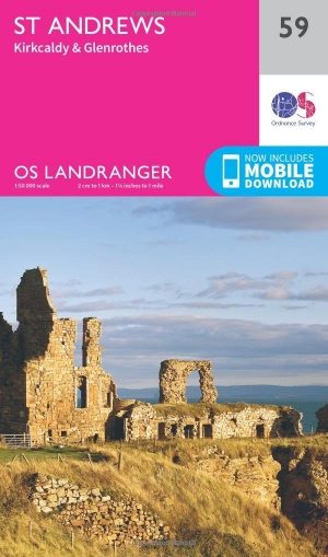
Wandelkaart 59 St-Andrews- Fife Schotland - OSI • 9780319261576
Wandelkaart 59 - St-Andrews - Fife Schotland Productbeschrijving: OS Landranger kaart 59 toont St-Andrews, Kirkcaldy en Glenrothes tussen de Firth of Forth en de Firth of Tay. St Andrews is het best bekend als de geboorteplaats van golf, en nog steeds trekt de plaats duizenden bezoekers naar de Links-cors. Het heeft ook één van de oudste universiteiten in de wereld. De OS Landranger ka…
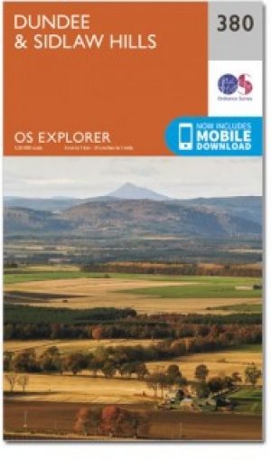
Wandelkaart 380 Dundee & Sidlaw Hills- Fife - OSI • 9780319246269
Wandelkaart Dundee & Sidlaw Hills - Fife East Schotland Productbeschrijving: 380 / Dundee & Sidlaw Hills, Fife, East Schotland - Dubbel zijdige OS Explorer kaart nummer 380 toont Dundee, de heuvels Sidlaw, de Firth of Tay en een deel van het Fife kustpad. Hoogtepunten van het gebied zijn evenals de industriestad van Dundee, Broughty Ferry en de Sidlaws. Kijk uit voor de verspreide cair…

Wandelkaart 59 St-Andrews- Fife- Schotland - OSI • 9780319473825
Wandelkaart St-Andrews - Fife Schotland Productbeschrijving: OS Landranger kaart 59 toont St-Andrews, Kirkcaldy en Glenrothes tussen de Firth of Forth en de Firth of Tay. St Andrews is het best bekend als de geboorteplaats van het golfen, en nog steeds duizenden bezoekers trekt naar de Links-corse. Het heeft ook een van de oudste universiteiten in de wereld. De OS Landranger kaarten reeks …