
Wandelgids - GR10 Trail through the French Pyrenees - Cicerone
Le Sentier des Pyrénées- 955km lange tocht door de Pyreneeën

Korte omschrijving
Wandelgidsen Occitanië, Frankrijk van CICERONE Press. Ideaal voor tochten in Frankrijk.
Wandelgids - GR10 Trail through the French Pyrenees - Cicerone Productomschrijving: Wandelgids over de GR10, "Le Sentier des Pyrénées", een 955km lange tocht door de Franse Pyreneeën van He...

Stockactie
Specificaties
- Uitgever: CICERONE Press
- ISBN-13: 9781852847739
- HOOFDCATEGORIEËN: Wandelgids
- Activiteiten: Wandelen, Hiking & Trekking
- Regio: Occitanië, Frankrijk
- Land: Frankrijk
- Departement: Pyrénées-Orientales (66)
- Editie: 1
- Taal: Engels
Volledige omschrijving
Wandelgids - GR10 Trail through the French Pyrenees - Cicerone
Productomschrijving: Wandelgids over de GR10, "Le Sentier des Pyrénées", een 955km lange tocht door de Franse Pyreneeën van Hendaye aan de Atlantische kust tot de Middellandse Zeekust in Banyuls-sur-Mer. Het boek beschrijft 55 etappes, met informatie over planning, vervoer, accommodatie en faciliteiten. U kunt de hele GR10 in ongeveer 45 dagen of in korter afleggen.
Productdescription: Guidebook to walking the GR10, the Sentier des Pyrénées, a 955km trek across the French Pyrenees from Hendaye on the Atlantic Coast to the Mediterranean coast at Banyuls-sur-Mer. The book describes 55 stages, with information on planning, transport, accommodation and facilities. Walk the entire GR10 in around 45 days or in shorter trips.
Product description: Guidebook to walking the GR10, the Sentier des Pyrénées, a 955km trek across the French Pyrenees from Hendaye on the Atlantic Coast to the Mediterranean coast at Banyuls-sur-Mer. The book describes 55 stages, with information on planning, transport, accommodation and facilities. Walk the entire GR10 in around 45 days or in shorter trips.
Seasons:
Best July to October (June in a low snow year).
Centres:
Hendaye-Plage on the Atlantic coast to Banyuls-sur-Mer on the Mediterranean through the French Pyrenees.
Difficulty:
The GR10 is extremely well waymarked following good mountain paths with short sections of boulderfield and occasional very easy scrambling. It is tough because there is more steep climb and descent than on many long-distance paths. Good network of inexpensive accommodation for those who prefer not to camp. Frequent resupply possible. In early season (May/June) ice-axe and crampons may be required.
Must See:
The GR10 starts with the rolling hills of the Basque country leading to the High Pyrenees including Pic du Midi d'Ossau, Vignemale and Gavarnie. The remote Ariège with Mont Vallier follows and Canigou dominates the approach to the Mediterranean. Wildflower meadows are magnificent throughout.

Locatie op kaart
Artikelen uit dezelfde regio
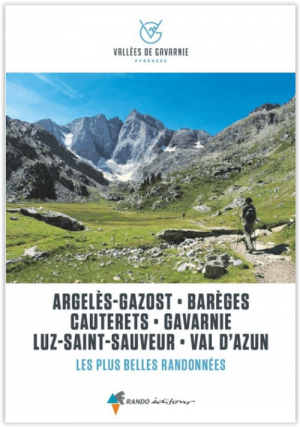
Wandelgids Vallees de Gavernies - Rando Ed. • 9782344057803
Vallees de Gavernies, Les plus belles randonnees - Rando Productomschrijving: In het hart van de Hautes-Pyrénées, de TOP 15 van de mooiste dagwandelingen om de hoogtepunten van de Gavarnie valleien te ontdekken. In het hart van het Nationaal Park van de Pyreneeën, in een omgeving die 100% groen, milieuvriendelijk, verantwoord en vooral duurzaam is, waar de toppen de hemel raken op een hoog…

Wandelkaart 2642 OT Le Caylar & La Couvertoirade - IGN • 9782758543084
Wandelkaart Le Caylar & La Couvertoirade - IGN Productomschrijving: Le Caylar & La Couvertoirade zijn twee Franse dorpen gelegen aan de rand van zowel het Parc naturel régional des Grands Causses & het Parc naturel régional Haut-Languedoc. Dat maakt ze dan ook de perfecte uitgangsplaats voor wandelingen in de twee parken. Omvat: Le Caylar, Lacouvertoirade, Fozières, Campestre-et-Luc, L…
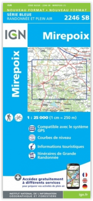
Wandelkaart 2246 SB Mirepoix- Ariège Occitanië - IGN • 9782758548522
Wandelkaart 2246 SB - Mirepoix- Ariège Occitanië Productomschrijving: Ariège wordt omringd door de departementen Haute-Garonne, Aude en de Pyrénées-Orientales. Het departement grenst bovendien aan Spanje en Andorra Desciptive produits: Entre 2014 et 2018, l’IGN renouvelle l’intégralité de sa collection SERIE BLEUE. Une nouvelle cartographie pour une lisibilité optimale, avec une meille…

Reisgids Aude Onbekend Frankrijk - Edicola • 9789492920263
Reisgids - Aude Onbekend Frankrijk - Edicola Productomschrijving: Het departement van de Aude, bekend van de katharenkastelen en Carcassonne, de grootste middeleeuwse vesting van Europa, heeft nog veel meer te bieden. De natuur is overweldigend en de geschiedenis gaat terug tot de prehistorie: bezoek de oudste mens van Europa in Tautavel en dinosauriërs in Espéraza! Ook op sportief gebied …

Wandelgids 0811 Tours en Haute Terre d'Oc - FFR • 9782751407871
TOPO Wandelgids 811 - Tours en Haute Terre d'Oc Productomschrijving: Monts de Lacaune is een gemeente in het Franse departement Tarn, regio Midi-Pyrénées. De plaats maakt deel uit van het arrondissement Castres. Ze zijn dan ook grensoverschrijdend te vinden over aanpalende landen. De FFR collectie bestaat uit Topo gidsen, E-topo's PR wandel- en hikingroutes, en de GR collectie, die eer…